Checkerboard historic centre
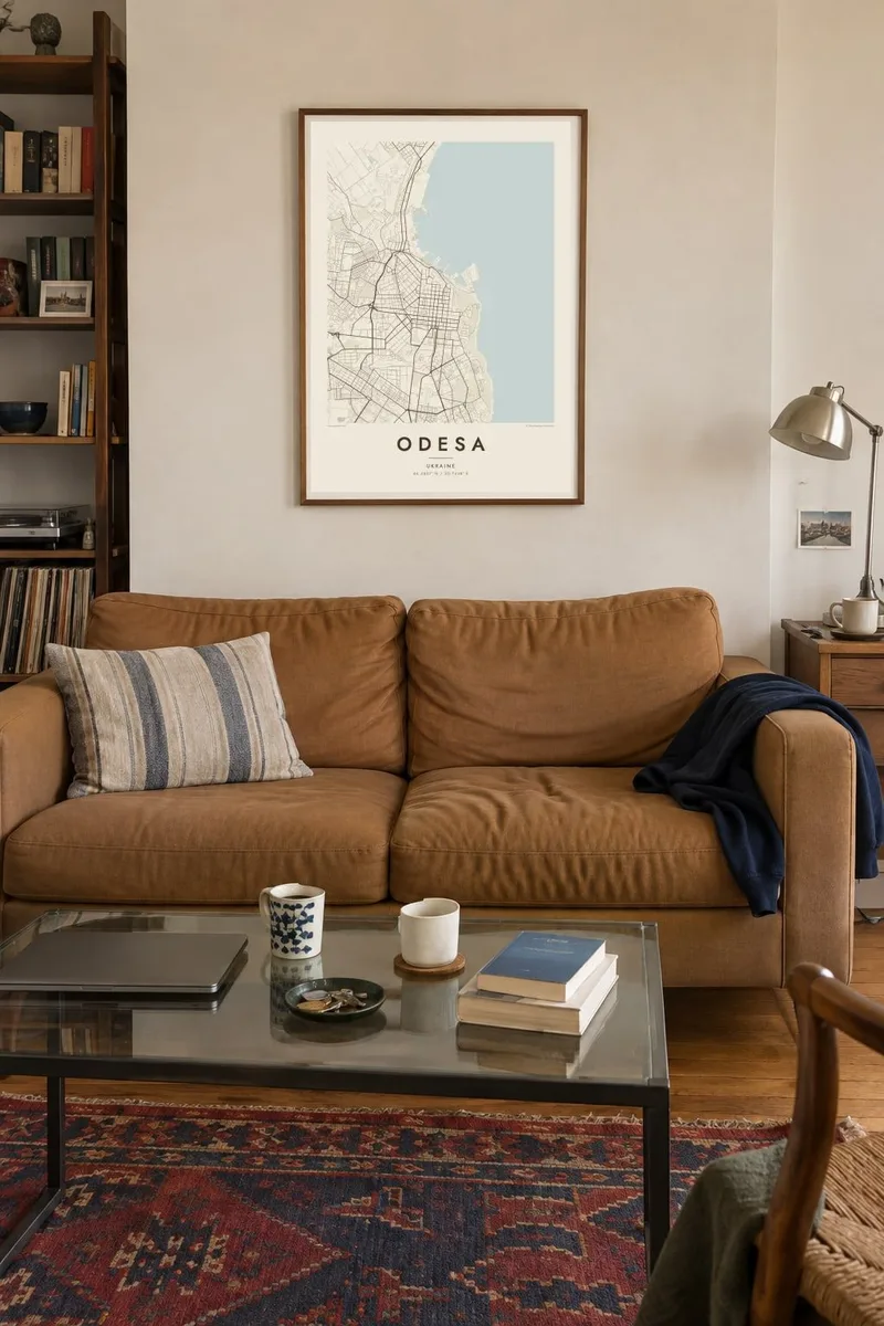
The old town is a regular grid of straight streets meeting at right angles, one of the clearest planned layouts of any port city in the region.
Fakatino mape mukamuka · Ukraine
46.4857° N / 30.7438° E
A port city laid out on a strict grid above the Black Sea, its streets ending abruptly at cliffs, harbour piers and long sandy beaches.


Taha e taone, lima e onoonoaga
Tapaki e taha puhala ke kitia ai ki luga he puipui. Kua tatai e totogi he tau puhala oti — pete he lolomi, poloka, po ke faila HD.
 Tau pikselo mooli · faila lolomi 24 × 36″
Maama mitaki ke lolomi
Ko e 100% e fahi mooli mai he faila lolomi. Ko e tau poster oti — pete kua lolomi, poloka, po ke utu hifo — kua taute ke he ha mautolu a tau tokoluga (server) ke he 300 DPI, hokotia ke he 7,200 × 10,800 piksela, ke maeke ai e tau ala ikiiki tote ke maaliali fakamitaki he lolomi 24 × 36″.
He Pā


Ko e mape
Seen from above, Odesa is one of the most legible cities on the Black Sea coast. Its historic centre is a tight orthogonal grid, planned at the end of the eighteenth century after an imperial decree of 1794 founded a new port here. Straight streets run inland from the bluff above the harbour and cross at right angles, giving the old town a checkerboard look that you can recognise at a glance.
Along the edge of that grid, the land drops toward the port. Piers, breakwaters and cargo basins push out into the bay, and a green belt of parks and slopes separates the upper city from the water. To the south, the coastline softens into a string of beaches, from Lanzheron past Arcadia, while to the north the long, narrow limans, flooded river estuaries, cut deep into the land.
An Odesa map poster shows how deliberate the city was from the start: a planned grid set against an irregular coast. The historic centre was added to the UNESCO World Heritage List in 2023, and the famous stairway linking the upper boulevard to the port appears as a short, precise line between the two levels of the city.
The old town is a regular grid of straight streets meeting at right angles, one of the clearest planned layouts of any port city in the region.
Piers, basins and protective moles extend from below the bluff into Odesa Bay, drawing hard geometric shapes against the open water of the Black Sea.
Narrow estuary lakes such as Khadzhibey and Kuyalnyk reach inland from the coast, long pale shapes that frame the city's northern edge on the map.
Taute ke ha hau
Lafi e aho, taha higoa po ke taha kupu haau, hiki e fakatino, lahi po ke tuaga.
Ko e kitiaaga nakai totogi kua tote e maaliali mo e fakamailoga vai. Ko e tau lolomi mo e tau faila HD kua taute ke he 300 DPI, hokotia ke he 7,200 × 10,800 px, nakai fai fakamailoga vai.
Ko e ha Odesa
Odesa means the sea, a particular summer, a family story that started in one of those courtyards. A map of its grid holds all of that quietly, without needing a photograph. It suits a hallway or a study, and it reads as clearly from across the room as it does up close.
You can set your own title, add a subtitle with a date or a street name, and edit the coordinates line. Choose from five styles, Classic black & white, Noir, Paper, Blueprint or Sand, and order a $9 HD file or a printed poster, framed if you like.
Talaage e poster Odesa| Lahi he lolomi | Maama | Tau faila |
|---|---|---|
| 30 × 40 cm11.8 × 15.7″ | 3,543 × 4,724 px | PNG · PDF |
| 29.7 × 42 cm (A3)11.7 × 16.5″ | 3,508 × 4,961 px | PNG · PDF |
| 42 × 59.4 cm (A2)16.5 × 23.4″ | 4,961 × 7,016 px | PNG · PDF |
| 45.7 × 61 cm18 × 24″ | 5,400 × 7,200 px | PNG · PDF |
| 50 × 70 cm19.7 × 27.6″ | 5,906 × 8,268 px | PNG · PDF |
| 61 × 91.4 cm24 × 36″ | 7,200 × 10,800 px | PNG · PDF |
Ke fakatatai, ko e fakatino noa kua 900 px e laulahi, fai fakamailoga mo e mo e tau mata komipiuta ni. Ko e tau faila HD kua ato hoko ke he 8× e maama ke he tau faahi takitaha mo e lolomi mitaki he lahi katoa he fakatino.
Fifili e taha puhala i luga he kupega, ti fifili e Poster Lolomi — e lahi mo e, kaeke ke manako ai koe, taha poloka — po ke Tau Faila HD Fakaeletonika. Ko e fakaotiaga totogi ko e taha gahua ni, ti ko e kupega he hau a talaaga ka fakafou fakahaga i mua he fakaotiaga e totogi.
Kua lolomi ai ke he pepa mitaki 200 gsm matte he taha he tau lahi ono, mai he 30 × 40 cm ke hoko ke he 24 × 36″. Kamata e tau poster lolomi mai he $39, kua putoia ai e utaaga.
E. Fifili e poloka akau malolō ke he lanu uli, tea, akau oki mooli, po ke akau pouli. Kua fakalataha mo e sioga malolō nakai malepe ti kua mautali ke tautau. Kamata e tau poster poloka mai he $99, kua putoia ai e utaaga.
Nakai totogi e fakafano ke he motu 60+. Ko e fakatino taha kua lolomi he fenoga lolomi ha mautolu kua tata mo e tau motu 30+, kua hoko mai he tau aho gahua 3–7. Maeke ia koe ke kikite e tuaga mo e fakamuitua he lalo he Haku Tau Fakatonu. Ke he falu motu kua 2–5 e tau tapu, ti ka nakai fakafano a mautolu ki ai, to fakaha he api tupe ia ki mua he totogi.
Fakafano mai e taha ata ki a mautolu he loto he 14 e tau aho tali mai he hokoaga, ti to lolomi foki e mautolu nakai totogi po ke liu atu e totogi ki a koe.
E. He editor i luga he kupega nei, hikihiki e matakupu, e matakupu lalo mo e laini coordinates ke he taha mena kua manako a koe ki ai, ti fifili e puhala mo e lahi. Ko e tau talaaga lolomi, poloka mo e fakaeletonika oti kua fakaaoga tonu e hau a fakatino.
Ma e $9 ka moua e koe e tau faila PNG 300 DPI mo e PDF kua mautali ke lolomi he tau lahi ono oti, nakai fai fakamailoga vai, ke lolomi i fe mena. Nakai maopoopo agaia? Utu hifo fakamua e kitiaaga nakai totogi ne fai fakamailoga vai.
