The railway junction
Tracks approach across the flat plain and divide near the station. They are the longest, straightest lines on the map, and the town is laid out around them.
Fakatino mape mukamuka · India
25.8130° N / 72.5788° E
A railway town on the dry Rajasthan plain, with tracks fanning out and the wide sandy bed of the Luni nearby




Taha e taone, lima e onoonoaga
Tapaki e taha puhala ke kitia ai ki luga he puipui. Kua tatai e totogi he tau puhala oti — pete he lolomi, poloka, po ke faila HD.
 Tau pikselo mooli · faila lolomi 24 × 36″
Maama mitaki ke lolomi
Ko e 100% e fahi mooli mai he faila lolomi. Ko e tau poster oti — pete kua lolomi, poloka, po ke utu hifo — kua taute ke he ha mautolu a tau tokoluga (server) ke he 300 DPI, hokotia ke he 7,200 × 10,800 piksela, ke maeke ai e tau ala ikiiki tote ke maaliali fakamitaki he lolomi 24 × 36″.
He Pā


Ko e mape
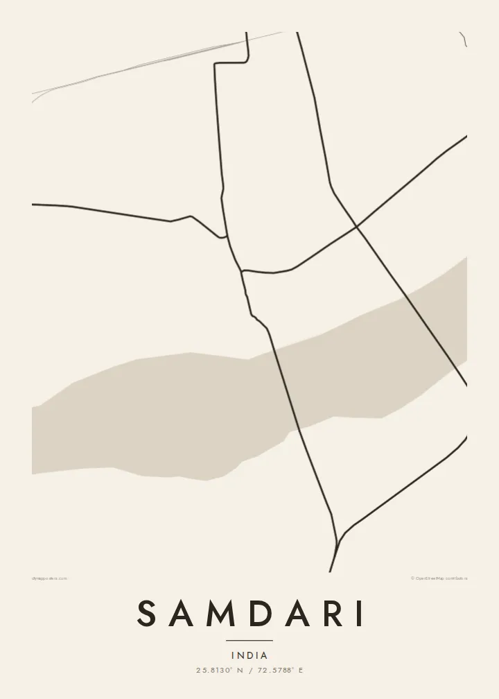
From above, Samdari reads as a compact settlement on the open, arid country of western Rajasthan. The streets gather around the railway station and grow outward in a low, irregular pattern, with lanes branching from a few main roads. Past the last houses the map thins quickly into field boundaries, tracks and dry watercourses. Almost all the drawing sits in the middle of the sheet and empty ground surrounds it.
Samdari is best known as a junction on the line running west from Jodhpur towards Barmer, and the rails give the map its strongest lines. They come in straight across the plain and split near the town, so the sidings and branches look like a small diagram of how the region is connected. The broad, seasonal bed of the Luni River runs through the surrounding district.
A Samdari map poster suits this spareness. In black and white, the tight cluster of lanes stands out against the pale surrounding ground, and the straight railway lines give the page a clear structure. It does not show a famous skyline or a coastline. It shows a working desert town and the lines that link it to the rest of Rajasthan, drawn as plainly as they are on a map.
Tracks approach across the flat plain and divide near the station. They are the longest, straightest lines on the map, and the town is laid out around them.
The lanes are short and packed close together and follow no strict grid. On the page they form a dense knot that looks darker than the open land around it.
Past the town, the map shows sparse field edges, tracks and dry channels. This thin detail is what makes western Rajasthan look so different from a crowded city map.
Taute ke ha hau
Lafi e aho, taha higoa po ke taha kupu haau, hiki e fakatino, lahi po ke tuaga.
Ko e kitiaaga nakai totogi kua tote e maaliali mo e fakamailoga vai. Ko e tau lolomi mo e tau faila HD kua taute ke he 300 DPI, hokotia ke he 7,200 × 10,800 px, nakai fai fakamailoga vai.
Ko e ha Samdari
People hang Samdari because it is where they grew up, where their family still lives, or where they changed trains on long journeys across Rajasthan. A map of a small town is rarely sold anywhere else, so having one on the wall carries a personal meaning that a big-city print does not.
You can change the title, subtitle and coordinates line, for example to add a family name, a year or a date that matters. Choose from Classic black & white, Noir, Paper, Blueprint or Sand. The digital HD files cost $9, or you can order a printed poster on matte paper, with an optional wooden frame.
Talaage e poster Samdari| Lahi he lolomi | Maama | Tau faila |
|---|---|---|
| 30 × 40 cm11.8 × 15.7″ | 3,543 × 4,724 px | PNG · PDF |
| 29.7 × 42 cm (A3)11.7 × 16.5″ | 3,508 × 4,961 px | PNG · PDF |
| 42 × 59.4 cm (A2)16.5 × 23.4″ | 4,961 × 7,016 px | PNG · PDF |
| 45.7 × 61 cm18 × 24″ | 5,400 × 7,200 px | PNG · PDF |
| 50 × 70 cm19.7 × 27.6″ | 5,906 × 8,268 px | PNG · PDF |
| 61 × 91.4 cm24 × 36″ | 7,200 × 10,800 px | PNG · PDF |
Ke fakatatai, ko e fakatino noa kua 900 px e laulahi, fai fakamailoga mo e mo e tau mata komipiuta ni. Ko e tau faila HD kua ato hoko ke he 8× e maama ke he tau faahi takitaha mo e lolomi mitaki he lahi katoa he fakatino.
Fifili e taha puhala i luga he kupega, ti fifili e Poster Lolomi — e lahi mo e, kaeke ke manako ai koe, taha poloka — po ke Tau Faila HD Fakaeletonika. Ko e fakaotiaga totogi ko e taha gahua ni, ti ko e kupega he hau a talaaga ka fakafou fakahaga i mua he fakaotiaga e totogi.
Kua lolomi ai ke he pepa mitaki 200 gsm matte he taha he tau lahi ono, mai he 30 × 40 cm ke hoko ke he 24 × 36″. Kamata e tau poster lolomi mai he $39, kua putoia ai e utaaga.
E. Fifili e poloka akau malolō ke he lanu uli, tea, akau oki mooli, po ke akau pouli. Kua fakalataha mo e sioga malolō nakai malepe ti kua mautali ke tautau. Kamata e tau poster poloka mai he $99, kua putoia ai e utaaga.
Nakai totogi e fakafano ke he motu 60+. Ko e fakatino taha kua lolomi he fenoga lolomi ha mautolu kua tata mo e tau motu 30+, kua hoko mai he tau aho gahua 3–7. Maeke ia koe ke kikite e tuaga mo e fakamuitua he lalo he Haku Tau Fakatonu. Ke he falu motu kua 2–5 e tau tapu, ti ka nakai fakafano a mautolu ki ai, to fakaha he api tupe ia ki mua he totogi.
Fakafano mai e taha ata ki a mautolu he loto he 14 e tau aho tali mai he hokoaga, ti to lolomi foki e mautolu nakai totogi po ke liu atu e totogi ki a koe.
E. He editor i luga he kupega nei, hikihiki e matakupu, e matakupu lalo mo e laini coordinates ke he taha mena kua manako a koe ki ai, ti fifili e puhala mo e lahi. Ko e tau talaaga lolomi, poloka mo e fakaeletonika oti kua fakaaoga tonu e hau a fakatino.
Ma e $9 ka moua e koe e tau faila PNG 300 DPI mo e PDF kua mautali ke lolomi he tau lahi ono oti, nakai fai fakamailoga vai, ke lolomi i fe mena. Nakai maopoopo agaia? Utu hifo fakamua e kitiaaga nakai totogi ne fai fakamailoga vai.
Tata mai
