Market Square
One of the largest market squares in England sits at the heart of the old town. It is a clear open space surrounded by tightly packed streets.
Minimalist map poster · United Kingdom
52.2500° N / 0.8833° W
An English market town circled by main roads, with a large central square and the River Nene along its southern side.

One city, five moods
Tap a style to see it on the wall. Every style costs the same — printed, framed or as HD files.
 Actual pixels · 24 × 36″ print file
Print-sharp
This is a 100% crop of the real print file. Every poster — printed, framed or downloaded — is rendered on our servers at 300 DPI, up to 7,200 × 10,800 pixels, so even the smallest lanes stay crisp on a 24 × 36″ print.
On the wall


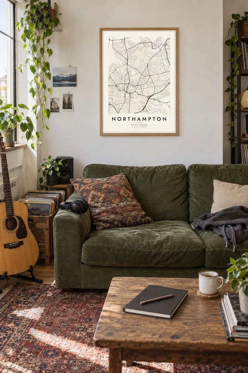
The map
Northampton grew up on a rise above the River Nene. Its medieval core still shows on the map as a knot of streets around one of the largest market squares in England. A ring of main roads now circles the old centre. Beyond it, Victorian terraces spread out in dense, regular rows, followed by later estates reaching toward the town's outer bypasses.
For centuries the town was a centre of shoe and boot making, and several well-known footwear firms are still based there. The Church of the Holy Sepulchre, founded after the First Crusade, is one of the few surviving round churches in England. Further out, the tall National Lift Tower, built to test lifts, rises above the skyline.
The River Nene and its branches run through a chain of parks and flood meadows on the southern side, with Becket's Park and the marina close to the centre. The Racecourse, a large open common, lies to the north. A Northampton map poster brings together the tight historic core, the green river valley and the steady growth of the town around them.
One of the largest market squares in England sits at the heart of the old town. It is a clear open space surrounded by tightly packed streets.
The river and its branches wind along the southern edge of the centre through parks, meadows and a marina, softening the map with a band of green.
Rows of Victorian terraced houses fill the areas around the centre and form a fine, repetitive pattern that reads well in black and white.
Make it yours
Add a date, a name or a line of your own, switch style, size or orientation.
The free preview is low-resolution with a watermark. Prints and HD files are rendered at 300 DPI, up to 7,200 × 10,800 px, without a watermark.
Why Northampton
Northampton is a natural choice for anyone who grew up in the county, studied at the university or has ties to the town's shoemaking history. The layered map records how an old market town has expanded over the centuries.
Set a personal title, subtitle and coordinates line, perhaps a street name or the year of a move. Choose from five styles, Classic black & white, Noir, Paper, Blueprint or Sand, and order it as a digital file or a framed print.
Order the Northampton poster| Print size | Resolution | Files |
|---|---|---|
| 30 × 40 cm11.8 × 15.7″ | 3,543 × 4,724 px | PNG · PDF |
| 29.7 × 42 cm (A3)11.7 × 16.5″ | 3,508 × 4,961 px | PNG · PDF |
| 42 × 59.4 cm (A2)16.5 × 23.4″ | 4,961 × 7,016 px | PNG · PDF |
| 45.7 × 61 cm18 × 24″ | 5,400 × 7,200 px | PNG · PDF |
| 50 × 70 cm19.7 × 27.6″ | 5,906 × 8,268 px | PNG · PDF |
| 61 × 91.4 cm24 × 36″ | 7,200 × 10,800 px | PNG · PDF |
For comparison, the free preview is 900 px wide, watermarked and meant for screens. The HD files have up to 8× the resolution in each direction and print cleanly at full poster size.
Pick a style at the top of the page, then choose Printed Poster — a size and, if you like, a frame — or Digital HD Files. Checkout takes one step, and your order page updates as soon as the payment goes through.
It is printed on premium 200 gsm matte paper in one of six sizes, from 30 × 40 cm to 24 × 36″. Printed posters start at $39, shipping included.
Yes. Choose a solid wood frame in black, white, natural oak or dark wood. It comes with shatterproof glazing and is ready to hang. Framed posters start at $99, shipping included.
Shipping is free to 60+ countries. Each poster is printed by the nearest of our print partners in 30+ countries and usually arrives in 3–7 business days. You can follow the status and tracking under My Orders. A few countries take 2–5 weeks, and where we don't ship yet, the site tells you before you pay.
Send us a photo within 14 days of delivery and we will reprint it for free or refund you.
Yes. In the editor on this page, change the title, the subtitle and the coordinates line to anything you like, and pick a style and size. Printed, framed and digital orders all use exactly your design.
For $9 you get 300 DPI PNG and print-ready PDF files in all six sizes, without a watermark, to print anywhere. Not sure yet? Download a free watermarked preview first.
Nearby
