Colonial Harbour
The historic cove near the tip of the peninsula, where the first settlement was founded. A small cluster of streets surrounds its sheltered water.
Minimalist map poster · Greenland
64.1835° N / 51.7216° W
A rocky Arctic peninsula at the mouth of a vast fjord, with a small colonial harbour and apartment blocks spread across its hills.

One city, five moods
Tap a style to see it on the wall. Every style costs the same — printed, framed or as HD files.
 Actual pixels · 24 × 36″ print file
Print-sharp
This is a 100% crop of the real print file. Every poster — printed, framed or downloaded — is rendered on our servers at 300 DPI, up to 7,200 × 10,800 pixels, so even the smallest lanes stay crisp on a 24 × 36″ print.
On the wall
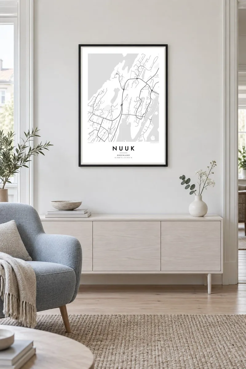


The map
Nuuk occupies a peninsula on the southwest coast of Greenland, where the long Nuuk Fjord meets the open sea. On a map, irregular rocky shorelines, small bays and islands frame the town on every side. Roads wind across uneven ground between outcrops and lakes. The built-up area forms separate clusters rather than one continuous grid.
The oldest part of town is the Colonial Harbour, where Hans Egede founded the settlement in 1728, with small historic buildings around a sheltered cove. Newer districts spread inland and to the east, including large apartment blocks and the neighbourhood of Qinngorput, reached by a road that curves across the hills. Across the water rises Sermitsiaq, a steep mountain that has become a symbol of the town.
Nuuk is often described as the northernmost capital in the world. No roads connect it to any other town in Greenland, so people and goods arrive by sea or by air. A Nuuk map poster turns this remote Arctic capital into a composition of broken coastlines, winding roads and open water, spare and quietly dramatic.
The historic cove near the tip of the peninsula, where the first settlement was founded. A small cluster of streets surrounds its sheltered water.
The mouth of one of the largest fjord systems in the world opens beside the town. It surrounds the peninsula with deep water, islands and rugged shorelines.
A newer district east of the centre, reached by a road that loops across rocky terrain. It adds long, curved lines to the outer edge of the map.
Make it yours
Add a date, a name or a line of your own, switch style, size or orientation.
The free preview is low-resolution with a watermark. Prints and HD files are rendered at 300 DPI, up to 7,200 × 10,800 px, without a watermark.
Why Nuuk
Nuuk appeals to people with ties to Greenland, to Arctic travellers and to anyone who loves remote northern places. The broken coastline and scattered districts create a spare, graphic pattern that looks especially striking in the Noir or Blueprint styles.
Personalise the title and subtitle, add the date of an expedition or a move, and adjust the coordinates line. Choose one of five styles and download six sizes as 300 DPI PNG and PDF files for $9, or order a matte print from a nearby print partner.
Order the Nuuk poster| Print size | Resolution | Files |
|---|---|---|
| 30 × 40 cm11.8 × 15.7″ | 3,543 × 4,724 px | PNG · PDF |
| 29.7 × 42 cm (A3)11.7 × 16.5″ | 3,508 × 4,961 px | PNG · PDF |
| 42 × 59.4 cm (A2)16.5 × 23.4″ | 4,961 × 7,016 px | PNG · PDF |
| 45.7 × 61 cm18 × 24″ | 5,400 × 7,200 px | PNG · PDF |
| 50 × 70 cm19.7 × 27.6″ | 5,906 × 8,268 px | PNG · PDF |
| 61 × 91.4 cm24 × 36″ | 7,200 × 10,800 px | PNG · PDF |
For comparison, the free preview is 900 px wide, watermarked and meant for screens. The HD files have up to 8× the resolution in each direction and print cleanly at full poster size.
Pick a style at the top of the page, then choose Printed Poster — a size and, if you like, a frame — or Digital HD Files. Checkout takes one step, and your order page updates as soon as the payment goes through.
It is printed on premium 200 gsm matte paper in one of six sizes, from 30 × 40 cm to 24 × 36″. Printed posters start at $39, shipping included.
Yes. Choose a solid wood frame in black, white, natural oak or dark wood. It comes with shatterproof glazing and is ready to hang. Framed posters start at $99, shipping included.
Shipping is free to 60+ countries. Each poster is printed by the nearest of our print partners in 30+ countries and usually arrives in 3–7 business days. You can follow the status and tracking under My Orders. A few countries take 2–5 weeks, and where we don't ship yet, the site tells you before you pay.
Send us a photo within 14 days of delivery and we will reprint it for free or refund you.
Yes. In the editor on this page, change the title, the subtitle and the coordinates line to anything you like, and pick a style and size. Printed, framed and digital orders all use exactly your design.
For $9 you get 300 DPI PNG and print-ready PDF files in all six sizes, without a watermark, to print anywhere. Not sure yet? Download a free watermarked preview first.
Nearby
