Niger River border
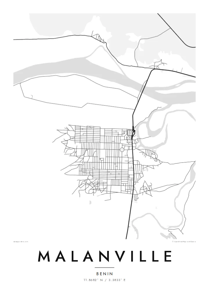
The broad Niger runs along the northern edge of the town and marks the international boundary. Its braided channels and sandbanks give the top of the print texture and movement.
Positala ya mapu yosavuta · Benin
11.8682° N / 3.3833° E
Benin's northern gateway on the Niger River, a market town facing the neighbouring country across the water


Mzinda umodzi, mawonekedwe asanu
Khudzani sitayelo kuti muwone pa khoma. Masitayelo onse amawononga ndalama zofanana — zosindikizidwa, zokutidwa mu chimango kapena ngati mafayilo a HD.
 Ma pixel enieni · fayilo yosindikiza 24 × 36″
Yowala posindikiza
Awa ndi chithunzi 100% chodulidwa cha fayilo yeniyeni yosindikiza. Poster iliyonse — yosindikizidwa, yokutidwa mu chimango kapena yotsitsidwa — imapangidwa pa maseva athu pa 300 DPI, mpaka ma pixel 7,200 × 10,800, choncho ngakhale misewu yaying'ono kwambiri imakhalabe yowoneka bwino pa kope la 24 × 36″.
Pakhoma


Mapu
Malanville is at the northern tip of Benin, where the Niger River forms the border with the Republic of Niger. From above, the river is the dominant feature: a wide channel with sandbanks and side branches. A bridge carries the main road north across it. The town spreads along the southern bank in a loose grid, and flat, cultivated floodplain fills the space between streets and water.
The town is best known for its large regional market, which draws traders from Benin, Niger, Nigeria and further afield. It also sits on the main road corridor linking the Gulf of Guinea coast with the Sahel. The Malanville map poster shows that meeting point clearly: a river, a bridge and a road that ties two countries together.
Around the town, the floodplain is worked for rice and other crops. On a clean monochrome map it shows as open ground crossed by channels. To the west lies the wider Niger valley, and protected parkland is not far away. The print leaves out everything except structure: a town set between the river and the long road south.
The broad Niger runs along the northern edge of the town and marks the international boundary. Its braided channels and sandbanks give the top of the print texture and movement.
The road bridge over the Niger connects Malanville with the town of Gaya on the opposite bank. It is a short, decisive line that joins two countries.
The streets form a loose, practical grid around the market district. It is the densest part of the map, where regional trade gathers every week.
Ipangeni yanu
Onjezani tsiku, dzina kapena mawu anu, sinthani mawonekedwe, kukula kapena momwe yaimira.
Chitsanzo chaulere ndi chotsika mu resolution ndipo chili ndi chizindikiro chothira madzi. Zosindikizidwa ndi mafayilo a HD zimapangidwa pa 300 DPI, mpaka ma px 7,200 × 10,800, popanda chizindikiro chothira madzi.
Chifukwa chiyani Malanville
For anyone who has crossed the Niger here, traded at the market or grown up in Alibori, this map records a place defined by movement and exchange. The river-and-bridge composition works well in a living room or an office.
Personalise the title, subtitle and coordinates line with a name or date that matters to you. Choose one of five styles: Classic black & white, Noir, Paper, Blueprint or Sand. Printed posters on matte paper ship from partners in more than 30 countries.
Odara poster ya Malanville| Kukula kosindikiza | Mphamvu ya chithunzi | Mafayilo |
|---|---|---|
| 30 × 40 cm11.8 × 15.7″ | 3,543 × 4,724 px | PNG · PDF |
| 29.7 × 42 cm (A3)11.7 × 16.5″ | 3,508 × 4,961 px | PNG · PDF |
| 42 × 59.4 cm (A2)16.5 × 23.4″ | 4,961 × 7,016 px | PNG · PDF |
| 45.7 × 61 cm18 × 24″ | 5,400 × 7,200 px | PNG · PDF |
| 50 × 70 cm19.7 × 27.6″ | 5,906 × 8,268 px | PNG · PDF |
| 61 × 91.4 cm24 × 36″ | 7,200 × 10,800 px | PNG · PDF |
Poyerekeza, chithunzi chaulere ndi cha 900 px m'lifupi, chili ndi chizindikiro ndipo ndi cha pa sikirini. Mafayilo a HD ali ndi mphamvu yochulukira mpaka 8× mbali iliyonse ndipo amasindikizika bwino pa kukula konse kwa positala.
Sankhani sitayelo kumtunda kwa tsamba, kenako musankhe Poster Yosindikizidwa — kukula ndi, mukafuna, chimango — kapena Mafayilo a Digital HD. Kulipira kumatenga sitepe imodzi, ndipo tsamba la oda yanu limasinthidwa nthawi yomweyo pambuyo pa kulipira.
Imasindikizidwa pa pepala labwino la matte la 200 gsm mu kukula kumodzi mwa zisanu ndi chimodzi, kuyambira 30 × 40 cm mpaka 24 × 36″. Maposita osindikizidwa amayamba pa $39, kutumiza kuphatikizidwa.
Inde. Sankhani chimango cha mtengo wolimba mu utoto wakuda, woyera, oak wachilengedwe kapena mtengo wakuda. Chimabwera ndi galasi losathyoka ndipo chikonzekera kupachikidwa nthawi yomweyo. Maposita a mu chimango amayamba pa $99, kutumiza kuphatikizidwa.
Kutumiza ndi kwaulere kumayiko oposa 60. Positala iliyonse imasindikizidwa ndi mnzathu wosindikiza wapafupi kwambiri mwa anzathu m'mayiko oposa 30, ndipo nthawi zambiri imafika m'masiku 3–7 antchito. Mukhoza kutsatira momwe oda ilili ndi malo ake pa "Maoda Anga". Mayiko ena amatenga masabata 2–5, ndipo kumene sitinayambe kutumiza, tsambali likuuzani musanalipire.
Titumizireni chithunzi masiku 14 kuchokera pa tsiku la kutumiza ndipo tidzaisindikizanso kwaulere kapena kukubwezerani ndalama zanu.
Inde. Mu chida chokonzera pa tsambali, sinthani mutu, mutu wowonjezera ndi mzere wa ma coordinates kukhala chilichonse chomwe mufuna, ndipo sankhani sitayelo ndi kukula. Maoda osindikizidwa, a mu chimango ndi a digital onse amagwiritsa ntchito kapangidwe kanu enieni.
Pa $9 mumalandira mafayilo a PNG a 300 DPI ndi PDF okonzeka kusindikiza mu kukula konse kwa zisanu ndi chimodzi, popanda chizindikiro chothira madzi, kuti musindikize kulikonse. Simunatsimikize? Tsitsani kaye chitsanzo chaulere chokhala ndi chizindikiro chothira madzi.
Pafupi
