Numbered grid
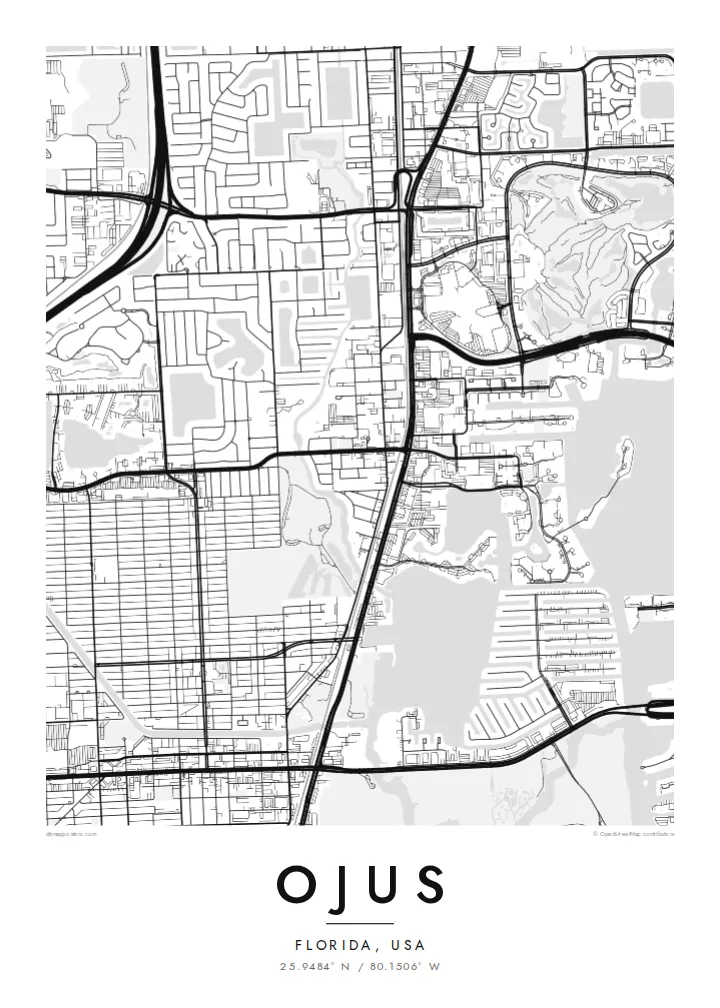
Streets and avenues follow the numbered Miami-Dade system, creating a regular mesh of rectangular blocks that fills much of the poster with fine, even lines.
Minimalist map poster · United States
25.9484° N / 80.1506° W
A flat grid of South Florida streets near the Oleta River, between the Dixie Highway corridor and Biscayne Bay.
One city, five moods
Tap a style to see it on the wall. Every style costs the same — printed, framed or as HD files.
 Actual pixels · 24 × 36″ print file
Print-sharp
This is a 100% crop of the real print file. Every poster — printed, framed or downloaded — is rendered on our servers at 300 DPI, up to 7,200 × 10,800 pixels, so even the smallest lanes stay crisp on a 24 × 36″ print.
On the wall


The map
Ojus is one of the older place names in north-eastern Miami-Dade County, used for the area around the Dixie Highway near Aventura and North Miami Beach. Much of the land once called Ojus now lies within neighbouring cities, but the name lives on. On a map, the area shows the flat, orderly pattern of South Florida development.
Numbered streets and avenues form a tight grid, broken by the railway and by major roads running north to south, parallel to the coast. To the east, the Oleta River, the Intracoastal Waterway and Biscayne Bay bring curving shorelines, mangrove edges and marina basins into the picture, a strong contrast with the right angles further inland.
An Ojus map poster brings these two geometries together: the regular grid of homes and shopping streets on one side, and the irregular line of river and bay on the other. For people who grew up here before the area was split among newer cities, the old name on the title line has a particular meaning.
Streets and avenues follow the numbered Miami-Dade system, creating a regular mesh of rectangular blocks that fills much of the poster with fine, even lines.
Highway and rail lines run parallel to the coast through the area, forming long straight bands that divide the grid into distinct strips.
The river winds toward Biscayne Bay just to the east, bringing soft curves, inlets and green shoreline that break up the strict geometry of the streets.
Make it yours
Add a date, a name or a line of your own, switch style, size or orientation.
The free preview is low-resolution with a watermark. Prints and HD files are rendered at 300 DPI, up to 7,200 × 10,800 px, without a watermark.
Why Ojus
Long-time residents of north Miami-Dade still use the name Ojus, even where city boundaries have changed. A map with that title keeps a neighbourhood identity that newer maps tend to leave out, and it makes a thoughtful gift for family.
Set the title to Ojus or to your own street, add a subtitle and a year, and choose from five styles: Classic black & white, Noir, Paper, Blueprint and Sand. Sizes include 18×24″ and 24×36″, as digital files or as printed posters.
Order the Ojus poster| Print size | Resolution | Files |
|---|---|---|
| 30 × 40 cm11.8 × 15.7″ | 3,543 × 4,724 px | PNG · PDF |
| 29.7 × 42 cm (A3)11.7 × 16.5″ | 3,508 × 4,961 px | PNG · PDF |
| 42 × 59.4 cm (A2)16.5 × 23.4″ | 4,961 × 7,016 px | PNG · PDF |
| 45.7 × 61 cm18 × 24″ | 5,400 × 7,200 px | PNG · PDF |
| 50 × 70 cm19.7 × 27.6″ | 5,906 × 8,268 px | PNG · PDF |
| 61 × 91.4 cm24 × 36″ | 7,200 × 10,800 px | PNG · PDF |
For comparison, the free preview is 900 px wide, watermarked and meant for screens. The HD files have up to 8× the resolution in each direction and print cleanly at full poster size.
Pick a style at the top of the page, then choose Printed Poster — a size and, if you like, a frame — or Digital HD Files. Checkout takes one step, and your order page updates as soon as the payment goes through.
It is printed on premium 200 gsm matte paper in one of six sizes, from 30 × 40 cm to 24 × 36″. Printed posters start at $39, shipping included.
Yes. Choose a solid wood frame in black, white, natural oak or dark wood. It comes with shatterproof glazing and is ready to hang. Framed posters start at $99, shipping included.
Shipping is free to 60+ countries. Each poster is printed by the nearest of our print partners in 30+ countries and usually arrives in 3–7 business days. You can follow the status and tracking under My Orders. A few countries take 2–5 weeks, and where we don't ship yet, the site tells you before you pay.
Send us a photo within 14 days of delivery and we will reprint it for free or refund you.
Yes. In the editor on this page, change the title, the subtitle and the coordinates line to anything you like, and pick a style and size. Printed, framed and digital orders all use exactly your design.
For $9 you get 300 DPI PNG and print-ready PDF files in all six sizes, without a watermark, to print anywhere. Not sure yet? Download a free watermarked preview first.
Nearby
