Naoussa Bay
A deep, branching inlet in the north coast. On the map it bites far into the island, with the fishing harbour of Naoussa tucked into its southern corner.
Minimalist map poster · Greece
37.0500° N / 25.1833° E
A rounded Cycladic island with a marble-white harbour town on its western bay and a deep notch of sea cutting in from the north

One city, five moods
Tap a style to see it on the wall. Every style costs the same — printed, framed or as HD files.
 Actual pixels · 24 × 36″ print file
Print-sharp
This is a 100% crop of the real print file. Every poster — printed, framed or downloaded — is rendered on our servers at 300 DPI, up to 7,200 × 10,800 pixels, so even the smallest lanes stay crisp on a 24 × 36″ print.
On the wall
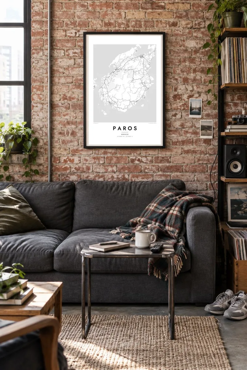


The island
From above, Paros is almost circular, a broad dome of land rising to Profitis Ilias near its centre. Roads spread from the interior villages toward the coast like spokes, and a thinner road runs most of the way around the island. Two bays break the outline: the wide western bay at Parikia and the long inlet of Naoussa, which cuts deep into the north coast.
Parikia, the main port, is a small tangle of lanes packed around the harbour. It holds the church of Panagia Ekatontapiliani and the ruins of a Venetian-era kastro built partly from ancient marble. That marble is what made Paros famous: Parian stone was quarried here in antiquity and used for some of the best-known sculptures of the Greek world.
A Paros map poster also shows the narrow channel to Antiparos in the south-west, where small islets scatter across shallow water. Inland, the lines get thinner and more crooked as tracks climb terraced slopes toward the mountain villages of Lefkes and Marpissa. Around the edge, the coast turns into a long row of small coves, each reached by its own short road.
A deep, branching inlet in the north coast. On the map it bites far into the island, with the fishing harbour of Naoussa tucked into its southern corner.
A narrow, shallow channel in the south-west, dotted with small islets. It separates Paros from its smaller neighbour and draws a delicate line of water across the print.
The dense core behind the western harbour, where lanes too narrow for cars wind past the Ekatontapiliani church and the old kastro walls.
Make it yours
Add a date, a name or a line of your own, switch style, size or orientation.
The free preview is low-resolution with a watermark. Prints and HD files are rendered at 300 DPI, up to 7,200 × 10,800 px, without a watermark.
Why Paros
Paros is often the island people come back to, somewhere a Cycladic summer was spent in the lanes of Naoussa or on a ferry into Parikia. Its rounded outline is easy to recognise on a wall, even from across the room, and the clean black and white lines suit a bright room.
You can add your own title, subtitle and coordinates line, such as the name of a village or the dates of a trip. Choose Classic black & white, Noir, Paper, Blueprint or Sand, then download HD files for $9 or order a printed poster, framed or unframed.
Order the Paros poster| Print size | Resolution | Files |
|---|---|---|
| 30 × 40 cm11.8 × 15.7″ | 3,543 × 4,724 px | PNG · PDF |
| 29.7 × 42 cm (A3)11.7 × 16.5″ | 3,508 × 4,961 px | PNG · PDF |
| 42 × 59.4 cm (A2)16.5 × 23.4″ | 4,961 × 7,016 px | PNG · PDF |
| 45.7 × 61 cm18 × 24″ | 5,400 × 7,200 px | PNG · PDF |
| 50 × 70 cm19.7 × 27.6″ | 5,906 × 8,268 px | PNG · PDF |
| 61 × 91.4 cm24 × 36″ | 7,200 × 10,800 px | PNG · PDF |
For comparison, the free preview is 900 px wide, watermarked and meant for screens. The HD files have up to 8× the resolution in each direction and print cleanly at full poster size.
Pick a style at the top of the page, then choose Printed Poster — a size and, if you like, a frame — or Digital HD Files. Checkout takes one step, and your order page updates as soon as the payment goes through.
It is printed on premium 200 gsm matte paper in one of six sizes, from 30 × 40 cm to 24 × 36″. Printed posters start at $39, shipping included.
Yes. Choose a solid wood frame in black, white, natural oak or dark wood. It comes with shatterproof glazing and is ready to hang. Framed posters start at $99, shipping included.
Shipping is free to 60+ countries. Each poster is printed by the nearest of our print partners in 30+ countries and usually arrives in 3–7 business days. You can follow the status and tracking under My Orders. A few countries take 2–5 weeks, and where we don't ship yet, the site tells you before you pay.
Send us a photo within 14 days of delivery and we will reprint it for free or refund you.
Yes. In the editor on this page, change the title, the subtitle and the coordinates line to anything you like, and pick a style and size. Printed, framed and digital orders all use exactly your design.
For $9 you get 300 DPI PNG and print-ready PDF files in all six sizes, without a watermark, to print anywhere. Not sure yet? Download a free watermarked preview first.
Nearby
