Ždrelac bridge
A short road bridge at the northern tip crosses the narrow strait to Ugljan. It is the one point where the island's main road leaves Pašman without a boat.
Minimalist map poster · Croatia
43.9540° N / 15.3539° E
A long, slender Dalmatian island running parallel to the coast, joined to Ugljan by a short bridge at its northern tip.
One city, five moods
Tap a style to see it on the wall. Every style costs the same — printed, framed or as HD files.
 Actual pixels · 24 × 36″ print file
Print-sharp
This is a 100% crop of the real print file. Every poster — printed, framed or downloaded — is rendered on our servers at 300 DPI, up to 7,200 × 10,800 pixels, so even the smallest lanes stay crisp on a 24 × 36″ print.
On the wall


The island
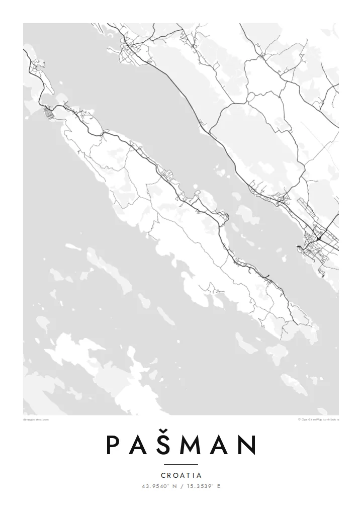
Pašman is a narrow island in the Zadar archipelago, stretching along the Pašman Channel opposite Biograd na Moru on the mainland. From above it is a long ribbon of land running northwest to southeast. A string of villages lines the sheltered channel shore, and a rougher, emptier coast faces the outer islands on the other side.
At the northern end a small bridge over the Ždrelac strait links Pašman to Ugljan, so on a map the two islands read almost as one long, broken line. A ferry connects Tkon, on the channel side, with Biograd. On the ground, olive groves, vineyards and dry-stone walls cover much of the land and divide the slopes into small plots.
On a hill above Tkon stands the Benedictine monastery of Ćokovac, one of the few active Benedictine communities in Croatia. A Pašman map poster works well in a tall format. It follows the island's length and leaves room for the channel and the mainland shore beside it, which is the view most people have when they arrive.
A short road bridge at the northern tip crosses the narrow strait to Ugljan. It is the one point where the island's main road leaves Pašman without a boat.
Settlements such as Tkon and Pašman line the sheltered eastern shore. Each is a small knot of lanes and harbour walls facing Biograd across the water.
The southwestern side looks toward a scatter of smaller islands in the direction of the Kornati. It has few roads and a quieter, more indented shoreline of coves and small bays.
Make it yours
Add a date, a name or a line of your own, switch style, size or orientation.
The free preview is low-resolution with a watermark. Prints and HD files are rendered at 300 DPI, up to 7,200 × 10,800 px, without a watermark.
Why Pašman
Pašman is a place people return to: sailors who anchor in its coves every summer, families with a house in one of the channel villages, visitors who cycle from Tkon to the bridge. Its slim outline makes an elegant, understated poster, particularly in a narrow hallway or beside a window.
Personalise the title with the name of your village or boat, add a year to the subtitle, and keep or edit the coordinates line. Choose from Classic black & white, Noir, Paper, Blueprint and Sand. HD files in six sizes cost $9, and printed matte posters can come in a wooden frame.
Order the Pašman poster| Print size | Resolution | Files |
|---|---|---|
| 30 × 40 cm11.8 × 15.7″ | 3,543 × 4,724 px | PNG · PDF |
| 29.7 × 42 cm (A3)11.7 × 16.5″ | 3,508 × 4,961 px | PNG · PDF |
| 42 × 59.4 cm (A2)16.5 × 23.4″ | 4,961 × 7,016 px | PNG · PDF |
| 45.7 × 61 cm18 × 24″ | 5,400 × 7,200 px | PNG · PDF |
| 50 × 70 cm19.7 × 27.6″ | 5,906 × 8,268 px | PNG · PDF |
| 61 × 91.4 cm24 × 36″ | 7,200 × 10,800 px | PNG · PDF |
For comparison, the free preview is 900 px wide, watermarked and meant for screens. The HD files have up to 8× the resolution in each direction and print cleanly at full poster size.
Pick a style at the top of the page, then choose Printed Poster — a size and, if you like, a frame — or Digital HD Files. Checkout takes one step, and your order page updates as soon as the payment goes through.
It is printed on premium 200 gsm matte paper in one of six sizes, from 30 × 40 cm to 24 × 36″. Printed posters start at $39, shipping included.
Yes. Choose a solid wood frame in black, white, natural oak or dark wood. It comes with shatterproof glazing and is ready to hang. Framed posters start at $99, shipping included.
Shipping is free to 60+ countries. Each poster is printed by the nearest of our print partners in 30+ countries and usually arrives in 3–7 business days. You can follow the status and tracking under My Orders. A few countries take 2–5 weeks, and where we don't ship yet, the site tells you before you pay.
Send us a photo within 14 days of delivery and we will reprint it for free or refund you.
Yes. In the editor on this page, change the title, the subtitle and the coordinates line to anything you like, and pick a style and size. Printed, framed and digital orders all use exactly your design.
For $9 you get 300 DPI PNG and print-ready PDF files in all six sizes, without a watermark, to print anywhere. Not sure yet? Download a free watermarked preview first.
Nearby
