Rivière des Prairies
The river forms the northern edge of Pierrefonds, with an uneven shoreline and small islands. It gives the poster a natural, flowing boundary along the top.
Minimalist map poster · Canada
45.4599° N / 73.8928° W
Curving suburban streets on the north shore of Montreal island, facing the Rivière des Prairies

One city, five moods
Tap a style to see it on the wall. Every style costs the same — printed, framed or as HD files.
 Actual pixels · 24 × 36″ print file
Print-sharp
This is a 100% crop of the real print file. Every poster — printed, framed or downloaded — is rendered on our servers at 300 DPI, up to 7,200 × 10,800 pixels, so even the smallest lanes stay crisp on a 24 × 36″ print.
On the wall
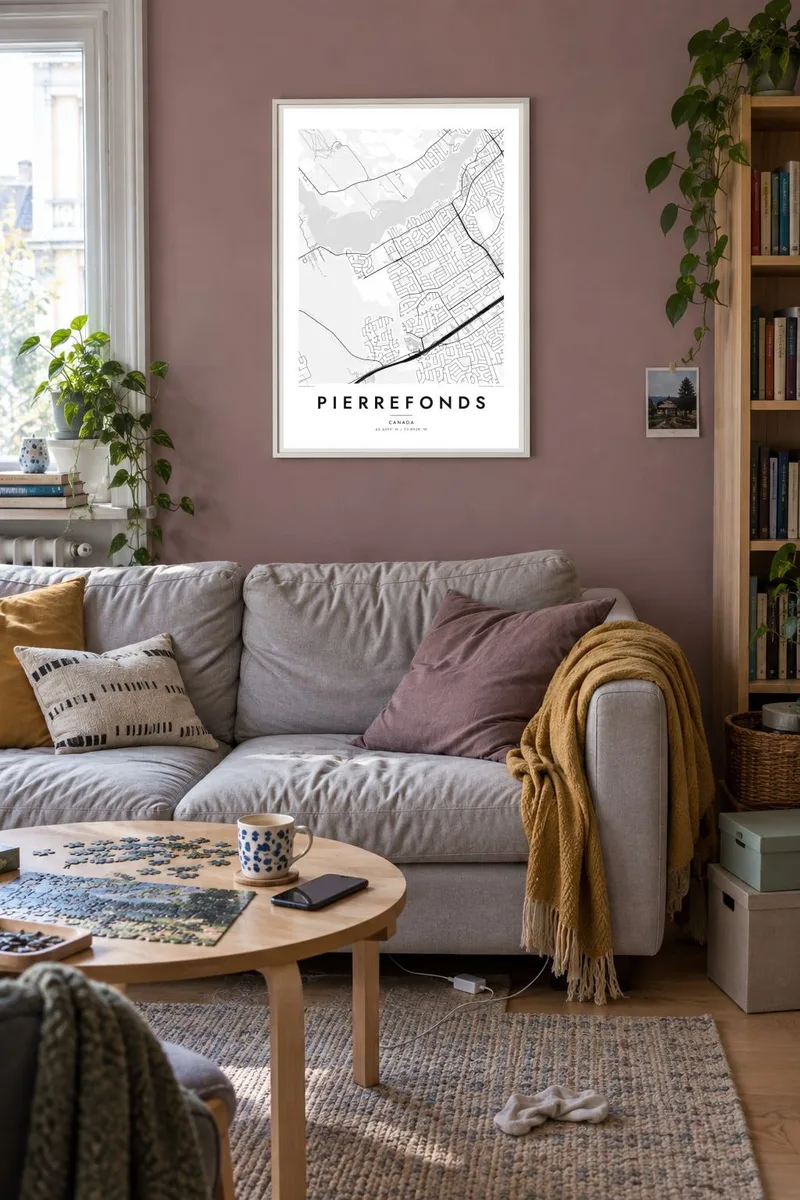


The map
Pierrefonds lies on the northwestern side of the island of Montreal, along the Rivière des Prairies. From above, it is a landscape of curving residential streets, crescents and cul-de-sacs, cut through by a few long boulevards that run parallel to the water. The river edge is irregular, with points, bays and small islands.
Once a separate municipality, Pierrefonds merged into Montreal in 2002 and now forms part of the Pierrefonds-Roxboro borough. At its western end, the large Cap-Saint-Jacques nature park occupies a peninsula where the river meets the Lac des Deux Montagnes, a green space that appears as a broad open area on the map.
A Pierrefonds map poster shows a very different Montreal from the downtown grid. The pattern is softer and more organic, built around homes, schools and parks, with the river always close. In a minimal style, the flowing streets and the long shoreline create a calm, balanced composition.
The river forms the northern edge of Pierrefonds, with an uneven shoreline and small islands. It gives the poster a natural, flowing boundary along the top.
Major boulevards cross the area roughly east to west. They act as the backbone of the map, organising the curving residential streets on either side.
The nature park at the western tip covers a wide peninsula of woods and shoreline. On the map it opens up the composition with generous green space.
Make it yours
Add a date, a name or a line of your own, switch style, size or orientation.
The free preview is low-resolution with a watermark. Prints and HD files are rendered at 300 DPI, up to 7,200 × 10,800 px, without a watermark.
Why Pierrefonds
Pierrefonds is where many Montreal families put down roots, and a map of its streets speaks to that: the walk to school, the river path, the house on the crescent. It is a personal image that still looks restrained and modern.
Personalise the title, subtitle and coordinates line, for example with a street or a move-in date, and choose Classic black & white, Noir, Paper, Blueprint or Sand. A free watermarked preview shows the exact layout before buying.
Order the Pierrefonds poster| Print size | Resolution | Files |
|---|---|---|
| 30 × 40 cm11.8 × 15.7″ | 3,543 × 4,724 px | PNG · PDF |
| 29.7 × 42 cm (A3)11.7 × 16.5″ | 3,508 × 4,961 px | PNG · PDF |
| 42 × 59.4 cm (A2)16.5 × 23.4″ | 4,961 × 7,016 px | PNG · PDF |
| 45.7 × 61 cm18 × 24″ | 5,400 × 7,200 px | PNG · PDF |
| 50 × 70 cm19.7 × 27.6″ | 5,906 × 8,268 px | PNG · PDF |
| 61 × 91.4 cm24 × 36″ | 7,200 × 10,800 px | PNG · PDF |
For comparison, the free preview is 900 px wide, watermarked and meant for screens. The HD files have up to 8× the resolution in each direction and print cleanly at full poster size.
Pick a style at the top of the page, then choose Printed Poster — a size and, if you like, a frame — or Digital HD Files. Checkout takes one step, and your order page updates as soon as the payment goes through.
It is printed on premium 200 gsm matte paper in one of six sizes, from 30 × 40 cm to 24 × 36″. Printed posters start at $39, shipping included.
Yes. Choose a solid wood frame in black, white, natural oak or dark wood. It comes with shatterproof glazing and is ready to hang. Framed posters start at $99, shipping included.
Shipping is free to 60+ countries. Each poster is printed by the nearest of our print partners in 30+ countries and usually arrives in 3–7 business days. You can follow the status and tracking under My Orders. A few countries take 2–5 weeks, and where we don't ship yet, the site tells you before you pay.
Send us a photo within 14 days of delivery and we will reprint it for free or refund you.
Yes. In the editor on this page, change the title, the subtitle and the coordinates line to anything you like, and pick a style and size. Printed, framed and digital orders all use exactly your design.
For $9 you get 300 DPI PNG and print-ready PDF files in all six sizes, without a watermark, to print anywhere. Not sure yet? Download a free watermarked preview first.
Nearby
