The Point
At the tip of downtown, the Allegheny and Monongahela merge into the Ohio. The precise, arrow-like shape makes this one of the most recognisable city centres on any map.
Minimalist map poster · United States
40.4406° N / 79.9959° W
Three rivers meeting at a sharp point of land, surrounded by steep hills, bridges and winding hillside streets.

One city, five moods
Tap a style to see it on the wall. Every style costs the same — printed, framed or as HD files.
 Actual pixels · 24 × 36″ print file
Print-sharp
This is a 100% crop of the real print file. Every poster — printed, framed or downloaded — is rendered on our servers at 300 DPI, up to 7,200 × 10,800 pixels, so even the smallest lanes stay crisp on a 24 × 36″ print.
On the wall

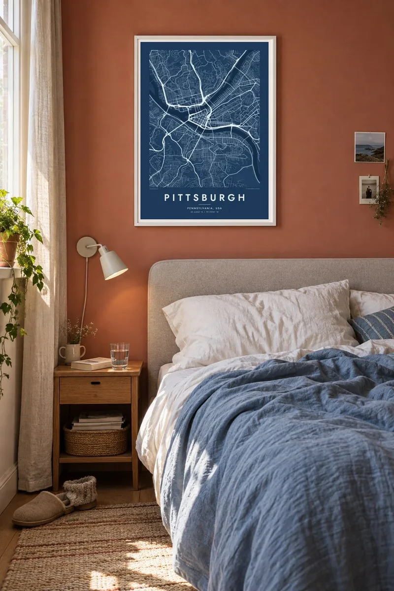
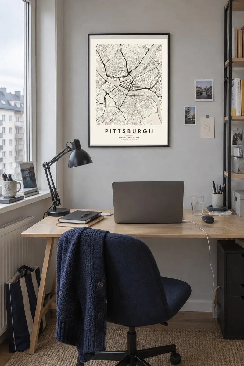
The map
Pittsburgh is defined by the meeting of the Allegheny and Monongahela rivers, which join at the Point to form the Ohio. Downtown, known as the Golden Triangle, fills the wedge of land between them, its street grids angled to follow the two shorelines. On a map this confluence is instantly recognisable: a clear triangle bounded by water on two sides.
The city is often said to have more bridges than almost any other, with hundreds crossing its rivers, creeks and ravines. Beyond downtown, steep hills break the street network into neighbourhoods set in valleys and along ridgelines. Roads switch back, and public staircases climb where streets can't.
Across the Monongahela, Mount Washington rises above downtown, reached by the historic Duquesne and Monongahela inclines. A Pittsburgh map poster shows how the rivers and hills, more than any plan, shaped the Steel City into the pattern it has today.
At the tip of downtown, the Allegheny and Monongahela merge into the Ohio. The precise, arrow-like shape makes this one of the most recognisable city centres on any map.
Dozens of bridges cross the rivers near downtown alone. They link the North Side, the South Side and the Golden Triangle with fine parallel lines over the water.
On slopes such as Mount Washington and the South Side Slopes, streets curve along the contours and end abruptly. They create a looser, winding pattern above the flat riverside neighbourhoods.
Make it yours
Add a date, a name or a line of your own, switch style, size or orientation.
The free preview is low-resolution with a watermark. Prints and HD files are rendered at 300 DPI, up to 7,200 × 10,800 px, without a watermark.
Why Pittsburgh
Pittsburgh maps are popular with university alumni, sports fans and families who have lived there for generations. Add a neighbourhood, a wedding date or simply 'Steel City' to the title and subtitle, and set the coordinates to a specific block.
Noir makes the rivers stand out against dark streets, Blueprint and Classic black & white bring out the bridges, and Paper and Sand feel warmer. Digital files cost $9 for six sizes, or you can order a matte print, framed or unframed.
Order the Pittsburgh poster| Print size | Resolution | Files |
|---|---|---|
| 30 × 40 cm11.8 × 15.7″ | 3,543 × 4,724 px | PNG · PDF |
| 29.7 × 42 cm (A3)11.7 × 16.5″ | 3,508 × 4,961 px | PNG · PDF |
| 42 × 59.4 cm (A2)16.5 × 23.4″ | 4,961 × 7,016 px | PNG · PDF |
| 45.7 × 61 cm18 × 24″ | 5,400 × 7,200 px | PNG · PDF |
| 50 × 70 cm19.7 × 27.6″ | 5,906 × 8,268 px | PNG · PDF |
| 61 × 91.4 cm24 × 36″ | 7,200 × 10,800 px | PNG · PDF |
For comparison, the free preview is 900 px wide, watermarked and meant for screens. The HD files have up to 8× the resolution in each direction and print cleanly at full poster size.
Pick a style at the top of the page, then choose Printed Poster — a size and, if you like, a frame — or Digital HD Files. Checkout takes one step, and your order page updates as soon as the payment goes through.
It is printed on premium 200 gsm matte paper in one of six sizes, from 30 × 40 cm to 24 × 36″. Printed posters start at $39, shipping included.
Yes. Choose a solid wood frame in black, white, natural oak or dark wood. It comes with shatterproof glazing and is ready to hang. Framed posters start at $99, shipping included.
Shipping is free to 60+ countries. Each poster is printed by the nearest of our print partners in 30+ countries and usually arrives in 3–7 business days. You can follow the status and tracking under My Orders. A few countries take 2–5 weeks, and where we don't ship yet, the site tells you before you pay.
Send us a photo within 14 days of delivery and we will reprint it for free or refund you.
Yes. In the editor on this page, change the title, the subtitle and the coordinates line to anything you like, and pick a style and size. Printed, framed and digital orders all use exactly your design.
For $9 you get 300 DPI PNG and print-ready PDF files in all six sizes, without a watermark, to print anywhere. Not sure yet? Download a free watermarked preview first.
Nearby
