Wooden old town
The historic centre around Pekkatori square follows a regular 17th-century street plan, with small blocks of wooden houses that form a fine, even pattern on the map.
Minimalist map poster · Finland
64.6833° N / 24.4833° E
A compact grid of wooden streets meeting the Gulf of Bothnia, with low islands and a steelworks harbour spread along the shore

One city, five moods
Tap a style to see it on the wall. Every style costs the same — printed, framed or as HD files.
 Actual pixels · 24 × 36″ print file
Print-sharp
This is a 100% crop of the real print file. Every poster — printed, framed or downloaded — is rendered on our servers at 300 DPI, up to 7,200 × 10,800 pixels, so even the smallest lanes stay crisp on a 24 × 36″ print.
On the wall


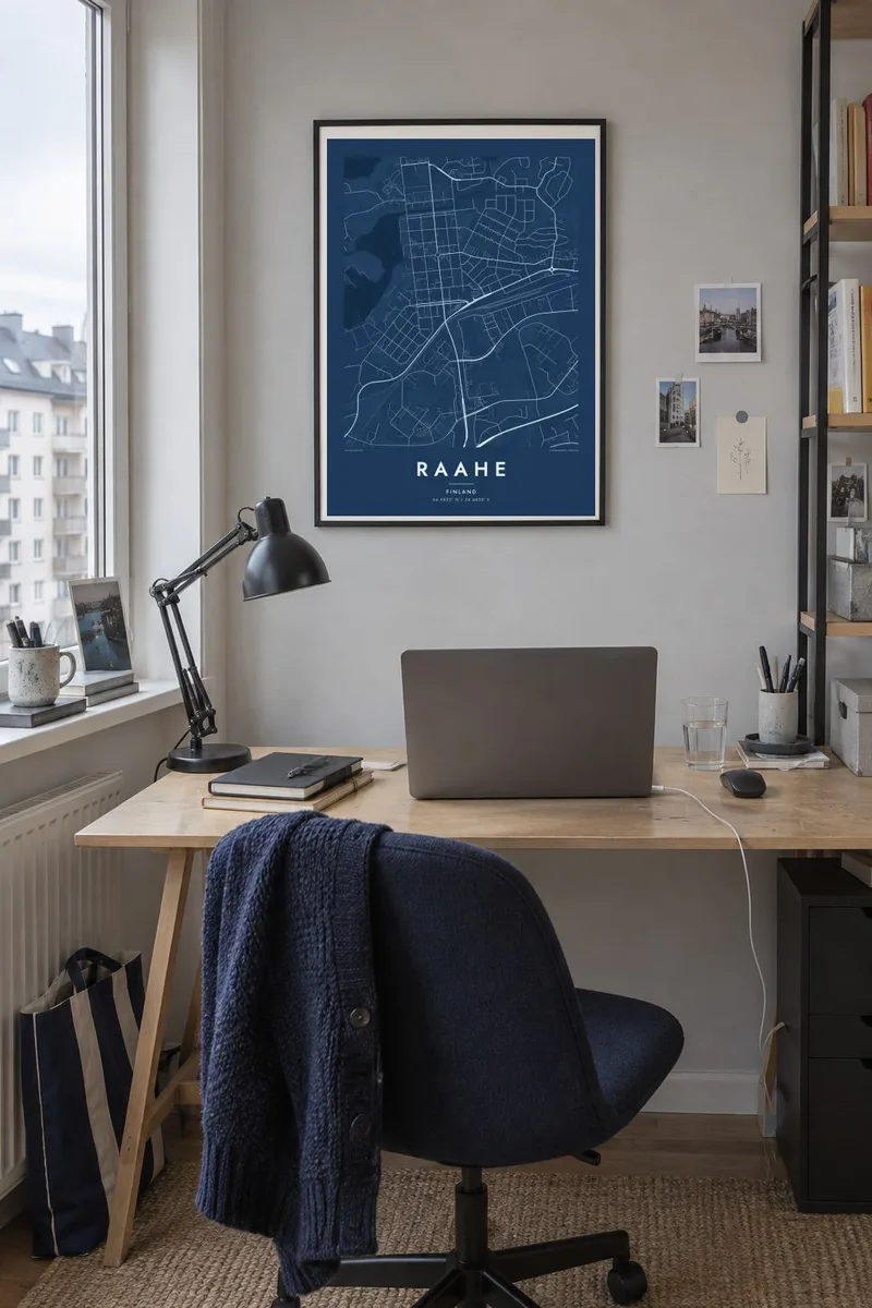
The map
Raahe sits on the flat eastern shore of the Gulf of Bothnia, where land that is still slowly rising from the sea meets a coast broken into shallow bays and small islands. On a map the town reads as a tidy rectangular core with newer districts reaching inland, while to the south a large industrial harbour pushes its straight piers into the water.
The town was founded in 1649 by Count Per Brahe, and its old centre keeps the regular plan of that era. Around the Pekkatori square, low wooden houses line straight streets set at right angles, one of the better-preserved wooden town cores in Finland. From above this shows up as a fine, even mesh of blocks close to the waterfront.
A Raahe map poster brings together these three layers: the orderly old town, the broad blocks of the steelworks that have shaped the local economy for decades, and the scattered islands offshore. Drawn in black and white, the difference between the gentle grid and the jagged, reedy coastline gives the sheet a quiet, northern balance.
The historic centre around Pekkatori square follows a regular 17th-century street plan, with small blocks of wooden houses that form a fine, even pattern on the map.
South of the centre, the steelworks and its port cover a wide area of long rectangular halls and straight quays, a strong geometric counterweight to the older town.
Low islands and skerries sit just off the coast, and the shoreline itself is irregular and shallow, giving the edges of the map an intricate, fragmented outline.
Make it yours
Add a date, a name or a line of your own, switch style, size or orientation.
The free preview is low-resolution with a watermark. Prints and HD files are rendered at 300 DPI, up to 7,200 × 10,800 px, without a watermark.
Why Raahe
People who grew up among Raahe's wooden streets, or who spent summers on its shore, often want something that shows the town as a whole rather than a single photograph. A map holds the square, the harbour and the islands in one calm composition.
The poster can carry your own title and a date or subtitle in place of the default text, along with the coordinates line. Choose from five styles, Classic black & white, Noir, Paper, Blueprint or Sand, to suit the room where it will hang.
Order the Raahe poster| Print size | Resolution | Files |
|---|---|---|
| 30 × 40 cm11.8 × 15.7″ | 3,543 × 4,724 px | PNG · PDF |
| 29.7 × 42 cm (A3)11.7 × 16.5″ | 3,508 × 4,961 px | PNG · PDF |
| 42 × 59.4 cm (A2)16.5 × 23.4″ | 4,961 × 7,016 px | PNG · PDF |
| 45.7 × 61 cm18 × 24″ | 5,400 × 7,200 px | PNG · PDF |
| 50 × 70 cm19.7 × 27.6″ | 5,906 × 8,268 px | PNG · PDF |
| 61 × 91.4 cm24 × 36″ | 7,200 × 10,800 px | PNG · PDF |
For comparison, the free preview is 900 px wide, watermarked and meant for screens. The HD files have up to 8× the resolution in each direction and print cleanly at full poster size.
Pick a style at the top of the page, then choose Printed Poster — a size and, if you like, a frame — or Digital HD Files. Checkout takes one step, and your order page updates as soon as the payment goes through.
It is printed on premium 200 gsm matte paper in one of six sizes, from 30 × 40 cm to 24 × 36″. Printed posters start at $39, shipping included.
Yes. Choose a solid wood frame in black, white, natural oak or dark wood. It comes with shatterproof glazing and is ready to hang. Framed posters start at $99, shipping included.
Shipping is free to 60+ countries. Each poster is printed by the nearest of our print partners in 30+ countries and usually arrives in 3–7 business days. You can follow the status and tracking under My Orders. A few countries take 2–5 weeks, and where we don't ship yet, the site tells you before you pay.
Send us a photo within 14 days of delivery and we will reprint it for free or refund you.
Yes. In the editor on this page, change the title, the subtitle and the coordinates line to anything you like, and pick a style and size. Printed, framed and digital orders all use exactly your design.
For $9 you get 300 DPI PNG and print-ready PDF files in all six sizes, without a watermark, to print anywhere. Not sure yet? Download a free watermarked preview first.
Nearby
