Olt reservoirs
Dams on the Olt widen the river into still lakes beside the city, giving the map broad water shapes instead of a thin river line.
Minimalist map poster · Romania
Carpathian foothill city lying along the Olt River, pressed between the water and green hills on its western side
45.1000° N / 24.3667° E
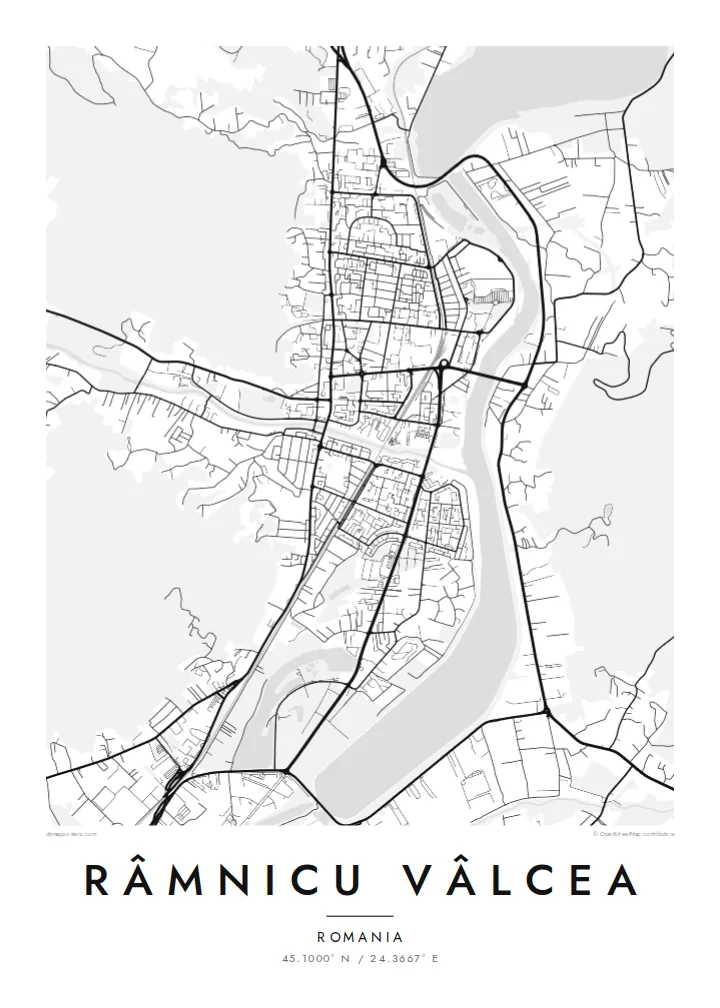


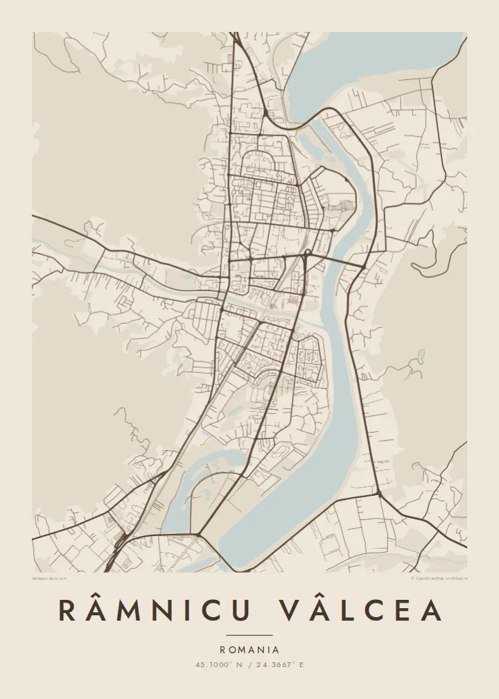
One city, five moods
Tap a style to see it on the wall. Every style is included in the same $9 price.
 Actual pixels · 24 × 36″ HD file
Print-sharp
This is a crop of the real HD file at 100%. The paid download is rendered on our servers at 300 DPI, up to 7,200 × 10,800 pixels, so even the smallest lanes stay crisp on a 24 × 36″ print.
The map
Râmnicu Vâlcea lies in the Olt valley, where the river leaves the Southern Carpathians and heads for the Wallachian plain. The city extends north to south along the water, and hills close in on the west. On a map the result is a long, narrow city: parallel main roads, residential districts in the side valleys, and the river running along the eastern edge.
The Olt is heavily managed here, with dams and reservoirs that widen it into a series of lakes near the city. On the hills, Capela Park forms a wooded patch above the centre. The city has its place in national history too: the song that later became Romania's anthem, Deșteaptă-te, române, is traditionally said to have been sung publicly for the first time here in 1848.
A Râmnicu Vâlcea map poster shows the city's valley shape clearly. The river and its reservoirs form a strong vertical line, the road network follows it, and the hills set a soft boundary on the other side. It is a clear example of a city whose plan comes directly from its terrain.
Dams on the Olt widen the river into still lakes beside the city, giving the map broad water shapes instead of a thin river line.
A wooded hill park rises above the centre on the western side, one of the green masses that hold the city against the river.
Main streets run parallel to the Olt, and neighbourhoods reach into the side valleys. The plan is long and narrow.
Make it yours
Add a date, a name or a line of your own, switch style, size or orientation.
Free preview is low-resolution with a watermark. The HD version is 7,200 × 10,800 px, 300 DPI, no watermark.
Why Râmnicu Vâlcea
For anyone from Vâlcea County, this map shows the valley they know: the river, the hills and the road north toward the mountains. It also appeals to travellers who have driven the Olt gorge and want a record of the route.
The title, subtitle and coordinates line can all be changed, for example to add a family name or a year. It comes in five styles, Classic black & white, Noir, Paper, Blueprint and Sand, as digital files or a framed print.
Get the Râmnicu Vâlcea poster — $9| Print size | Resolution | Files |
|---|---|---|
| 30 × 40 cm (11.8 × 15.7″) | 3,543 × 4,724 px | PNG · PDF |
| 50 × 70 cm (19.7 × 27.6″) | 5,906 × 8,268 px | PNG · PDF |
| 29.7 × 42 cm (A3, 11.7 × 16.5″) | 3,508 × 4,961 px | PNG · PDF |
| 42 × 59.4 cm (A2, 16.5 × 23.4″) | 4,961 × 7,016 px | PNG · PDF |
| 45.7 × 61 cm (18 × 24″) | 5,400 × 7,200 px | PNG · PDF |
| 61 × 91.4 cm (24 × 36″) | 7,200 × 10,800 px | PNG · PDF |
For comparison, the free preview is 900 px wide, watermarked and meant for screens. The HD files have up to 8× the resolution in each direction and print cleanly at full poster size.
Yes. Drag and zoom the map in the editor — centre it on your neighbourhood, the old town or the whole metro area. The text updates independently.
The HD purchase includes 30×40 cm, 50×70 cm, A3, A2, 18×24″ and 24×36″, each as a 300 DPI PNG and a print-ready PDF.
You can download a free 900 px preview with a watermark. The paid HD files have no watermark and are sharp enough for large prints.
Send the PDF to any local print shop or online printing service and ask for the matching paper size. Matte paper and a thin black or oak frame suit this style best.
Nearby
