Raja Bazaar
The historic commercial core is a tight weave of narrow streets and small plots. It is the densest texture on the map and contrasts sharply with the planned areas nearby.
Minimalist map poster · Pakistan
33.5973° N / 73.0479° E
An old bazaar city and a planned cantonment side by side, with Islamabad's sectors beginning just beyond the northern edge.

One city, five moods
Tap a style to see it on the wall. Every style costs the same — printed, framed or as HD files.
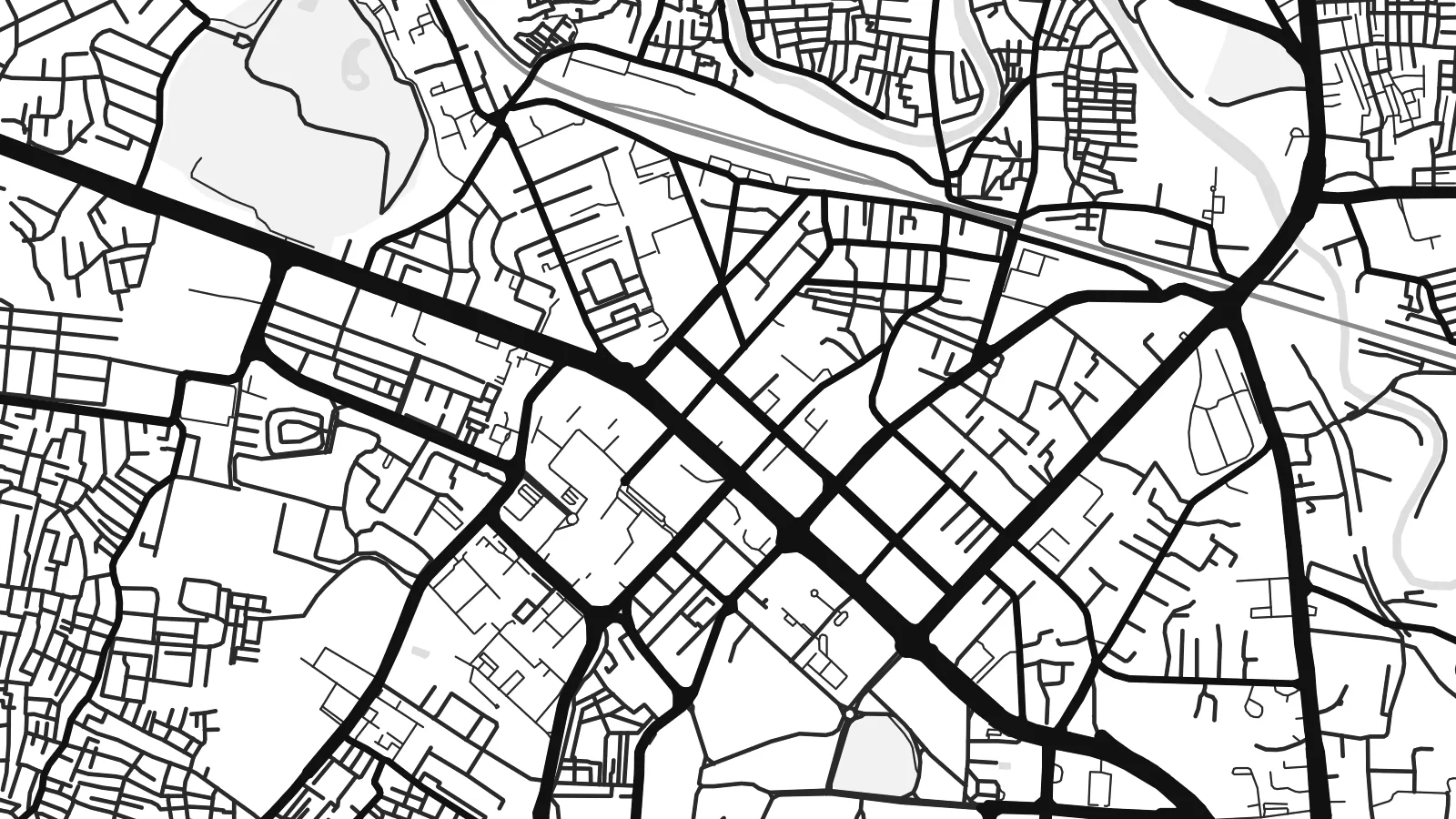 Actual pixels · 24 × 36″ print file
Print-sharp
This is a 100% crop of the real print file. Every poster — printed, framed or downloaded — is rendered on our servers at 300 DPI, up to 7,200 × 10,800 pixels, so even the smallest lanes stay crisp on a 24 × 36″ print.
On the wall


The map
Rawalpindi grew as a trading town on the Grand Trunk Road and later became one of the largest military cantonments of British India. Both histories show from above. The old city around Raja Bazaar is a dense, irregular mesh of lanes. The cantonment to the south has wider roads, larger plots and noticeably more green space.
The Leh Nullah, a seasonal stream, winds through the city from north to south and has long defined its low-lying neighbourhoods. Murree Road runs north as the main spine. Since 2015 the elevated Metro Bus has followed it toward Islamabad, whose planned sectors begin only a few kilometres away. On the map the two cities form one continuous urban area.
Rawalpindi is also home to the headquarters of Pakistan's army and to a cricket stadium that has hosted Test matches. A Rawalpindi map poster can be framed tightly on the bazaars and Saddar. It can also be widened to take in the Soan River to the south and the Margalla Hills rising behind Islamabad.
The historic commercial core is a tight weave of narrow streets and small plots. It is the densest texture on the map and contrasts sharply with the planned areas nearby.
South of the old city, the cantonment has the broad, straight roads and spacious compounds of colonial military planning, with Saddar as its commercial centre.
The stream meanders through the city from the direction of Islamabad. Its line of open ground runs against the grain of the streets on either side.
Make it yours
Add a date, a name or a line of your own, switch style, size or orientation.
The free preview is low-resolution with a watermark. Prints and HD files are rendered at 300 DPI, up to 7,200 × 10,800 px, without a watermark.
Why Rawalpindi
Rawalpindi is a city of deep family roots and frequent departures, and many people who hang this map live far away from it. The mix of bazaar lanes and cantonment roads makes it easy to point out a childhood street or a family shop.
Change the title, write your own subtitle, and keep or edit the coordinates line. Five styles are available. The $9 download includes watermark-free 300 DPI PNG and PDF files in six sizes, and you can check a free preview first.
Order the Rawalpindi poster| Print size | Resolution | Files |
|---|---|---|
| 30 × 40 cm11.8 × 15.7″ | 3,543 × 4,724 px | PNG · PDF |
| 29.7 × 42 cm (A3)11.7 × 16.5″ | 3,508 × 4,961 px | PNG · PDF |
| 42 × 59.4 cm (A2)16.5 × 23.4″ | 4,961 × 7,016 px | PNG · PDF |
| 45.7 × 61 cm18 × 24″ | 5,400 × 7,200 px | PNG · PDF |
| 50 × 70 cm19.7 × 27.6″ | 5,906 × 8,268 px | PNG · PDF |
| 61 × 91.4 cm24 × 36″ | 7,200 × 10,800 px | PNG · PDF |
For comparison, the free preview is 900 px wide, watermarked and meant for screens. The HD files have up to 8× the resolution in each direction and print cleanly at full poster size.
Pick a style at the top of the page, then choose Printed Poster — a size and, if you like, a frame — or Digital HD Files. Checkout takes one step, and your order page updates as soon as the payment goes through.
It is printed on premium 200 gsm matte paper in one of six sizes, from 30 × 40 cm to 24 × 36″. Printed posters start at $39, shipping included.
Yes. Choose a solid wood frame in black, white, natural oak or dark wood. It comes with shatterproof glazing and is ready to hang. Framed posters start at $99, shipping included.
Shipping is free to 60+ countries. Each poster is printed by the nearest of our print partners in 30+ countries and usually arrives in 3–7 business days. You can follow the status and tracking under My Orders. A few countries take 2–5 weeks, and where we don't ship yet, the site tells you before you pay.
Send us a photo within 14 days of delivery and we will reprint it for free or refund you.
Yes. In the editor on this page, change the title, the subtitle and the coordinates line to anything you like, and pick a style and size. Printed, framed and digital orders all use exactly your design.
For $9 you get 300 DPI PNG and print-ready PDF files in all six sizes, without a watermark, to print anywhere. Not sure yet? Download a free watermarked preview first.
Nearby
