The river Regge
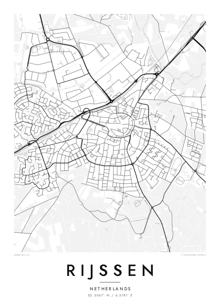
The Regge winds past the town in loose bends, one of the few curved lines in an otherwise rectilinear plan, and it gives the composition a natural edge.
Minimalist map poster · Netherlands
52.3067° N / 6.5181° E
A Twente town on the river Regge, its older centre ringed by newer streets and wide, flat farmland.
One city, five moods
Tap a style to see it on the wall. Every style costs the same — printed, framed or as HD files.
 Actual pixels · 24 × 36″ print file
Print-sharp
This is a 100% crop of the real print file. Every poster — printed, framed or downloaded — is rendered on our servers at 300 DPI, up to 7,200 × 10,800 pixels, so even the smallest lanes stay crisp on a 24 × 36″ print.
On the wall


The map
Rijssen lies in Twente, the eastern corner of Overijssel, on the small river Regge. On a map the town reads as a rounded core of older streets around the church, surrounded by post-war neighbourhoods and business areas that spread outward in careful, orderly blocks. The Regge meanders along the edge of town, a thin curving line that softens an otherwise tidy Dutch layout.
Since 2001 Rijssen has formed a single municipality with Holten to the west, where the land begins to rise towards the wooded Holterberg. Around Rijssen itself the country is flat and patterned with fields, farm lanes and patches of woodland, the fine-grained landscape Twente is known for. The town has a strong industrial side as well, historically tied to jute and textiles.
A Rijssen map poster captures the balance between a close-knit centre and the open land around it. The river, the ring of newer streets and the straight rural lanes all come through clearly in black and white, giving the sheet structure without any need for colour. It works as a quiet reminder of a town where many families have stayed close to home.
The Regge winds past the town in loose bends, one of the few curved lines in an otherwise rectilinear plan, and it gives the composition a natural edge.
Around the church, the historic core forms a small, dense cluster of short streets, clearly different in grain from the broader residential blocks that surround it.
Outside the built-up area, farm tracks, hedgerows and woodland plots create a fine patchwork typical of eastern Overijssel, rewarding a closer look at larger print sizes.
Make it yours
Add a date, a name or a line of your own, switch style, size or orientation.
The free preview is low-resolution with a watermark. Prints and HD files are rendered at 300 DPI, up to 7,200 × 10,800 px, without a watermark.
Why Rijssen
For people who grew up in Rijssen or moved away from Twente, a map of the town is an understated way to keep home in view. It also makes a considered gift for a new house, a wedding or a retirement, especially when the streets are ones the recipient knows by heart.
You can personalise the title, subtitle and coordinates, and choose Classic black & white, Noir, Paper, Blueprint or Sand. The $9 digital download includes six sizes as 300 DPI PNG and PDF files, while printed posters on matte paper ship from partners in more than 30 countries.
Order the Rijssen poster| Print size | Resolution | Files |
|---|---|---|
| 30 × 40 cm11.8 × 15.7″ | 3,543 × 4,724 px | PNG · PDF |
| 29.7 × 42 cm (A3)11.7 × 16.5″ | 3,508 × 4,961 px | PNG · PDF |
| 42 × 59.4 cm (A2)16.5 × 23.4″ | 4,961 × 7,016 px | PNG · PDF |
| 45.7 × 61 cm18 × 24″ | 5,400 × 7,200 px | PNG · PDF |
| 50 × 70 cm19.7 × 27.6″ | 5,906 × 8,268 px | PNG · PDF |
| 61 × 91.4 cm24 × 36″ | 7,200 × 10,800 px | PNG · PDF |
For comparison, the free preview is 900 px wide, watermarked and meant for screens. The HD files have up to 8× the resolution in each direction and print cleanly at full poster size.
Pick a style at the top of the page, then choose Printed Poster — a size and, if you like, a frame — or Digital HD Files. Checkout takes one step, and your order page updates as soon as the payment goes through.
It is printed on premium 200 gsm matte paper in one of six sizes, from 30 × 40 cm to 24 × 36″. Printed posters start at $39, shipping included.
Yes. Choose a solid wood frame in black, white, natural oak or dark wood. It comes with shatterproof glazing and is ready to hang. Framed posters start at $99, shipping included.
Shipping is free to 60+ countries. Each poster is printed by the nearest of our print partners in 30+ countries and usually arrives in 3–7 business days. You can follow the status and tracking under My Orders. A few countries take 2–5 weeks, and where we don't ship yet, the site tells you before you pay.
Send us a photo within 14 days of delivery and we will reprint it for free or refund you.
Yes. In the editor on this page, change the title, the subtitle and the coordinates line to anything you like, and pick a style and size. Printed, framed and digital orders all use exactly your design.
For $9 you get 300 DPI PNG and print-ready PDF files in all six sizes, without a watermark, to print anywhere. Not sure yet? Download a free watermarked preview first.
Nearby
