Descending ravines
Rivers and gullies cut down from the interior in long, roughly parallel lines. On the map they give the land a striped, rhythmic structure pointing toward the ocean.
Minimalist map poster · Reunion
20.9062° S / 55.6079° E
A commune on Réunion's northeastern coast, where river valleys and cane fields run down from the mountains to the Indian Ocean

One city, five moods
Tap a style to see it on the wall. Every style costs the same — printed, framed or as HD files.
 Actual pixels · 24 × 36″ print file
Print-sharp
This is a 100% crop of the real print file. Every poster — printed, framed or downloaded — is rendered on our servers at 300 DPI, up to 7,200 × 10,800 pixels, so even the smallest lanes stay crisp on a 24 × 36″ print.
On the wall

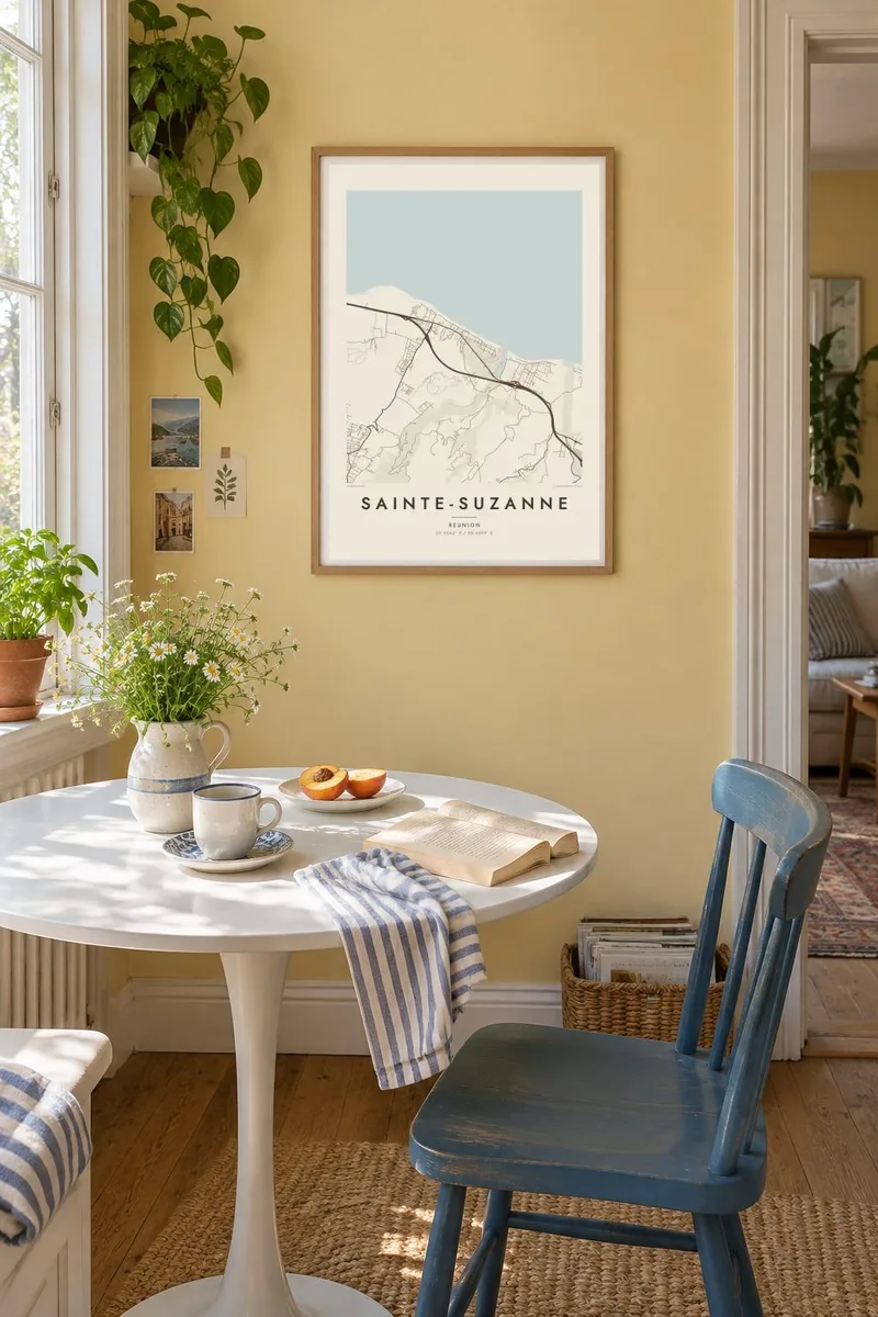

The map
Sainte-Suzanne lies along the northeastern coast of Réunion. The island's steep interior slopes toward the Indian Ocean here, and from above the land looks combed. Ravines and rivers run down from the heights in near-parallel lines, separated by long strips of sugar cane. The coastal road runs across all of them, linking the small settlements that hold on to the shoreline.
The Sainte-Suzanne river is one of the commune's defining features. It reaches the sea near the town centre, and upstream it drops over the Cascade Niagara, a waterfall known across the island. On the coast stands the Bel-Air lighthouse, the only lighthouse on Réunion. Few maps offer that combination of a river, a waterfall and a lone beacon.
A Sainte-Suzanne map poster shows the logic of a volcanic island in miniature. Lines of water descend from the mountains, roads follow the contours, and a thin band of houses forms along the coast. It is a calm composition with a strong sense of direction, as if everything on the page were flowing toward the sea.
Rivers and gullies cut down from the interior in long, roughly parallel lines. On the map they give the land a striped, rhythmic structure pointing toward the ocean.
The lighthouse stands on the coast north of the town centre. It is the only one on Réunion, and it marks a small but memorable point on the shoreline.
The main road and most of the houses follow a narrow band near the sea. It forms a clear horizontal line across the grain of the descending valleys.
Make it yours
Add a date, a name or a line of your own, switch style, size or orientation.
The free preview is low-resolution with a watermark. Prints and HD files are rendered at 300 DPI, up to 7,200 × 10,800 px, without a watermark.
Why Sainte-Suzanne
Réunion leaves a strong impression on the people who live there and the people who visit. A map of Sainte-Suzanne captures a corner of the island that is less photographed than the cirques and volcano but just as characteristic, with its rivers, cane and coast.
Add your own title, a subtitle such as a date or a family name, and the coordinates line. Then choose one of five styles: Classic black & white, Noir, Paper, Blueprint or Sand. Noir makes the white lines of the rivers stand out sharply.
Order the Sainte-Suzanne poster| Print size | Resolution | Files |
|---|---|---|
| 30 × 40 cm11.8 × 15.7″ | 3,543 × 4,724 px | PNG · PDF |
| 29.7 × 42 cm (A3)11.7 × 16.5″ | 3,508 × 4,961 px | PNG · PDF |
| 42 × 59.4 cm (A2)16.5 × 23.4″ | 4,961 × 7,016 px | PNG · PDF |
| 45.7 × 61 cm18 × 24″ | 5,400 × 7,200 px | PNG · PDF |
| 50 × 70 cm19.7 × 27.6″ | 5,906 × 8,268 px | PNG · PDF |
| 61 × 91.4 cm24 × 36″ | 7,200 × 10,800 px | PNG · PDF |
For comparison, the free preview is 900 px wide, watermarked and meant for screens. The HD files have up to 8× the resolution in each direction and print cleanly at full poster size.
Pick a style at the top of the page, then choose Printed Poster — a size and, if you like, a frame — or Digital HD Files. Checkout takes one step, and your order page updates as soon as the payment goes through.
It is printed on premium 200 gsm matte paper in one of six sizes, from 30 × 40 cm to 24 × 36″. Printed posters start at $39, shipping included.
Yes. Choose a solid wood frame in black, white, natural oak or dark wood. It comes with shatterproof glazing and is ready to hang. Framed posters start at $99, shipping included.
Shipping is free to 60+ countries. Each poster is printed by the nearest of our print partners in 30+ countries and usually arrives in 3–7 business days. You can follow the status and tracking under My Orders. A few countries take 2–5 weeks, and where we don't ship yet, the site tells you before you pay.
Send us a photo within 14 days of delivery and we will reprint it for free or refund you.
Yes. In the editor on this page, change the title, the subtitle and the coordinates line to anything you like, and pick a style and size. Printed, framed and digital orders all use exactly your design.
For $9 you get 300 DPI PNG and print-ready PDF files in all six sizes, without a watermark, to print anywhere. Not sure yet? Download a free watermarked preview first.
Nearby
