Shing Mun River
A wide, straight channel running through the middle of town to the harbour, lined with promenades and bridges, which acts as the central axis of the whole map.
Minimalist map poster · Hong Kong
22.3833° N / 114.1833° E
A planned new town along a straightened river channel, ringed by steep green hills and opening onto Tolo Harbour

One city, five moods
Tap a style to see it on the wall. Every style costs the same — printed, framed or as HD files.
 Actual pixels · 24 × 36″ print file
Print-sharp
This is a 100% crop of the real print file. Every poster — printed, framed or downloaded — is rendered on our servers at 300 DPI, up to 7,200 × 10,800 pixels, so even the smallest lanes stay crisp on a 24 × 36″ print.
On the wall

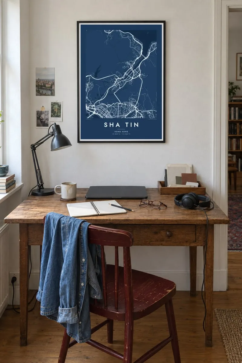

The map
Sha Tin lies in the eastern New Territories, in a valley enclosed by hills, with the Shing Mun River channel running down its middle to Tolo Harbour. From above it looks carefully arranged: tall estates and podiums grouped on either bank, cycle paths following the water, and footbridges crossing the channel at regular intervals. Steep, wooded slopes rise sharply on almost every side.
Much of the town stands on land reclaimed from a shallow bay when it was developed as a new town from the 1970s onward, which explains its tidy riverside layout. The name means sandy field. Sha Tin Racecourse forms a large oval beside the river, and the Lion Rock Tunnel and other routes cut through the hills toward Kowloon.
To the north, the Chinese University of Hong Kong occupies a hillside campus of terraces and winding roads above the harbour. Monasteries, hiking trails and Amah Rock sit in the surrounding hills. A Sha Tin map poster shows a rare contrast within one frame: dense towers on flat land, and untouched country only a few hundred metres away.
A wide, straight channel running through the middle of town to the harbour, lined with promenades and bridges, which acts as the central axis of the whole map.
The oval racetrack beside the water, one of Hong Kong's two racecourses, makes a clean, bold shape among the surrounding housing estates and roads.
The Chinese University campus spreads across a slope overlooking Tolo Harbour, its roads looping along the contours around buildings stepped into the hill.
Make it yours
Add a date, a name or a line of your own, switch style, size or orientation.
The free preview is low-resolution with a watermark. Prints and HD files are rendered at 300 DPI, up to 7,200 × 10,800 px, without a watermark.
Why Sha Tin
Sha Tin is home to hundreds of thousands of people and a place many remember from school, university or weekends at the races. A map poster keeps its river, hills and estates in one calm image, whether it hangs in Hong Kong or overseas.
Title it Sha Tin or with the name of your estate, add a date in the subtitle, and set the coordinates line. Five styles are available: Classic black & white, Noir, Paper, Blueprint and Sand. The $9 digital download includes all six print sizes.
Order the Sha Tin poster| Print size | Resolution | Files |
|---|---|---|
| 30 × 40 cm11.8 × 15.7″ | 3,543 × 4,724 px | PNG · PDF |
| 29.7 × 42 cm (A3)11.7 × 16.5″ | 3,508 × 4,961 px | PNG · PDF |
| 42 × 59.4 cm (A2)16.5 × 23.4″ | 4,961 × 7,016 px | PNG · PDF |
| 45.7 × 61 cm18 × 24″ | 5,400 × 7,200 px | PNG · PDF |
| 50 × 70 cm19.7 × 27.6″ | 5,906 × 8,268 px | PNG · PDF |
| 61 × 91.4 cm24 × 36″ | 7,200 × 10,800 px | PNG · PDF |
For comparison, the free preview is 900 px wide, watermarked and meant for screens. The HD files have up to 8× the resolution in each direction and print cleanly at full poster size.
Pick a style at the top of the page, then choose Printed Poster — a size and, if you like, a frame — or Digital HD Files. Checkout takes one step, and your order page updates as soon as the payment goes through.
It is printed on premium 200 gsm matte paper in one of six sizes, from 30 × 40 cm to 24 × 36″. Printed posters start at $39, shipping included.
Yes. Choose a solid wood frame in black, white, natural oak or dark wood. It comes with shatterproof glazing and is ready to hang. Framed posters start at $99, shipping included.
Shipping is free to 60+ countries. Each poster is printed by the nearest of our print partners in 30+ countries and usually arrives in 3–7 business days. You can follow the status and tracking under My Orders. A few countries take 2–5 weeks, and where we don't ship yet, the site tells you before you pay.
Send us a photo within 14 days of delivery and we will reprint it for free or refund you.
Yes. In the editor on this page, change the title, the subtitle and the coordinates line to anything you like, and pick a style and size. Printed, framed and digital orders all use exactly your design.
For $9 you get 300 DPI PNG and print-ready PDF files in all six sizes, without a watermark, to print anywhere. Not sure yet? Download a free watermarked preview first.
Nearby
