The shape
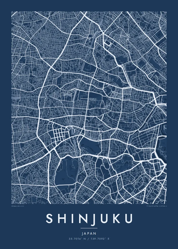
The outline of Shinjuku reads as one bold shape from across the room, with every line drawn from OpenStreetMap data.
Minimalist map poster · Japan
Shinjuku from above: its streets, squares and corners, block by block, reduced to pure line art.
35.7016° N / 139.7092° E



One city, five moods
Tap a style to see it on the wall. Every style is included in the same $9 price.
 Actual pixels · 24 × 36″ HD file
Print-sharp
This is a crop of the real HD file at 100%. The paid download is rendered on our servers at 300 DPI, up to 7,200 × 10,800 pixels, so even the smallest lanes stay crisp on a 24 × 36″ print.
The district
Shinjuku is shown here as the whole neighbourhood: its streets, squares and corners, block by block.
Shinjuku lies in Japan. The poster is framed to show the whole neighbourhood with a calm margin around it.
The map is rendered from OpenStreetMap vector data, so the coastline and every road stay razor-sharp even at 24 × 36 inches.
The outline of Shinjuku reads as one bold shape from across the room, with every line drawn from OpenStreetMap data.
Main roads and small lanes cross the map in fine lines, from the busiest towns to the quietest corners.
The HD files are rendered at 300 DPI — up to 7,200 × 10,800 pixels — so the details hold up at poster size.
Make it yours
Move the map, add a date, a name or a line of your own, switch style or orientation.
Free preview is low-resolution with a watermark. The HD version is 7,200 × 10,800 px, 300 DPI, no watermark.
Why Shinjuku
A map of Shinjuku is a souvenir that doesn't gather dust: a place of a honeymoon, a family summer, a degree or the trip you still talk about.
Add the dates or a line of your own, pick Classic black & white, Noir, Paper, Blueprint or Sand, and hang it as a daily reminder.
Get the Shinjuku poster — $9| Print size | Resolution | Files |
|---|---|---|
| 30 × 40 cm | 3,543 × 4,724 px | PNG · PDF |
| 50 × 70 cm | 5,906 × 8,268 px | PNG · PDF |
| A3 · 29.7 × 42 cm | 3,508 × 4,961 px | PNG · PDF |
| A2 · 42 × 59.4 cm | 4,961 × 7,016 px | PNG · PDF |
| 18 × 24" | 5,400 × 7,200 px | PNG · PDF |
| 24 × 36" | 7,200 × 10,800 px | PNG · PDF |
For comparison, the free preview is 900 px wide, watermarked and meant for screens. The HD files have up to 8× the resolution in each direction and print cleanly at full poster size.
The map is framed to show the whole neighbourhood, with a calm margin around it.
The HD purchase includes 30×40 cm, 50×70 cm, A3, A2, 18×24″ and 24×36″, each as a 300 DPI PNG and a print-ready PDF. You can also order it printed and shipped.
Yes — change the title, subtitle and coordinates line to anything you like, such as your names and the dates of your trip.
You can download a free 900 px preview with a watermark. The paid HD files have no watermark and are sharp enough for large prints.
Nearby
