Stora Värtan shore
The bay along Täby's eastern edge brings an irregular coastline of inlets, small peninsulas and shoreline paths, the most intricate part of the map.
Minimalist map poster · Sweden
59.4439° N / 18.0687° E
A garden suburb north of Stockholm, spread between lakes, forest and the long bay of Stora Värtan on its eastern side.

One city, five moods
Tap a style to see it on the wall. Every style costs the same — printed, framed or as HD files.
 Actual pixels · 24 × 36″ print file
Print-sharp
This is a 100% crop of the real print file. Every poster — printed, framed or downloaded — is rendered on our servers at 300 DPI, up to 7,200 × 10,800 pixels, so even the smallest lanes stay crisp on a 24 × 36″ print.
On the wall
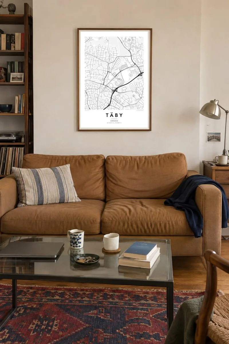


The map
Täby is a municipality in Stockholm County, about fifteen kilometres north of central Stockholm. On a map it is a patchwork of low residential neighbourhoods with curving streets, larger apartment areas around the centre and wooded tracts running between them. The E18 motorway and the Roslagsbanan narrow-gauge railway cross the municipality, and the eastern side opens onto the sheltered water of Stora Värtan.
The area has been settled for a very long time, and Täby is known for its Viking Age rune stones. The best-known group stands at Jarlabanke's Bridge, a raised causeway lined with stones erected by a local magnate in the eleventh century. Täby Centrum, one of Sweden's early large shopping centres, gives the municipality its modern focal point.
A Täby map poster captures the balance between built-up areas and open land typical of Stockholm's outer suburbs. Lakes such as Rönningesjön punctuate the landscape, and the indented coastline adds detail along the eastern edge. Classic black and white suits a bright Scandinavian interior, while Noir brings out the water and the dark masses of forest.
The bay along Täby's eastern edge brings an irregular coastline of inlets, small peninsulas and shoreline paths, the most intricate part of the map.
A short Viking Age causeway lined with rune stones, one of the best-known monuments of its kind in Sweden, set among later roads and houses.
The narrow-gauge commuter railway crosses Täby from south to north, drawing a thin, continuous line through neighbourhoods, forest and fields.
Make it yours
Add a date, a name or a line of your own, switch style, size or orientation.
The free preview is low-resolution with a watermark. Prints and HD files are rendered at 300 DPI, up to 7,200 × 10,800 px, without a watermark.
Why Täby
Täby is where many Stockholm families put down roots, and a map of the municipality suits the hallway of a first house or the room of a child who has grown up there. It is also a practical farewell gift when someone moves away from the area.
The title and subtitle can show a street, a surname or a moving-in date, and the coordinates line is editable. Choose between Classic black and white, Noir, Paper, Blueprint and Sand, and order a printed poster on matte paper, with or without a wooden frame.
Order the Täby poster| Print size | Resolution | Files |
|---|---|---|
| 30 × 40 cm11.8 × 15.7″ | 3,543 × 4,724 px | PNG · PDF |
| 29.7 × 42 cm (A3)11.7 × 16.5″ | 3,508 × 4,961 px | PNG · PDF |
| 42 × 59.4 cm (A2)16.5 × 23.4″ | 4,961 × 7,016 px | PNG · PDF |
| 45.7 × 61 cm18 × 24″ | 5,400 × 7,200 px | PNG · PDF |
| 50 × 70 cm19.7 × 27.6″ | 5,906 × 8,268 px | PNG · PDF |
| 61 × 91.4 cm24 × 36″ | 7,200 × 10,800 px | PNG · PDF |
For comparison, the free preview is 900 px wide, watermarked and meant for screens. The HD files have up to 8× the resolution in each direction and print cleanly at full poster size.
Pick a style at the top of the page, then choose Printed Poster — a size and, if you like, a frame — or Digital HD Files. Checkout takes one step, and your order page updates as soon as the payment goes through.
It is printed on premium 200 gsm matte paper in one of six sizes, from 30 × 40 cm to 24 × 36″. Printed posters start at $39, shipping included.
Yes. Choose a solid wood frame in black, white, natural oak or dark wood. It comes with shatterproof glazing and is ready to hang. Framed posters start at $99, shipping included.
Shipping is free to 60+ countries. Each poster is printed by the nearest of our print partners in 30+ countries and usually arrives in 3–7 business days. You can follow the status and tracking under My Orders. A few countries take 2–5 weeks, and where we don't ship yet, the site tells you before you pay.
Send us a photo within 14 days of delivery and we will reprint it for free or refund you.
Yes. In the editor on this page, change the title, the subtitle and the coordinates line to anything you like, and pick a style and size. Printed, framed and digital orders all use exactly your design.
For $9 you get 300 DPI PNG and print-ready PDF files in all six sizes, without a watermark, to print anywhere. Not sure yet? Download a free watermarked preview first.
Nearby
