Plateau street network
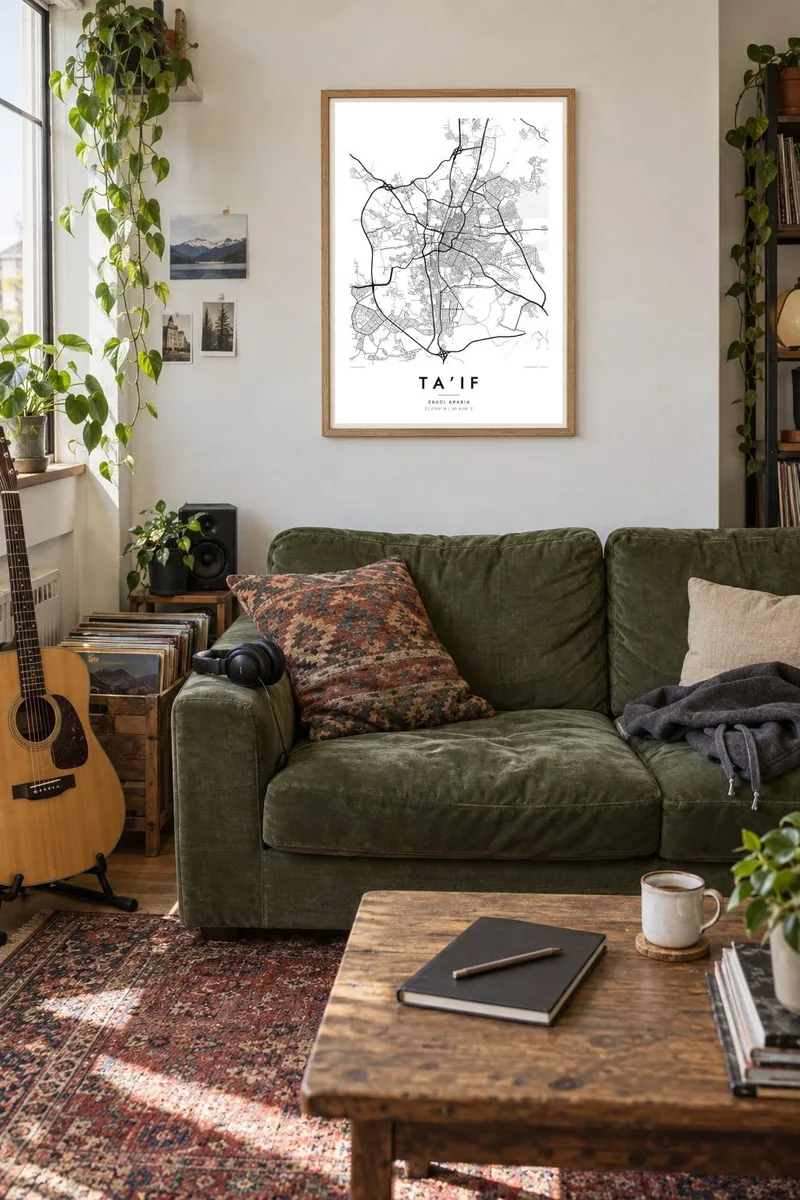
The city spreads across a high, open basin in a mix of regular blocks and curving roads. Large new districts on the outskirts extend the grid toward the hills.
Minimalist map poster · Saudi Arabia
21.2703° N / 40.4158° E
A mountain city on a high plateau of the Sarawat range, its streets spreading across a basin above steep escarpments.

One city, five moods
Tap a style to see it on the wall. Every style costs the same — printed, framed or as HD files.
 Actual pixels · 24 × 36″ print file
Print-sharp
This is a 100% crop of the real print file. Every poster — printed, framed or downloaded — is rendered on our servers at 300 DPI, up to 7,200 × 10,800 pixels, so even the smallest lanes stay crisp on a 24 × 36″ print.
On the wall


The map
Ta’if sits at around 1,800 metres in the Sarawat Mountains of western Saudi Arabia. It occupies a plateau above the steep escarpment that drops toward the coastal plain and Mecca. From above, the city spreads across a broad upland basin in a mix of grids and curving roads, and rocky hills and dry valleys push into the built area from several sides.
At this altitude Ta’if is milder than the lowlands, and it has long been a summer retreat for families from Mecca and Jeddah. It was also the traditional summer seat of the Saudi government. The surrounding farms are known for pomegranates, figs and above all roses, whose petals are distilled into the city's famous rose water.
West of the city, the Al Hada road descends the escarpment in a long sequence of hairpin bends. Ta’if also gave its name to the 1989 agreement that helped end the Lebanese Civil War. A Ta’if map poster shows a city defined by elevation, with a spreading street network on the plateau edged by rugged mountain terrain.
The city spreads across a high, open basin in a mix of regular blocks and curving roads. Large new districts on the outskirts extend the grid toward the hills.
West of the city, the road toward Mecca winds down the escarpment in tight switchbacks. In wider framings of the map it becomes a striking zigzag line.
Granite outcrops and dry valleys interrupt the urban area and leave pockets of open, unbuilt space. They give the poster an irregular, natural rhythm.
Make it yours
Add a date, a name or a line of your own, switch style, size or orientation.
The free preview is low-resolution with a watermark. Prints and HD files are rendered at 300 DPI, up to 7,200 × 10,800 px, without a watermark.
Why Ta’if
Ta’if is a place of family summers, rose harvests and cooler air, and many people in the Hijaz have long ties to it. A map of the city is a calm way to keep that highland retreat present at home.
Add a family name, a district or a year to the title and subtitle, and edit the coordinates line to mark a particular house or farm. Choose Classic black & white, Noir, Paper, Blueprint or Sand, as $9 HD files or a printed poster in an optional wooden frame.
Order the Ta’if poster| Print size | Resolution | Files |
|---|---|---|
| 30 × 40 cm11.8 × 15.7″ | 3,543 × 4,724 px | PNG · PDF |
| 29.7 × 42 cm (A3)11.7 × 16.5″ | 3,508 × 4,961 px | PNG · PDF |
| 42 × 59.4 cm (A2)16.5 × 23.4″ | 4,961 × 7,016 px | PNG · PDF |
| 45.7 × 61 cm18 × 24″ | 5,400 × 7,200 px | PNG · PDF |
| 50 × 70 cm19.7 × 27.6″ | 5,906 × 8,268 px | PNG · PDF |
| 61 × 91.4 cm24 × 36″ | 7,200 × 10,800 px | PNG · PDF |
For comparison, the free preview is 900 px wide, watermarked and meant for screens. The HD files have up to 8× the resolution in each direction and print cleanly at full poster size.
Pick a style at the top of the page, then choose Printed Poster — a size and, if you like, a frame — or Digital HD Files. Checkout takes one step, and your order page updates as soon as the payment goes through.
It is printed on premium 200 gsm matte paper in one of six sizes, from 30 × 40 cm to 24 × 36″. Printed posters start at $39, shipping included.
Yes. Choose a solid wood frame in black, white, natural oak or dark wood. It comes with shatterproof glazing and is ready to hang. Framed posters start at $99, shipping included.
Shipping is free to 60+ countries. Each poster is printed by the nearest of our print partners in 30+ countries and usually arrives in 3–7 business days. You can follow the status and tracking under My Orders. A few countries take 2–5 weeks, and where we don't ship yet, the site tells you before you pay.
Send us a photo within 14 days of delivery and we will reprint it for free or refund you.
Yes. In the editor on this page, change the title, the subtitle and the coordinates line to anything you like, and pick a style and size. Printed, framed and digital orders all use exactly your design.
For $9 you get 300 DPI PNG and print-ready PDF files in all six sizes, without a watermark, to print anywhere. Not sure yet? Download a free watermarked preview first.
Nearby
