The Ghaghara margin
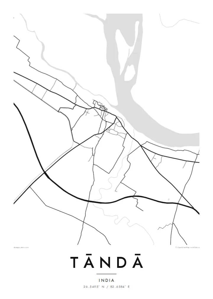
The river's broad floodplain forms the northern edge of the map. It is a wide, mostly empty band that makes the dense town beside it look even tighter.
Minimalist map poster · India
26.5495° N / 82.6584° E
A weaving town on the south bank of the Ghaghara, with a compact core and wide river flats to the north.
One city, five moods
Tap a style to see it on the wall. Every style costs the same — printed, framed or as HD files.
 Actual pixels · 24 × 36″ print file
Print-sharp
This is a 100% crop of the real print file. Every poster — printed, framed or downloaded — is rendered on our servers at 300 DPI, up to 7,200 × 10,800 pixels, so even the smallest lanes stay crisp on a 24 × 36″ print.
On the wall


The map
Tāndā lies in Ambedkar Nagar district in eastern Uttar Pradesh, on the southern bank of the Ghaghara, the broad river also known downstream as the Saryu. The town's layout is shaped by that position. The dense older quarters sit back from the water, and the ground towards the river opens into wide, low-lying flats that shift with each monsoon.
Tāndā has a long tradition of handloom weaving and is especially known for its cotton textiles. The work has historically taken place in small workshops woven into residential neighbourhoods, so the town centre is fine-grained: narrow streets, short blocks and very little open space. On a Tāndā map poster, that dense core stands out sharply against the empty river margin.
The area is also home to a large thermal power station, whose site and cooling infrastructure add a set of clean geometric shapes on the outskirts. Past that, rural roads spread out across the flat Gangetic plain towards surrounding villages. The overall picture is simple and legible: a river to the north, a compact town, and farmland stretching away in every other direction.
The river's broad floodplain forms the northern edge of the map. It is a wide, mostly empty band that makes the dense town beside it look even tighter.
The old neighbourhoods where handloom work took place form a close mesh of narrow lanes. At poster scale they read as a dark, intricate patch of detail.
Beyond the town, straight rural roads fan out across flat farmland towards neighbouring villages. They give the composition a calm, open frame.
Make it yours
Add a date, a name or a line of your own, switch style, size or orientation.
The free preview is low-resolution with a watermark. Prints and HD files are rendered at 300 DPI, up to 7,200 × 10,800 px, without a watermark.
Why Tāndā
A map of Tāndā speaks to anyone connected to its looms, its river or its families. It is a modest place with a clear shape, and the contrast between the crowded core and the open riverbank works well on the wall.
The title, subtitle and coordinates line can all be personalised, whether with a surname, a wedding date or simply the town's name. Choose from five styles, including the soft Paper tone or the technical-looking Blueprint.
Order the Tāndā poster| Print size | Resolution | Files |
|---|---|---|
| 30 × 40 cm11.8 × 15.7″ | 3,543 × 4,724 px | PNG · PDF |
| 29.7 × 42 cm (A3)11.7 × 16.5″ | 3,508 × 4,961 px | PNG · PDF |
| 42 × 59.4 cm (A2)16.5 × 23.4″ | 4,961 × 7,016 px | PNG · PDF |
| 45.7 × 61 cm18 × 24″ | 5,400 × 7,200 px | PNG · PDF |
| 50 × 70 cm19.7 × 27.6″ | 5,906 × 8,268 px | PNG · PDF |
| 61 × 91.4 cm24 × 36″ | 7,200 × 10,800 px | PNG · PDF |
For comparison, the free preview is 900 px wide, watermarked and meant for screens. The HD files have up to 8× the resolution in each direction and print cleanly at full poster size.
Pick a style at the top of the page, then choose Printed Poster — a size and, if you like, a frame — or Digital HD Files. Checkout takes one step, and your order page updates as soon as the payment goes through.
It is printed on premium 200 gsm matte paper in one of six sizes, from 30 × 40 cm to 24 × 36″. Printed posters start at $39, shipping included.
Yes. Choose a solid wood frame in black, white, natural oak or dark wood. It comes with shatterproof glazing and is ready to hang. Framed posters start at $99, shipping included.
Shipping is free to 60+ countries. Each poster is printed by the nearest of our print partners in 30+ countries and usually arrives in 3–7 business days. You can follow the status and tracking under My Orders. A few countries take 2–5 weeks, and where we don't ship yet, the site tells you before you pay.
Send us a photo within 14 days of delivery and we will reprint it for free or refund you.
Yes. In the editor on this page, change the title, the subtitle and the coordinates line to anything you like, and pick a style and size. Printed, framed and digital orders all use exactly your design.
For $9 you get 300 DPI PNG and print-ready PDF files in all six sizes, without a watermark, to print anywhere. Not sure yet? Download a free watermarked preview first.
Nearby
