The old medina
The historic core is a dense, organic tangle of alleys with no straight axis. On the map it looks almost woven, and that texture comes through strongly in Noir.
Minimalist map poster · Mali
16.7735° N / 3.0074° W
A sand-coloured maze of lanes on the Sahara's edge, a few kilometres from the great bend of the Niger
One city, five moods
Tap a style to see it on the wall. Every style costs the same — printed, framed or as HD files.
 Actual pixels · 24 × 36″ print file
Print-sharp
This is a 100% crop of the real print file. Every poster — printed, framed or downloaded — is rendered on our servers at 300 DPI, up to 7,200 × 10,800 pixels, so even the smallest lanes stay crisp on a 24 × 36″ print.
On the wall


The map
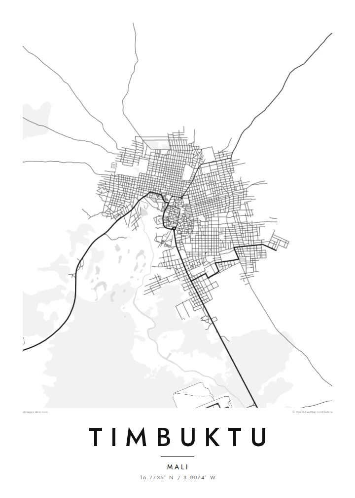
Timbuktu stands where the Sahara meets the floodplain of the Niger, a short distance north of the river. From above, the old town is a tight knot of narrow, irregular lanes. The houses are built of earth and set close together, and beyond them sand runs to the horizon on every side. A road and seasonal channels link the town to its river port at Kabara.
For centuries the town was a meeting point for camel caravans from the desert and boats on the Niger. It became a centre of Islamic learning, and its three great earthen mosques, Djinguereber, Sankore and Sidi Yahia, are listed together with the old town as a UNESCO World Heritage Site.
Its libraries still hold hundreds of thousands of manuscripts on law, astronomy, medicine and poetry, many of them preserved by local families. A Timbuktu map poster shows how compact the historic town really is. There is no grid and no ring road, only lanes that bend around courtyards and open onto small squares, much as they have for generations.
The historic core is a dense, organic tangle of alleys with no straight axis. On the map it looks almost woven, and that texture comes through strongly in Noir.
Djinguereber, Sankore and Sidi Yahia sit within the old town. Their open courtyards leave small gaps in the dense street pattern, which make useful points of reference.
To the south, a road and seasonal channels run towards Kabara on the Niger. It is a reminder that the town has always depended on its river port as well as the desert routes.
Make it yours
Add a date, a name or a line of your own, switch style, size or orientation.
The free preview is low-resolution with a watermark. Prints and HD files are rendered at 300 DPI, up to 7,200 × 10,800 px, without a watermark.
Why Timbuktu
Timbuktu has been a byword for distance for centuries, which is part of why a precise map of it feels so striking. Hung on a wall, it turns a half-legendary name into real streets, and it suits readers, travellers and anyone who has worked in the Sahel.
The Sand style matches the town's earthen colours, and Paper gives it the feel of an archive. You can personalise the title, subtitle and coordinates. Printed posters come on matte paper, with an optional wooden frame, and HD files cost $9.
Order the Timbuktu poster| Print size | Resolution | Files |
|---|---|---|
| 30 × 40 cm11.8 × 15.7″ | 3,543 × 4,724 px | PNG · PDF |
| 29.7 × 42 cm (A3)11.7 × 16.5″ | 3,508 × 4,961 px | PNG · PDF |
| 42 × 59.4 cm (A2)16.5 × 23.4″ | 4,961 × 7,016 px | PNG · PDF |
| 45.7 × 61 cm18 × 24″ | 5,400 × 7,200 px | PNG · PDF |
| 50 × 70 cm19.7 × 27.6″ | 5,906 × 8,268 px | PNG · PDF |
| 61 × 91.4 cm24 × 36″ | 7,200 × 10,800 px | PNG · PDF |
For comparison, the free preview is 900 px wide, watermarked and meant for screens. The HD files have up to 8× the resolution in each direction and print cleanly at full poster size.
Pick a style at the top of the page, then choose Printed Poster — a size and, if you like, a frame — or Digital HD Files. Checkout takes one step, and your order page updates as soon as the payment goes through.
It is printed on premium 200 gsm matte paper in one of six sizes, from 30 × 40 cm to 24 × 36″. Printed posters start at $39, shipping included.
Yes. Choose a solid wood frame in black, white, natural oak or dark wood. It comes with shatterproof glazing and is ready to hang. Framed posters start at $99, shipping included.
Shipping is free to 60+ countries. Each poster is printed by the nearest of our print partners in 30+ countries and usually arrives in 3–7 business days. You can follow the status and tracking under My Orders. A few countries take 2–5 weeks, and where we don't ship yet, the site tells you before you pay.
Send us a photo within 14 days of delivery and we will reprint it for free or refund you.
Yes. In the editor on this page, change the title, the subtitle and the coordinates line to anything you like, and pick a style and size. Printed, framed and digital orders all use exactly your design.
For $9 you get 300 DPI PNG and print-ready PDF files in all six sizes, without a watermark, to print anywhere. Not sure yet? Download a free watermarked preview first.
Nearby
