Avenida España ring
An oval boulevard encloses the historic centre along the route of the former city walls, giving Trujillo one of the most recognisable outlines of any Peruvian city.
Minimalist map poster · Peru
8.1160° S / 79.0300° W
An oval avenue tracing lost colonial walls, a tight grid inside, and adobe ruins reaching toward the Pacific.

One city, five moods
Tap a style to see it on the wall. Every style costs the same — printed, framed or as HD files.
 Actual pixels · 24 × 36″ print file
Print-sharp
This is a 100% crop of the real print file. Every poster — printed, framed or downloaded — is rendered on our servers at 300 DPI, up to 7,200 × 10,800 pixels, so even the smallest lanes stay crisp on a 24 × 36″ print.
On the wall

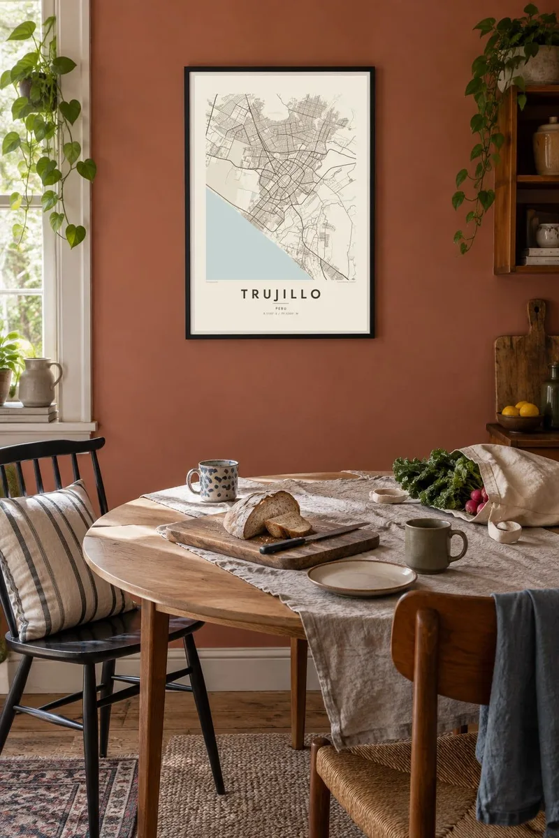
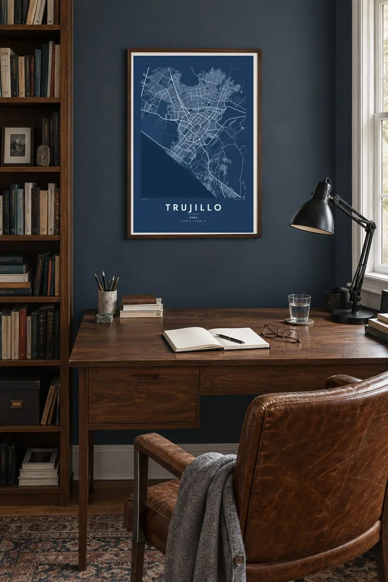
The map
Seen from above, Trujillo is easy to read. Avenida España curves in a closed oval around the historic centre, following the line of the colonial walls that once stood there. Inside it, a regular grid of blocks meets at the Plaza de Armas. Beyond the oval, newer districts spread across the flat floor of the Moche valley in looser, less regular patterns.
West of the city lies Chan Chan, the capital of the Chimú kingdom and the largest adobe city built in the pre-Columbian Americas. On a map its walled compounds appear as faint rectangles in open ground between the edge of the city and the sea. Further along the coast, Huanchaco still keeps its fishing tradition of reed boats known as caballitos de totora.
A Trujillo map poster brings these layers into one frame: the colonial ring, the rectangular outlines of the ancient compounds and the long, straight Pacific shoreline. In fine black line, the contrast between the dense old centre and the looser suburbs on the desert edge becomes the real subject. It is a plan that explains a great deal about how the city grew.
An oval boulevard encloses the historic centre along the route of the former city walls, giving Trujillo one of the most recognisable outlines of any Peruvian city.
The Chimú capital, a UNESCO World Heritage Site, spreads across the plain toward the ocean. Its large walled enclosures form rectangles that read clearly at map scale.
Northwest of the centre the land meets the Pacific in a straight coastal line, where the fishing village of Huanchaco still launches traditional reed boats into the surf.
Make it yours
Add a date, a name or a line of your own, switch style, size or orientation.
The free preview is low-resolution with a watermark. Prints and HD files are rendered at 300 DPI, up to 7,200 × 10,800 px, without a watermark.
Why Trujillo
Trujillo suits people who know it through family, a semester in northern Peru or a trip to the archaeological sites. The oval centre works as a natural focal point, so the composition stays balanced whether you print it small for a shelf or large above a desk.
You can change the title, subtitle and coordinates line to mark a neighbourhood, a wedding or a year, then choose Classic black & white, Noir, Paper, Blueprint or Sand. Download the HD files for $9, or order a printed poster on matte paper with an optional wooden frame.
Order the Trujillo poster| Print size | Resolution | Files |
|---|---|---|
| 30 × 40 cm11.8 × 15.7″ | 3,543 × 4,724 px | PNG · PDF |
| 29.7 × 42 cm (A3)11.7 × 16.5″ | 3,508 × 4,961 px | PNG · PDF |
| 42 × 59.4 cm (A2)16.5 × 23.4″ | 4,961 × 7,016 px | PNG · PDF |
| 45.7 × 61 cm18 × 24″ | 5,400 × 7,200 px | PNG · PDF |
| 50 × 70 cm19.7 × 27.6″ | 5,906 × 8,268 px | PNG · PDF |
| 61 × 91.4 cm24 × 36″ | 7,200 × 10,800 px | PNG · PDF |
For comparison, the free preview is 900 px wide, watermarked and meant for screens. The HD files have up to 8× the resolution in each direction and print cleanly at full poster size.
Pick a style at the top of the page, then choose Printed Poster — a size and, if you like, a frame — or Digital HD Files. Checkout takes one step, and your order page updates as soon as the payment goes through.
It is printed on premium 200 gsm matte paper in one of six sizes, from 30 × 40 cm to 24 × 36″. Printed posters start at $39, shipping included.
Yes. Choose a solid wood frame in black, white, natural oak or dark wood. It comes with shatterproof glazing and is ready to hang. Framed posters start at $99, shipping included.
Shipping is free to 60+ countries. Each poster is printed by the nearest of our print partners in 30+ countries and usually arrives in 3–7 business days. You can follow the status and tracking under My Orders. A few countries take 2–5 weeks, and where we don't ship yet, the site tells you before you pay.
Send us a photo within 14 days of delivery and we will reprint it for free or refund you.
Yes. In the editor on this page, change the title, the subtitle and the coordinates line to anything you like, and pick a style and size. Printed, framed and digital orders all use exactly your design.
For $9 you get 300 DPI PNG and print-ready PDF files in all six sizes, without a watermark, to print anywhere. Not sure yet? Download a free watermarked preview first.
Nearby
