Chain of lakes
Alta, Nita, Alpha and Green Lakes lie along the valley floor, giving the map a string of calm shapes between the highway, the railway and the residential streets.
Minimalist map poster · Canada
50.1172° N / 122.9543° W
A valley strung with small lakes and the Sea-to-Sky Highway, two great mountains meeting at a compact pedestrian village.
One city, five moods
Tap a style to see it on the wall. Every style costs the same — printed, framed or as HD files.
 Actual pixels · 24 × 36″ print file
Print-sharp
This is a 100% crop of the real print file. Every poster — printed, framed or downloaded — is rendered on our servers at 300 DPI, up to 7,200 × 10,800 pixels, so even the smallest lanes stay crisp on a 24 × 36″ print.
On the wall


The resort
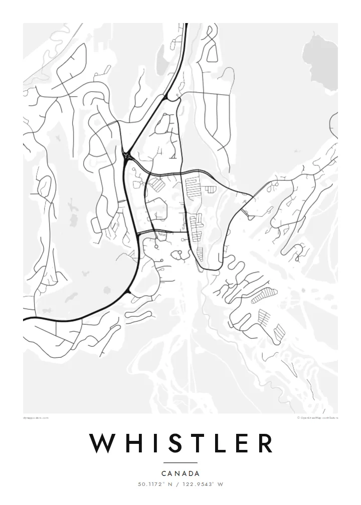
Whistler sits in a narrow valley of the Coast Mountains, and on the map its structure is easy to follow. Highway 99 runs north to south through the middle, a chain of lakes lies along the valley floor, and neighbourhoods branch off in short cul-de-sacs toward the slopes. Whistler Village gathers at the foot of both mountains, where Fitzsimmons Creek comes down between them.
Whistler and Blackcomb operated as rival ski areas until they came under one owner in the late 1990s, and since 2008 the Peak 2 Peak Gondola has linked their upper slopes across the Fitzsimmons valley. In 2010 the resort hosted the alpine skiing events of the Vancouver Winter Olympics, with the races run on Whistler Mountain above Creekside.
A Whistler map poster shows the resort the way it is actually organised: lakes, a highway, two peaks and a village pinned between them. The Valley Trail threads through it all, linking the lakes and neighbourhoods on a paved path that turns up clearly as a thin winding line alongside the main road and the railway.
Alta, Nita, Alpha and Green Lakes lie along the valley floor, giving the map a string of calm shapes between the highway, the railway and the residential streets.
Whistler Village is laid out as a car-free stroll of squares and walkways, a compact cluster that stands out against the looser suburban loops to the north and south.
The creek runs down between Whistler and Blackcomb mountains and through the village, marking the split between the two ski areas that the gondola now spans high above.
Make it yours
Add a date, a name or a line of your own, switch style, size or orientation.
The free preview is low-resolution with a watermark. Prints and HD files are rendered at 300 DPI, up to 7,200 × 10,800 px, without a watermark.
Why Whistler
Whistler draws visitors from all over the world, along with plenty of people who came for a season and stayed. A map of the valley is a way to keep a sense of the place: the lakes you skated or swam in, the road to Vancouver, the village you walked through at the end of the day.
Personalise the poster with a title, a subtitle such as a season or a year, and a coordinates line, then choose Classic black & white, Noir, Paper, Blueprint or Sand. Printed posters come on matte paper, with an optional wooden frame, from print partners in more than 30 countries.
Order the Whistler poster| Print size | Resolution | Files |
|---|---|---|
| 30 × 40 cm11.8 × 15.7″ | 3,543 × 4,724 px | PNG · PDF |
| 29.7 × 42 cm (A3)11.7 × 16.5″ | 3,508 × 4,961 px | PNG · PDF |
| 42 × 59.4 cm (A2)16.5 × 23.4″ | 4,961 × 7,016 px | PNG · PDF |
| 45.7 × 61 cm18 × 24″ | 5,400 × 7,200 px | PNG · PDF |
| 50 × 70 cm19.7 × 27.6″ | 5,906 × 8,268 px | PNG · PDF |
| 61 × 91.4 cm24 × 36″ | 7,200 × 10,800 px | PNG · PDF |
For comparison, the free preview is 900 px wide, watermarked and meant for screens. The HD files have up to 8× the resolution in each direction and print cleanly at full poster size.
Pick a style at the top of the page, then choose Printed Poster — a size and, if you like, a frame — or Digital HD Files. Checkout takes one step, and your order page updates as soon as the payment goes through.
It is printed on premium 200 gsm matte paper in one of six sizes, from 30 × 40 cm to 24 × 36″. Printed posters start at $39, shipping included.
Yes. Choose a solid wood frame in black, white, natural oak or dark wood. It comes with shatterproof glazing and is ready to hang. Framed posters start at $99, shipping included.
Shipping is free to 60+ countries. Each poster is printed by the nearest of our print partners in 30+ countries and usually arrives in 3–7 business days. You can follow the status and tracking under My Orders. A few countries take 2–5 weeks, and where we don't ship yet, the site tells you before you pay.
Send us a photo within 14 days of delivery and we will reprint it for free or refund you.
Yes. In the editor on this page, change the title, the subtitle and the coordinates line to anything you like, and pick a style and size. Printed, framed and digital orders all use exactly your design.
For $9 you get 300 DPI PNG and print-ready PDF files in all six sizes, without a watermark, to print anywhere. Not sure yet? Download a free watermarked preview first.
Nearby
