North, Milwaukee, Damen
Three major streets meet at this six-way junction, the center of the neighborhood. The elevated Damen station is close by, and the corner buildings are cut at angles to fit.
Minimalist map poster · United States
41.9115° N / 87.6775° W
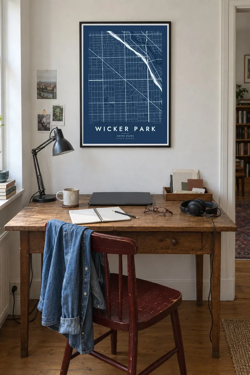
Chicago's rectangular grid, broken by the long diagonal of Milwaukee Avenue and a six-way crossing at its heart.

One city, five moods
Tap a style to see it on the wall. Every style costs the same — printed, framed or as HD files.
 Actual pixels · 24 × 36″ print file
Print-sharp
This is a 100% crop of the real print file. Every poster — printed, framed or downloaded — is rendered on our servers at 300 DPI, up to 7,200 × 10,800 pixels, so even the smallest lanes stay crisp on a 24 × 36″ print.
On the wall


The district
Wicker Park sits on Chicago's Northwest Side, where the city's strict grid meets one of its old diagonal roads. Milwaukee Avenue cuts through at an angle, and where it meets North and Damen Avenues the streets form a six-way intersection that anchors the neighborhood. Around it, houses, two-flats and storefronts fill the rectangular blocks in regular rows, with alleys running behind nearly every one.
The neighborhood takes its name from a small triangular park donated in 1870 by the brothers Charles and Joel Wicker. After the Great Chicago Fire of 1871, the area saw a wave of new building, including large Victorian houses near the park that still stand. Later decades brought working-class immigrant families, and in the 1990s the area became known for its music and art scene.
On a Wicker Park map poster, the elevated Blue Line follows the direction of Milwaukee Avenue. Along the northern edge runs the 606, a former rail embankment turned into a raised trail and park. Together with the diagonal avenue, these lines stand out against the fine repetition of the grid, a balance that works well in black and white.
Three major streets meet at this six-way junction, the center of the neighborhood. The elevated Damen station is close by, and the corner buildings are cut at angles to fit.
The park itself is a small triangle bounded by streets, a reminder of the diagonal geometry that runs through this part of the city.
The Bloomingdale Trail follows an old rail line for nearly three miles on a raised embankment. It forms a clean straight line along the northern edge of the area.
Make it yours
Add a date, a name or a line of your own, switch style, size or orientation.
The free preview is low-resolution with a watermark. Prints and HD files are rendered at 300 DPI, up to 7,200 × 10,800 px, without a watermark.
Why Wicker Park
If you rented a flat above a shop on Milwaukee or spent years around Damen and North, you know the tilted avenue slicing through the grid on sight, even without labels. It is the kind of shape you learn by walking it daily.
You can personalize the poster with a title, a subtitle for a year or an address, and a coordinates line. Choose Classic black and white, Noir, Paper, Blueprint or Sand, then print the files at home or order a framed version.
Order the Wicker Park poster| Print size | Resolution | Files |
|---|---|---|
| 30 × 40 cm11.8 × 15.7″ | 3,543 × 4,724 px | PNG · PDF |
| 29.7 × 42 cm (A3)11.7 × 16.5″ | 3,508 × 4,961 px | PNG · PDF |
| 42 × 59.4 cm (A2)16.5 × 23.4″ | 4,961 × 7,016 px | PNG · PDF |
| 45.7 × 61 cm18 × 24″ | 5,400 × 7,200 px | PNG · PDF |
| 50 × 70 cm19.7 × 27.6″ | 5,906 × 8,268 px | PNG · PDF |
| 61 × 91.4 cm24 × 36″ | 7,200 × 10,800 px | PNG · PDF |
For comparison, the free preview is 900 px wide, watermarked and meant for screens. The HD files have up to 8× the resolution in each direction and print cleanly at full poster size.
Pick a style at the top of the page, then choose Printed Poster — a size and, if you like, a frame — or Digital HD Files. Checkout takes one step, and your order page updates as soon as the payment goes through.
It is printed on premium 200 gsm matte paper in one of six sizes, from 30 × 40 cm to 24 × 36″. Printed posters start at $39, shipping included.
Yes. Choose a solid wood frame in black, white, natural oak or dark wood. It comes with shatterproof glazing and is ready to hang. Framed posters start at $99, shipping included.
Shipping is free to 60+ countries. Each poster is printed by the nearest of our print partners in 30+ countries and usually arrives in 3–7 business days. You can follow the status and tracking under My Orders. A few countries take 2–5 weeks, and where we don't ship yet, the site tells you before you pay.
Send us a photo within 14 days of delivery and we will reprint it for free or refund you.
Yes. In the editor on this page, change the title, the subtitle and the coordinates line to anything you like, and pick a style and size. Printed, framed and digital orders all use exactly your design.
For $9 you get 300 DPI PNG and print-ready PDF files in all six sizes, without a watermark, to print anywhere. Not sure yet? Download a free watermarked preview first.
Nearby
