Canal and locks
The Leeds and Liverpool Canal curves around the town and climbs east through a long lock flight, drawing a thin, deliberate line across the streets.
Minimalist map poster · United Kingdom
53.5430° N / 2.6371° W
A Lancashire mill town where the River Douglas and the Leeds and Liverpool Canal meet among terraced streets and flooded former coalfields.

One city, five moods
Tap a style to see it on the wall. Every style costs the same — printed, framed or as HD files.
 Actual pixels · 24 × 36″ print file
Print-sharp
This is a 100% crop of the real print file. Every poster — printed, framed or downloaded — is rendered on our servers at 300 DPI, up to 7,200 × 10,800 pixels, so even the smallest lanes stay crisp on a 24 × 36″ print.
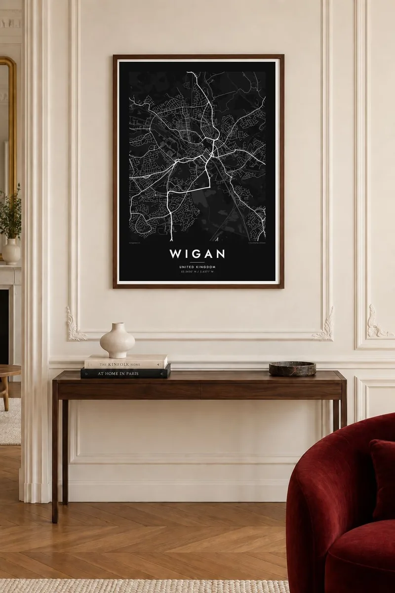
On the wall


The map
Wigan grew around the River Douglas, and its old centre sits on rising ground above the valley. The main streets meet near the parish church and market area. Around them, rows of terraced housing spread in tight parallel lines, the shape of a town that expanded quickly with coal and cotton. Ring roads and rail lines now thread through this older fabric.
The Leeds and Liverpool Canal passes to the south and west of the centre, and a flight of locks carries it up the hill toward the east. Wigan Pier, the old canal wharf, became widely known through George Orwell's book The Road to Wigan Pier. Today the warehouses and towpaths stand out as a slim waterside corridor on the map.
Mining left its own mark. Land that subsided over old workings flooded, forming the Wigan Flashes, a group of lakes and reedbeds that is now a nature reserve. On a Wigan map poster these water bodies appear as scattered, irregular shapes south of town. To the north, Haigh Hall and its woodland add a large green area to the frame.
The Leeds and Liverpool Canal curves around the town and climbs east through a long lock flight, drawing a thin, deliberate line across the streets.
Lakes formed where old mine workings subsided now lie south of the centre, a cluster of uneven water shapes that has become a wetland reserve.
Dense bands of parallel terraced streets surround the centre, giving the map a fine, striped texture typical of northern industrial towns.
Make it yours
Add a date, a name or a line of your own, switch style, size or orientation.
The free preview is low-resolution with a watermark. Prints and HD files are rendered at 300 DPI, up to 7,200 × 10,800 px, without a watermark.
Why Wigan
Wigan means a lot to people who grew up here, to rugby league supporters, and to anyone with family roots in Lancashire's mining and mill towns. The canal, the flashes and the terraced streets make an honest portrait of the place.
Add a title, subtitle and coordinates line, whether a street name, a family surname or a year, and choose one of five styles: Classic black & white, Noir, Paper, Blueprint or Sand. Printed posters come on matte paper with an optional wooden frame.
Order the Wigan poster| Print size | Resolution | Files |
|---|---|---|
| 30 × 40 cm11.8 × 15.7″ | 3,543 × 4,724 px | PNG · PDF |
| 29.7 × 42 cm (A3)11.7 × 16.5″ | 3,508 × 4,961 px | PNG · PDF |
| 42 × 59.4 cm (A2)16.5 × 23.4″ | 4,961 × 7,016 px | PNG · PDF |
| 45.7 × 61 cm18 × 24″ | 5,400 × 7,200 px | PNG · PDF |
| 50 × 70 cm19.7 × 27.6″ | 5,906 × 8,268 px | PNG · PDF |
| 61 × 91.4 cm24 × 36″ | 7,200 × 10,800 px | PNG · PDF |
For comparison, the free preview is 900 px wide, watermarked and meant for screens. The HD files have up to 8× the resolution in each direction and print cleanly at full poster size.
Pick a style at the top of the page, then choose Printed Poster — a size and, if you like, a frame — or Digital HD Files. Checkout takes one step, and your order page updates as soon as the payment goes through.
It is printed on premium 200 gsm matte paper in one of six sizes, from 30 × 40 cm to 24 × 36″. Printed posters start at $39, shipping included.
Yes. Choose a solid wood frame in black, white, natural oak or dark wood. It comes with shatterproof glazing and is ready to hang. Framed posters start at $99, shipping included.
Shipping is free to 60+ countries. Each poster is printed by the nearest of our print partners in 30+ countries and usually arrives in 3–7 business days. You can follow the status and tracking under My Orders. A few countries take 2–5 weeks, and where we don't ship yet, the site tells you before you pay.
Send us a photo within 14 days of delivery and we will reprint it for free or refund you.
Yes. In the editor on this page, change the title, the subtitle and the coordinates line to anything you like, and pick a style and size. Printed, framed and digital orders all use exactly your design.
For $9 you get 300 DPI PNG and print-ready PDF files in all six sizes, without a watermark, to print anywhere. Not sure yet? Download a free watermarked preview first.
Nearby
