İstiklal Avenue
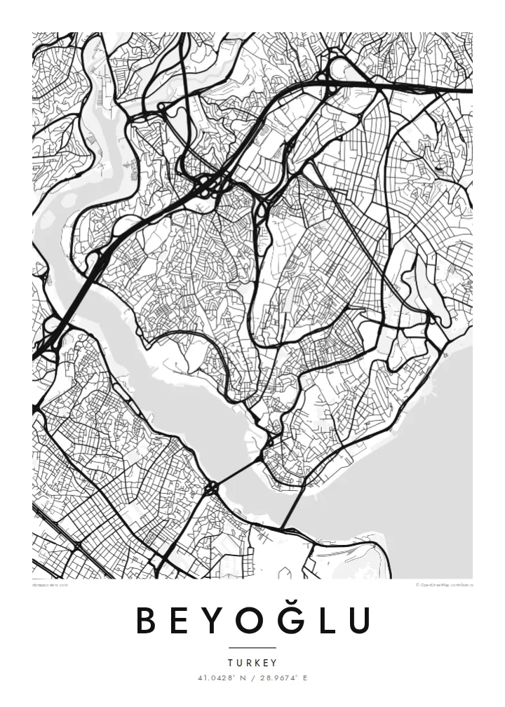
The pedestrian avenue from Taksim to Tünel follows the ridge in a long, slightly curving line. It is the clearest single stroke on the map.
Ata mapa faigafua · Türkiye
41.0428° N / 28.9674° E
A hilly district above the Golden Horn and Bosphorus, with a pedestrian avenue running along the ridge from Taksim to Galata



Kolo e tahi, lanu e nima
Tuki he sitaili ke sio ai ʻi te holo. ʻE tatau pē te totogi ʻo te sitaili fuli pē — mokā tā, fakakātoa, peʻe ko he ʻu faila HD.
 Ngaahi pikiseli moʻoni · faila tā 24 × 36″
Mahino lelei ki te pulūti
Ko he konga 100% ʻo te faila tā moʻoni ʻaeni. Ko te ʻu posita fuli pē — mokā tā, fakakātoa peʻe download — ʻe fakatupu ʻi ʻomātou seva ʻi te 300 DPI, aʻu ki te 7,200 × 10,800 pikiseli, koia ʻe nofo mahino ai te ʻu ala liliki ʻi he tā 24 × 36″.
ʻI Te Puipui


Te mapa
Beyoğlu covers the high ground north of the Golden Horn, where the land rises steeply from the water to a long ridge. The streets follow that terrain. Short, steep lanes and stairways drop down towards Karaköy and the Bosphorus shore, while the main avenue runs along the top. On the map, the district looks like a spine with ribs.
That spine is İstiklal Avenue, a pedestrian street about a kilometre and a half long. It links Taksim Square at the northern end to Tünel near the Galata Tower. A red heritage tram runs along it. At the southern end, the Tünel funicular, opened in 1875, carries passengers down the slope to Karaköy and is one of the oldest underground railways in the world.
Once known as Pera, the district was home to embassies, merchants and a large non-Muslim population in the late Ottoman period. Many of its apartment buildings and arcades date from that time. A Beyoğlu map poster shows how steep ground, a single strong avenue and two bodies of water shaped one of Istanbul's most distinctive districts.
The pedestrian avenue from Taksim to Tünel follows the ridge in a long, slightly curving line. It is the clearest single stroke on the map.
The medieval stone tower stands on the southern slope above Karaköy. It marks the point where the district begins its descent to the Golden Horn.
Short, steep streets and flights of steps connect the ridge to the waterfront, giving the map a dense, fine-grained texture on its southern and eastern edges.
Faʻu ke ʻau ʻa ʻau
Tuku he ʻaho, he hingoa peʻe he kiʻi palalau ʻa ʻau, fetogi te faʻahiga, te lahi peʻe te hake.
Ko te faʻata fua noa ʻe māʻulalo hono lelei pea ʻe ʻi ai he fakaʻilonga. Ko te ʻu tā mo te ʻu faila HD ʻe fakatupu ʻi te 300 DPI, aʻu ki te 7,200 × 10,800 px, ʻe mole ʻi ai he fakaʻilonga.
Koteā ko Beyoğlu
Beyoğlu is where many people lived their Istanbul years, whether as students, new arrivals or night owls. A map of its ridge and slopes holds those streets together more faithfully than any photograph.
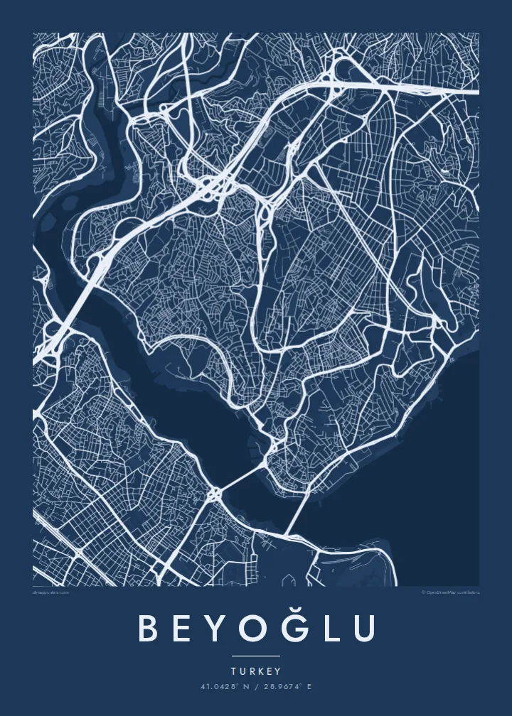
Personalise the title and subtitle with a date, an address or a line of your own. Choose one of five styles. Noir suits the district's late evenings, while Paper gives it the look of an old city plan.
Fakatau te posita Beyoğlu| Lahi ʻo te pulūti | Mahino | Faile |
|---|---|---|
| 30 × 40 cm (11.8 × 15.7″) | 3,543 × 4,724 px | PNG · PDF |
| 29.7 × 42 cm (A3, 11.7 × 16.5″) | 3,508 × 4,961 px | PNG · PDF |
| 42 × 59.4 cm (A2, 16.5 × 23.4″) | 4,961 × 7,016 px | PNG · PDF |
| 45.7 × 61 cm (18 × 24″) | 5,400 × 7,200 px | PNG · PDF |
| 50 × 70 cm (19.7 × 27.6″) | 5,906 × 8,268 px | PNG · PDF |
| 61 × 91.4 cm (24 × 36″) | 7,200 × 10,800 px | PNG · PDF |
Ko te ata ʻe mole totogi ʻe 900 px tona laulahi, mo te fakaʻilonga, ki te sioʻata pē. Ko te ʻu faile HD ʻe aʻu ki te liuga 8 tona mahino, pea ʻe pulūti lelei ʻi te lahi kātoa.
Fili he sitaili ʻi te tuʻa ʻo te pasina, pea fili leva te Posita Tā — he lahi pea, kapau ʻe ke loto ai, he fakakātoa — peʻe ko te ʻu Faila HD Fakakomipiuta. ʻE tahi pē te sitepu ʻo te totogi, pea ʻe fakafou fakavavevave pē tau pasina fakatau mai te taimi ʻe fai ai te totogi.
ʻE tā ʻi he pepa lelei ʻaupito 200 gsm matte, ʻi he tahi ʻo te ono lahi, mai te 30 × 40 cm ki te 24 × 36″. ʻE kamata te ʻu posita tā ʻi te {printFrom}, kātoa mo te ʻave.
ʻIo. Fili he fakakātoa ʻakau moʻoni ʻi te kili, hinahina, ʻakau natula peʻe ʻakau ʻuliʻuli. ʻE ʻi ai mo he sioga mālohi ʻe mole mafesi, pea kua teu ke tautau. ʻE kamata te ʻu posita fakakātoa ʻi te {framedFrom}, kātoa mo te ʻave.
ʻE fua noa te ʻave ki te lalolagi kātoa. ʻE tā takitaha posita e te kaugā tā ʻe ovi ki ai ʻi te lolotoga ʻo te ʻu puleʻanga e 30 tupu, pea ʻe aʻu mai tuʻumaʻu ʻi te ʻaho gāue e 3 ki te 7. ʻE feala ke ke sio ki te tuʻu pea mo te ʻalu ʻi lalo ʻo Taku ʻu Fakatau.
Fekau mai he ʻata ʻi loto ʻi te ʻaho e 14 talu mai te aʻu mai, pea mātou toe tā noa peʻe toe totogi atu.
ʻIo. ʻI te meʻa fakatonutonu ʻi te pasina ʻaeni, fetogi te kupu tāfito, te kupu lalo pea mo te laina koʻoliteti ki he meʻa fuli pē ʻe ke loto ai, pea fili he sitaili mo he lahi. Ko te ʻu fakatau tā, fakakātoa mo fakakomipiuta ʻe fakaʻaogaʻi katoa pē tou fakatātā.
Mo te $9 ʻe ke maʻu ai te ʻu faila PNG 300 DPI mo PDF kua teu ke tā, ʻi te ono lahi kātoa, ʻe mole ʻi ai he fakaʻilonga, ke ke tā ai ʻi soʻo he potu. Kei tā fakafiafia? Download muʻa he faʻata mokā mo he fakaʻilonga, ʻe fua noa.
