Central lakes
A chain of artificial lakes runs through the city, with the presidential palace beside them. They divide the districts and form the largest open shapes on the map.
Minimalist map poster · Ivory Coast
6.8205° N / 5.2767° W
A planned capital of wide boulevards and artificial lakes, laid out around the birthplace of Félix Houphouët-Boigny.

One city, five moods
Tap a style to see it on the wall. Every style costs the same — printed, framed or as HD files.
 Actual pixels · 24 × 36″ print file
Print-sharp
This is a 100% crop of the real print file. Every poster — printed, framed or downloaded — is rendered on our servers at 300 DPI, up to 7,200 × 10,800 pixels, so even the smallest lanes stay crisp on a 24 × 36″ print.
On the wall


The map
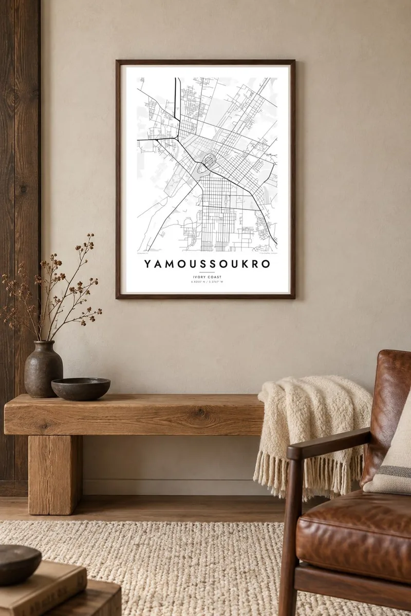
Yamoussoukro became the official capital of Ivory Coast in 1983. It was the home village of the country's first president, Félix Houphouët-Boigny, and was transformed into a planned city. From above, it is unusually spacious: broad avenues, large roundabouts and generous plots, with a series of artificial lakes running through the centre and separating its districts.
The city's best-known building is the Basilica of Our Lady of Peace, consecrated in 1990 and modelled in part on St Peter's in Rome. Its colonnaded forecourt shows clearly on the map. The lakes beside the presidential palace are home to crocodiles, a long-standing local attraction. The plan was drawn for a larger city than the one that has grown into it.
A Yamoussoukro map poster emphasises this deliberate layout. The lakes form soft, open shapes, the boulevards draw long straight lines, and the basilica's circular forecourt adds a precise geometric detail. In monochrome, the generous spacing gives the composition a light, airy quality that denser cities rarely have.
A chain of artificial lakes runs through the city, with the presidential palace beside them. They divide the districts and form the largest open shapes on the map.
The Basilica of Our Lady of Peace stands at the edge of town with a vast colonnaded plaza. From above, its circle and dome are easy to spot.
Wide, straight avenues, planned for a much larger population, cut across the city and give the map an unusually open, formal structure.
Make it yours
Add a date, a name or a line of your own, switch style, size or orientation.
The free preview is low-resolution with a watermark. Prints and HD files are rendered at 300 DPI, up to 7,200 × 10,800 px, without a watermark.
Why Yamoussoukro
Yamoussoukro is a capital built to a clear vision, and its map shows that intention plainly. It makes a considered choice for people from the city, for Ivorians abroad and for anyone interested in planned capitals and modern urban design.
Add your own title, subtitle and coordinates line, and pick one of five styles, from Classic black & white to Sand. HD files cost $9 and include six print sizes, or you can order a printed poster shipped from print partners in more than 30 countries.
Order the Yamoussoukro poster| Print size | Resolution | Files |
|---|---|---|
| 30 × 40 cm11.8 × 15.7″ | 3,543 × 4,724 px | PNG · PDF |
| 29.7 × 42 cm (A3)11.7 × 16.5″ | 3,508 × 4,961 px | PNG · PDF |
| 42 × 59.4 cm (A2)16.5 × 23.4″ | 4,961 × 7,016 px | PNG · PDF |
| 45.7 × 61 cm18 × 24″ | 5,400 × 7,200 px | PNG · PDF |
| 50 × 70 cm19.7 × 27.6″ | 5,906 × 8,268 px | PNG · PDF |
| 61 × 91.4 cm24 × 36″ | 7,200 × 10,800 px | PNG · PDF |
For comparison, the free preview is 900 px wide, watermarked and meant for screens. The HD files have up to 8× the resolution in each direction and print cleanly at full poster size.
Pick a style at the top of the page, then choose Printed Poster — a size and, if you like, a frame — or Digital HD Files. Checkout takes one step, and your order page updates as soon as the payment goes through.
It is printed on premium 200 gsm matte paper in one of six sizes, from 30 × 40 cm to 24 × 36″. Printed posters start at $39, shipping included.
Yes. Choose a solid wood frame in black, white, natural oak or dark wood. It comes with shatterproof glazing and is ready to hang. Framed posters start at $99, shipping included.
Shipping is free to 60+ countries. Each poster is printed by the nearest of our print partners in 30+ countries and usually arrives in 3–7 business days. You can follow the status and tracking under My Orders. A few countries take 2–5 weeks, and where we don't ship yet, the site tells you before you pay.
Send us a photo within 14 days of delivery and we will reprint it for free or refund you.
Yes. In the editor on this page, change the title, the subtitle and the coordinates line to anything you like, and pick a style and size. Printed, framed and digital orders all use exactly your design.
For $9 you get 300 DPI PNG and print-ready PDF files in all six sizes, without a watermark, to print anywhere. Not sure yet? Download a free watermarked preview first.
Nearby
