Slender West Lake
A narrow, winding lake north-west of the old city, its irregular outline curving through parkland in a shape that looks almost hand-drawn.
Minimalist map poster · China
An old canal city of moats, garden lakes and waterways, sitting where the Grand Canal approaches the Yangtze.
32.3972° N / 119.4358° E


One city, five moods
Tap a style to see it on the wall. Every style is included in the same $9 price.
 Actual pixels · 24 × 36″ HD file
Print-sharp
This is a crop of the real HD file at 100%. The paid download is rendered on our servers at 300 DPI, up to 7,200 × 10,800 pixels, so even the smallest lanes stay crisp on a 24 × 36″ print.
The map
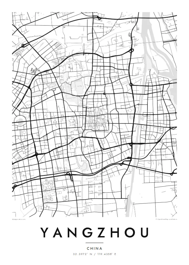
Yangzhou sits on the north bank of the Yangtze, and its map is shaped by water from every direction. The Grand Canal passes along the eastern side of the old city, while moats and smaller canals trace the outline of the former walls. Inside, the historic centre keeps a fine grid of narrow lanes, which survives in considerable detail beside the wider modern roads.
To the north-west lies Slender West Lake, a long, winding lake lined with gardens and pavilions, which appears on the map as a thin ribbon of water curving through green space. Classical gardens such as the Ge Garden and He Garden sit within the old city, small enclosed shapes among the surrounding lanes.
Yangzhou flourished for centuries as a centre of the salt trade and a stop on the Grand Canal, which became a UNESCO World Heritage Site in 2014. The monk Jianzhen, who travelled to Japan in the eighth century, came from here. A Yangzhou map poster shows a city where canals, lakes and old lanes still define the plan.
A narrow, winding lake north-west of the old city, its irregular outline curving through parkland in a shape that looks almost hand-drawn.
The canal passes the east side of the city on its long route north, a steady line of water that has shaped Yangzhou since ancient times.
Within the former walls, a dense network of narrow alleys survives, giving the centre a fine, intricate texture beside the broader modern roads.
Make it yours
Add a date, a name or a line of your own, switch style, size or orientation.
Free preview is low-resolution with a watermark. The HD version is 7,200 × 10,800 px, 300 DPI, no watermark.
Why Yangzhou
Yangzhou is often remembered for its gardens and slow canals, and a map of the old city and its waterways has the same quiet, measured quality. It suits a study, a reading corner or a gift for someone who grew up there.
The title, subtitle and coordinates line can all be changed, and five styles are available, including Paper and Sand for a softer, older look. Download HD files in six sizes for $9, or order a printed poster with an optional frame.
Get the Yangzhou poster — $9| Print size | Resolution | Files |
|---|---|---|
| 30 × 40 cm | 3,543 × 4,724 px | PNG · PDF |
| 50 × 70 cm | 5,906 × 8,268 px | PNG · PDF |
| A3 · 29.7 × 42 cm | 3,508 × 4,961 px | PNG · PDF |
| A2 · 42 × 59.4 cm | 4,961 × 7,016 px | PNG · PDF |
| 18 × 24" | 5,400 × 7,200 px | PNG · PDF |
| 24 × 36" | 7,200 × 10,800 px | PNG · PDF |
For comparison, the free preview is 900 px wide, watermarked and meant for screens. The HD files have up to 8× the resolution in each direction and print cleanly at full poster size.
Yes. Drag and zoom the map in the editor — centre it on your neighbourhood, the old town or the whole metro area. The text updates independently.
The HD purchase includes 30×40 cm, 50×70 cm, A3, A2, 18×24″ and 24×36″, each as a 300 DPI PNG and a print-ready PDF.
You can download a free 900 px preview with a watermark. The paid HD files have no watermark and are sharp enough for large prints.
Send the PDF to any local print shop or online printing service and ask for the matching paper size. Matte paper and a thin black or oak frame suit this style best.
Nearby
