Western cape
The western tip marks where Japan's inhabited land ends. It is a narrow, rocky point where the coastline closes like a wedge toward the open sea and Taiwan.
Minimalist map poster · Japan
24.4556° N / 122.9888° E
Japan's westernmost inhabited island, an elongated block of cliffs and pasture pointing toward Taiwan

One city, five moods
Tap a style to see it on the wall. Every style costs the same — printed, framed or as HD files.
 Actual pixels · 24 × 36″ print file
Print-sharp
This is a 100% crop of the real print file. Every poster — printed, framed or downloaded — is rendered on our servers at 300 DPI, up to 7,200 × 10,800 pixels, so even the smallest lanes stay crisp on a 24 × 36″ print.
On the wall


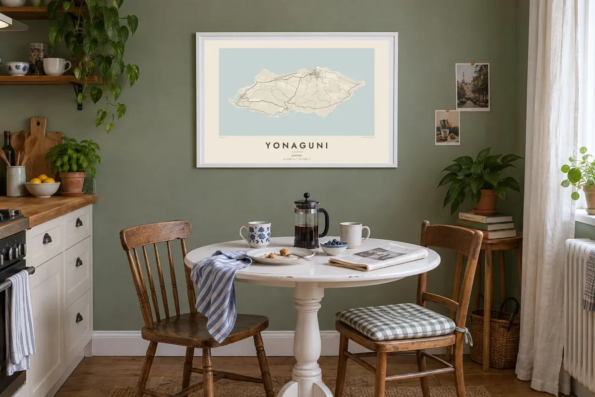
The island
Yonaguni is roughly oblong, with steep edges and a mostly high, rolling interior. On the map, three small settlements hold most of the street pattern. Around them, a looping road follows the coast and crosses a centre of pasture and low forest. The airstrip is a clean straight line, one of the few rigid shapes on an island otherwise drawn in curves.
This is the westernmost inhabited point of Japan, and on clear days Taiwan can be seen across the water. Divers know the island for the underwater rock formation off its southern coast, a stepped structure whose origin is still debated. On land, the small native Yonaguni horses graze freely across the eastern headlands.
A Yonaguni map poster shows a place that sits right at the edge of a country's map, and the frame makes that feel obvious. There is open ocean on every side, and the coastline hardens into cliffs at both ends. Beaches are few. The island's scale is easy to read at a glance: you could follow the entire coast road in an afternoon.
The western tip marks where Japan's inhabited land ends. It is a narrow, rocky point where the coastline closes like a wedge toward the open sea and Taiwan.
A single road circles the island and links the villages. It traces the shoreline almost as closely as the sea does and gives the poster a second, inner outline.
The eastern end narrows to a grassy cape where the island's horses graze. On the map it reads as open ground ending in steep coastal drops.
Make it yours
Add a date, a name or a line of your own, switch style, size or orientation.
The free preview is low-resolution with a watermark. Prints and HD files are rendered at 300 DPI, up to 7,200 × 10,800 px, without a watermark.
Why Yonaguni
For divers, travellers who wanted to reach the end of the country, or anyone with family ties to the Yaeyama islands, this outline carries a strong sense of distance. It looks especially clean in Blueprint, with the ocean dominating the page.
You can personalise the title, subtitle and coordinates line, perhaps with the date of a dive or a crossing, and pick one of five styles. The $9 HD download includes six print sizes as PNG and PDF, and printed posters ship from partners in over 30 countries.
Order the Yonaguni poster| Print size | Resolution | Files |
|---|---|---|
| 30 × 40 cm11.8 × 15.7″ | 3,543 × 4,724 px | PNG · PDF |
| 29.7 × 42 cm (A3)11.7 × 16.5″ | 3,508 × 4,961 px | PNG · PDF |
| 42 × 59.4 cm (A2)16.5 × 23.4″ | 4,961 × 7,016 px | PNG · PDF |
| 45.7 × 61 cm18 × 24″ | 5,400 × 7,200 px | PNG · PDF |
| 50 × 70 cm19.7 × 27.6″ | 5,906 × 8,268 px | PNG · PDF |
| 61 × 91.4 cm24 × 36″ | 7,200 × 10,800 px | PNG · PDF |
For comparison, the free preview is 900 px wide, watermarked and meant for screens. The HD files have up to 8× the resolution in each direction and print cleanly at full poster size.
Pick a style at the top of the page, then choose Printed Poster — a size and, if you like, a frame — or Digital HD Files. Checkout takes one step, and your order page updates as soon as the payment goes through.
It is printed on premium 200 gsm matte paper in one of six sizes, from 30 × 40 cm to 24 × 36″. Printed posters start at $39, shipping included.
Yes. Choose a solid wood frame in black, white, natural oak or dark wood. It comes with shatterproof glazing and is ready to hang. Framed posters start at $99, shipping included.
Shipping is free to 60+ countries. Each poster is printed by the nearest of our print partners in 30+ countries and usually arrives in 3–7 business days. You can follow the status and tracking under My Orders. A few countries take 2–5 weeks, and where we don't ship yet, the site tells you before you pay.
Send us a photo within 14 days of delivery and we will reprint it for free or refund you.
Yes. In the editor on this page, change the title, the subtitle and the coordinates line to anything you like, and pick a style and size. Printed, framed and digital orders all use exactly your design.
For $9 you get 300 DPI PNG and print-ready PDF files in all six sizes, without a watermark, to print anywhere. Not sure yet? Download a free watermarked preview first.
Nearby
