Sagami River edge
The river and its floodplain run along the western boundary, a wide band of water and fields that contrasts with the tight streets on the terraces above.
Minimalist map poster · Japan
35.4879° N / 139.3910° E
A compact Kanagawa city on terraces above the Sagami River, laced with commuter rail lines and bordered by a large base.

One city, five moods
Tap a style to see it on the wall. Every style costs the same — printed, framed or as HD files.
 Actual pixels · 24 × 36″ print file
Print-sharp
This is a 100% crop of the real print file. Every poster — printed, framed or downloaded — is rendered on our servers at 300 DPI, up to 7,200 × 10,800 pixels, so even the smallest lanes stay crisp on a 24 × 36″ print.
On the wall


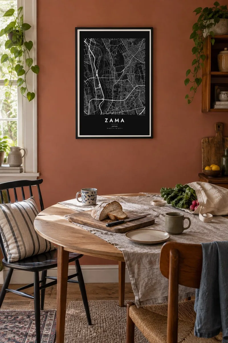
The map
Zama is a small city in central Kanagawa Prefecture, sitting on terraces above the Sagami River, which forms its western boundary. Its map is a tight suburban weave of residential streets, crossed by railway lines and dotted with small parks, typical of the commuter belt west of Tokyo and Yokohama. The river's broad channel and floodplain fields run along the western edge.
Camp Zama, a United States Army installation that also hosts units of Japan's Ground Self-Defense Force, straddles the city's northern boundary and appears on the map as a wide area of looser roads and open ground. In summer, Zama is known for its large sunflower fields on farmland near the river, which draw visitors for an annual festival.
A Zama map poster shows the texture of a Japanese commuter city in fine detail. Narrow lanes fill every block, the rail lines draw firm continuous strokes, and the river's floodplain opens up the western side. The contrast between the dense streets and the open ground of the base gives the composition a distinctive balance.
The river and its floodplain run along the western boundary, a wide band of water and fields that contrasts with the tight streets on the terraces above.
The base's grounds spread across the north as a large, loosely drawn area with curving roads and open space, clearly different from the surrounding residential blocks.
Railway lines cross the city and gather small clusters of shops and denser streets around their stations, the usual rhythm of the Tokyo region's suburbs.
Make it yours
Add a date, a name or a line of your own, switch style, size or orientation.
The free preview is low-resolution with a watermark. Prints and HD files are rendered at 300 DPI, up to 7,200 × 10,800 px, without a watermark.
Why Zama
Zama is home to commuters, families and many people connected to the base, including Americans posted there for a few years. A map poster is a practical way to remember an address that may be temporary but still meaningful.
Add a personal title and subtitle, perhaps a unit or your years in Japan, and keep the coordinates. Choose from five styles and order digital files for $9 or a printed poster from partners in over 30 countries.
Order the Zama poster| Print size | Resolution | Files |
|---|---|---|
| 30 × 40 cm11.8 × 15.7″ | 3,543 × 4,724 px | PNG · PDF |
| 29.7 × 42 cm (A3)11.7 × 16.5″ | 3,508 × 4,961 px | PNG · PDF |
| 42 × 59.4 cm (A2)16.5 × 23.4″ | 4,961 × 7,016 px | PNG · PDF |
| 45.7 × 61 cm18 × 24″ | 5,400 × 7,200 px | PNG · PDF |
| 50 × 70 cm19.7 × 27.6″ | 5,906 × 8,268 px | PNG · PDF |
| 61 × 91.4 cm24 × 36″ | 7,200 × 10,800 px | PNG · PDF |
For comparison, the free preview is 900 px wide, watermarked and meant for screens. The HD files have up to 8× the resolution in each direction and print cleanly at full poster size.
Pick a style at the top of the page, then choose Printed Poster — a size and, if you like, a frame — or Digital HD Files. Checkout takes one step, and your order page updates as soon as the payment goes through.
It is printed on premium 200 gsm matte paper in one of six sizes, from 30 × 40 cm to 24 × 36″. Printed posters start at $39, shipping included.
Yes. Choose a solid wood frame in black, white, natural oak or dark wood. It comes with shatterproof glazing and is ready to hang. Framed posters start at $99, shipping included.
Shipping is free to 60+ countries. Each poster is printed by the nearest of our print partners in 30+ countries and usually arrives in 3–7 business days. You can follow the status and tracking under My Orders. A few countries take 2–5 weeks, and where we don't ship yet, the site tells you before you pay.
Send us a photo within 14 days of delivery and we will reprint it for free or refund you.
Yes. In the editor on this page, change the title, the subtitle and the coordinates line to anything you like, and pick a style and size. Printed, framed and digital orders all use exactly your design.
For $9 you get 300 DPI PNG and print-ready PDF files in all six sizes, without a watermark, to print anywhere. Not sure yet? Download a free watermarked preview first.
Nearby
