Baťa factory grid
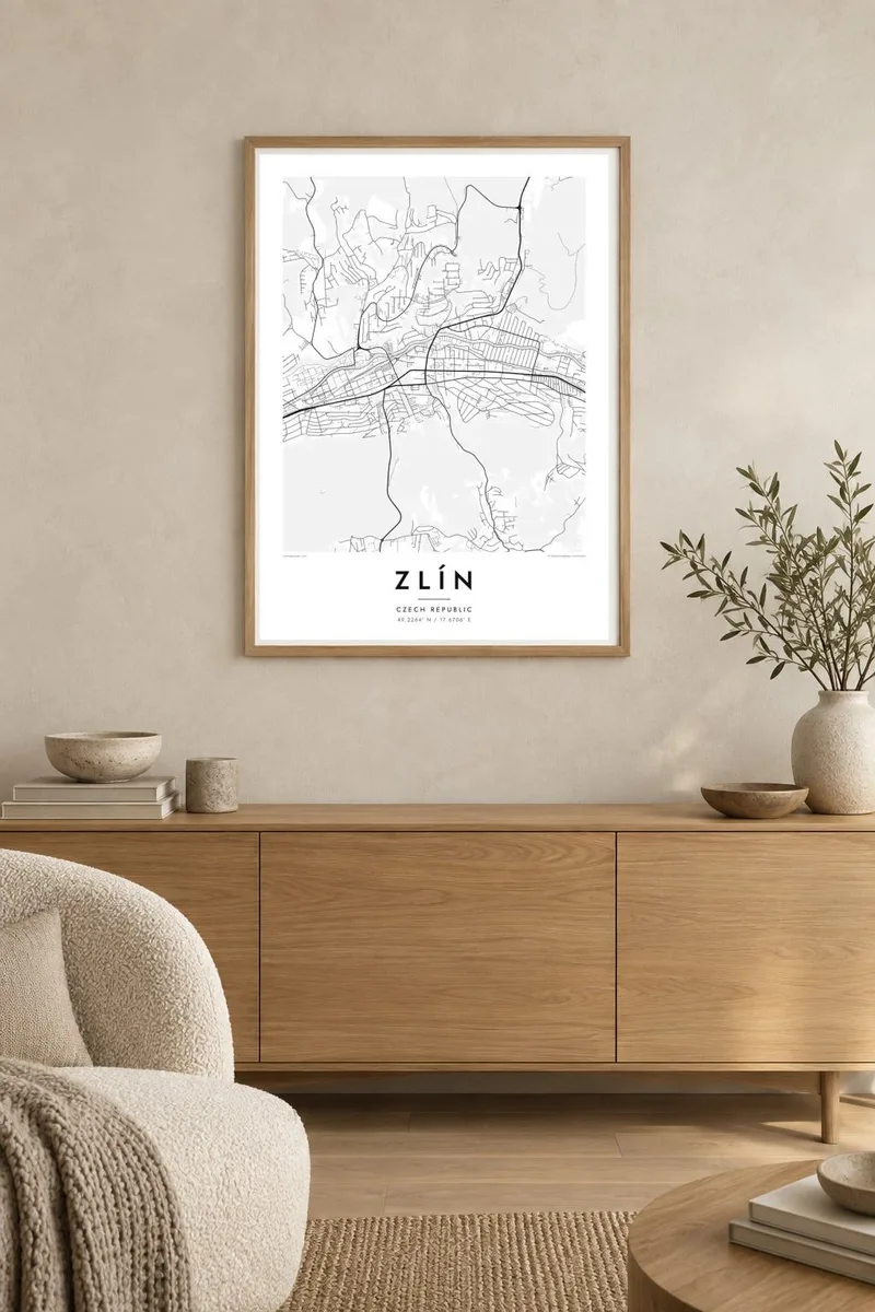
The former factory complex forms a rigid rectangular grid on the valley floor, its regular blocks unlike anything else on the map.
Minimalist map poster · Czech Republic
49.2264° N / 17.6706° E
A functionalist company town along the Dřevnice valley, with Baťa's factory grid below and rows of brick houses on the hills.

One city, five moods
Tap a style to see it on the wall. Every style costs the same — printed, framed or as HD files.
 Actual pixels · 24 × 36″ print file
Print-sharp
This is a 100% crop of the real print file. Every poster — printed, framed or downloaded — is rendered on our servers at 300 DPI, up to 7,200 × 10,800 pixels, so even the smallest lanes stay crisp on a 24 × 36″ print.
On the wall


The map
Zlín occupies the valley of the Dřevnice river in eastern Moravia, and the city's shape follows it closely: a long band of development running east to west, with neighbourhoods climbing the slopes on either side. On the map the valley floor holds the main roads, the river and the former factory complex, while the hills carry a finer network of residential streets.
Much of this layout was planned in the 1920s and 1930s by the Baťa shoe company, which turned a small town into a model industrial city. The factory area is a strict grid of numbered buildings, and on the slopes the company built estates of small red-brick family houses along curving streets, one of the most complete examples of functionalist planning in Europe.
The Baťa skyscraper, known as Building 21, still rises over the valley, and Tomas Bata University carries the family name. Between 1949 and 1989 the city was called Gottwaldov. A Zlín map poster shows the whole idea of the place at once: industry on the valley floor, homes on the hillsides, and gardens between them.
The former factory complex forms a rigid rectangular grid on the valley floor, its regular blocks unlike anything else on the map.
On the slopes, curving streets lined with small red-brick family houses follow the terrain, adding a soft, repetitive rhythm to the poster.
The river and the main road run together along the valley, drawing a long line that organises the entire city from east to west.
Make it yours
Add a date, a name or a line of your own, switch style, size or orientation.
The free preview is low-resolution with a watermark. Prints and HD files are rendered at 300 DPI, up to 7,200 × 10,800 px, without a watermark.
Why Zlín
Zlín draws architects, designers and anyone interested in modernist planning, as well as those who studied at the university or grew up in a Baťa house. Few cities show their design logic on a map with such clarity, which makes it a natural choice for a studio or office wall.
Personalise the title, subtitle and coordinates line, and try the Blueprint style, which suits a planned industrial city, or keep to Classic black & white. HD files cost $9; printed posters are available with an optional wooden frame.
Order the Zlín poster| Print size | Resolution | Files |
|---|---|---|
| 30 × 40 cm11.8 × 15.7″ | 3,543 × 4,724 px | PNG · PDF |
| 29.7 × 42 cm (A3)11.7 × 16.5″ | 3,508 × 4,961 px | PNG · PDF |
| 42 × 59.4 cm (A2)16.5 × 23.4″ | 4,961 × 7,016 px | PNG · PDF |
| 45.7 × 61 cm18 × 24″ | 5,400 × 7,200 px | PNG · PDF |
| 50 × 70 cm19.7 × 27.6″ | 5,906 × 8,268 px | PNG · PDF |
| 61 × 91.4 cm24 × 36″ | 7,200 × 10,800 px | PNG · PDF |
For comparison, the free preview is 900 px wide, watermarked and meant for screens. The HD files have up to 8× the resolution in each direction and print cleanly at full poster size.
Pick a style at the top of the page, then choose Printed Poster — a size and, if you like, a frame — or Digital HD Files. Checkout takes one step, and your order page updates as soon as the payment goes through.
It is printed on premium 200 gsm matte paper in one of six sizes, from 30 × 40 cm to 24 × 36″. Printed posters start at $39, shipping included.
Yes. Choose a solid wood frame in black, white, natural oak or dark wood. It comes with shatterproof glazing and is ready to hang. Framed posters start at $99, shipping included.
Shipping is free to 60+ countries. Each poster is printed by the nearest of our print partners in 30+ countries and usually arrives in 3–7 business days. You can follow the status and tracking under My Orders. A few countries take 2–5 weeks, and where we don't ship yet, the site tells you before you pay.
Send us a photo within 14 days of delivery and we will reprint it for free or refund you.
Yes. In the editor on this page, change the title, the subtitle and the coordinates line to anything you like, and pick a style and size. Printed, framed and digital orders all use exactly your design.
For $9 you get 300 DPI PNG and print-ready PDF files in all six sizes, without a watermark, to print anywhere. Not sure yet? Download a free watermarked preview first.
Nearby
