Central axis
A long ceremonial spine runs through the heart of the city, lined with government and civic buildings, and gives the whole map a clear sense of direction.
Minimalist map poster · Nigeria
9.0579° N / 7.4951° E
A planned capital laid out along a central axis beneath Aso Rock, with districts separated by expressways and green belts.

One city, five moods
Tap a style to see it on the wall. Every style costs the same — printed, framed or as HD files.
 Actual pixels · 24 × 36″ print file
Print-sharp
This is a 100% crop of the real print file. Every poster — printed, framed or downloaded — is rendered on our servers at 300 DPI, up to 7,200 × 10,800 pixels, so even the smallest lanes stay crisp on a 24 × 36″ print.
On the wall


The map
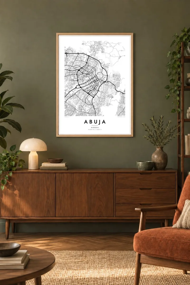
Abuja was built from scratch as Nigeria's capital near the geographic centre of the country, and it officially replaced Lagos as the seat of government in 1991. Its plan is deliberate and easy to follow on a map: a long central axis runs from the government area in the east toward the western districts, with broad avenues and open land on either side.
At the eastern end, the granite monolith of Aso Rock rises behind the Three Arms Zone, where the presidency, the National Assembly and the Supreme Court are grouped. The central district, whose design was developed by Kenzo Tange, lines up major buildings along the axis, including the National Mosque and the National Christian Centre.
Around this spine lie planned districts such as Garki, Wuse, Maitama and Asokoro, each set out with curving residential streets and separated by expressways and strips of green. An Abuja map poster shows how much the city depends on its plan, and how the ring roads and the hills to the north and east frame its growth.
A long ceremonial spine runs through the heart of the city, lined with government and civic buildings, and gives the whole map a clear sense of direction.
The large rock outcrop at the city's eastern edge breaks the pattern of streets entirely, leaving a blank, rounded shape behind the Three Arms Zone.
Each district is a self-contained unit of curving roads and closes, separated from its neighbours by major expressways, so the city reads as a set of distinct pieces.
Make it yours
Add a date, a name or a line of your own, switch style, size or orientation.
The free preview is low-resolution with a watermark. Prints and HD files are rendered at 300 DPI, up to 7,200 × 10,800 px, without a watermark.
Why Abuja
Abuja is still a young city, and many of its residents moved there for work, study or public service. A map of the capital marks that chapter clearly and suits offices and homes alike, especially for anyone drawn to planned cities.
The title, subtitle and coordinates line are yours to change, so the poster can name a district, an organisation or a year. Pick one of five styles and order a matte print from a partner near you, or download the HD files and print locally.
Order the Abuja poster| Print size | Resolution | Files |
|---|---|---|
| 30 × 40 cm11.8 × 15.7″ | 3,543 × 4,724 px | PNG · PDF |
| 29.7 × 42 cm (A3)11.7 × 16.5″ | 3,508 × 4,961 px | PNG · PDF |
| 42 × 59.4 cm (A2)16.5 × 23.4″ | 4,961 × 7,016 px | PNG · PDF |
| 45.7 × 61 cm18 × 24″ | 5,400 × 7,200 px | PNG · PDF |
| 50 × 70 cm19.7 × 27.6″ | 5,906 × 8,268 px | PNG · PDF |
| 61 × 91.4 cm24 × 36″ | 7,200 × 10,800 px | PNG · PDF |
For comparison, the free preview is 900 px wide, watermarked and meant for screens. The HD files have up to 8× the resolution in each direction and print cleanly at full poster size.
Pick a style at the top of the page, then choose Printed Poster — a size and, if you like, a frame — or Digital HD Files. Checkout takes one step, and your order page updates as soon as the payment goes through.
It is printed on premium 200 gsm matte paper in one of six sizes, from 30 × 40 cm to 24 × 36″. Printed posters start at $39, shipping included.
Yes. Choose a solid wood frame in black, white, natural oak or dark wood. It comes with shatterproof glazing and is ready to hang. Framed posters start at $99, shipping included.
Shipping is free to 60+ countries. Each poster is printed by the nearest of our print partners in 30+ countries and usually arrives in 3–7 business days. You can follow the status and tracking under My Orders. A few countries take 2–5 weeks, and where we don't ship yet, the site tells you before you pay.
Send us a photo within 14 days of delivery and we will reprint it for free or refund you.
Yes. In the editor on this page, change the title, the subtitle and the coordinates line to anything you like, and pick a style and size. Printed, framed and digital orders all use exactly your design.
For $9 you get 300 DPI PNG and print-ready PDF files in all six sizes, without a watermark, to print anywhere. Not sure yet? Download a free watermarked preview first.
Nearby
