Asakadai interchange
The Tobu Tojo and JR Musashino lines cross near Asakadai and Kita-Asaka stations, forming a clear intersection of rail lines within the dense residential blocks.
Minimalist map poster · Japan
35.8047° N / 139.6019° E
A dense commuter city on the edge of Tokyo, cut by rail lines and edged by the Arakawa floodplain

One city, five moods
Tap a style to see it on the wall. Every style costs the same — printed, framed or as HD files.
 Actual pixels · 24 × 36″ print file
Print-sharp
This is a 100% crop of the real print file. Every poster — printed, framed or downloaded — is rendered on our servers at 300 DPI, up to 7,200 × 10,800 pixels, so even the smallest lanes stay crisp on a 24 × 36″ print.
On the wall
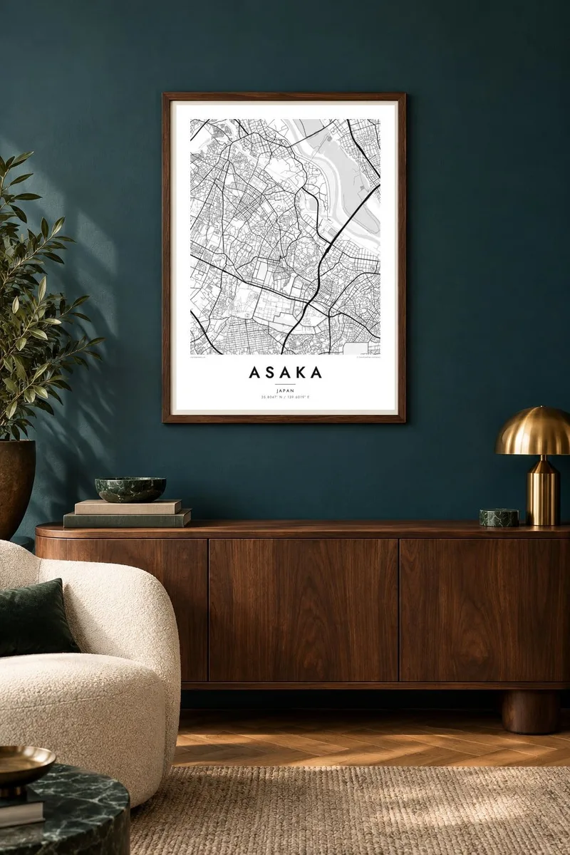


The map
Asaka sits just across the prefectural border from Tokyo's Nerima and Itabashi wards, and from above it looks like a continuation of the capital. Low-rise housing fills almost every block, and narrow lanes wind between them in the fine, irregular pattern typical of the Musashino plateau. Only the rail corridors and a few arterial roads break up the texture.
Two rail lines define the city's layout. The Tobu Tojo Line runs through Asakadai station, and the JR Musashino Line crosses it at Kita-Asaka, making one of the busiest interchanges in the area. The land drops to the north and east toward the wide, open floodplain of the Arakawa, where the grain of the streets gives way to fields and embankments.
Asaka hosted the shooting events at both the 1964 and 2020 Tokyo Olympics, at a range on land it shares with the neighbouring Ground Self-Defense Force camp. An Asaka map poster shows a place most people only pass through by train, with its busy grid, crossing tracks and the calm open space along the river.
The Tobu Tojo and JR Musashino lines cross near Asakadai and Kita-Asaka stations, forming a clear intersection of rail lines within the dense residential blocks.
Toward the river, the dense street pattern opens out into levees, fields and waterways, giving one edge of the map a much lighter, more open feel.
Across the higher ground, short winding lanes and small lots make a fine-grained texture that shows up well in detailed black and white printing.
Make it yours
Add a date, a name or a line of your own, switch style, size or orientation.
The free preview is low-resolution with a watermark. Prints and HD files are rendered at 300 DPI, up to 7,200 × 10,800 px, without a watermark.
Why Asaka
Asaka is where many people rent their first place near Tokyo, with a short ride into the city and quieter streets at home. A map of it marks that chapter well, whether it hangs in the same flat or somewhere far away.
Personalise the title, subtitle and coordinates line with a station name, an address or a move-in date. Pick one of five styles, Classic black & white, Noir, Paper, Blueprint or Sand, and download 300 DPI PNG and print-ready PDF files or order a printed poster.
Order the Asaka poster| Print size | Resolution | Files |
|---|---|---|
| 30 × 40 cm11.8 × 15.7″ | 3,543 × 4,724 px | PNG · PDF |
| 29.7 × 42 cm (A3)11.7 × 16.5″ | 3,508 × 4,961 px | PNG · PDF |
| 42 × 59.4 cm (A2)16.5 × 23.4″ | 4,961 × 7,016 px | PNG · PDF |
| 45.7 × 61 cm18 × 24″ | 5,400 × 7,200 px | PNG · PDF |
| 50 × 70 cm19.7 × 27.6″ | 5,906 × 8,268 px | PNG · PDF |
| 61 × 91.4 cm24 × 36″ | 7,200 × 10,800 px | PNG · PDF |
For comparison, the free preview is 900 px wide, watermarked and meant for screens. The HD files have up to 8× the resolution in each direction and print cleanly at full poster size.
Pick a style at the top of the page, then choose Printed Poster — a size and, if you like, a frame — or Digital HD Files. Checkout takes one step, and your order page updates as soon as the payment goes through.
It is printed on premium 200 gsm matte paper in one of six sizes, from 30 × 40 cm to 24 × 36″. Printed posters start at $39, shipping included.
Yes. Choose a solid wood frame in black, white, natural oak or dark wood. It comes with shatterproof glazing and is ready to hang. Framed posters start at $99, shipping included.
Shipping is free to 60+ countries. Each poster is printed by the nearest of our print partners in 30+ countries and usually arrives in 3–7 business days. You can follow the status and tracking under My Orders. A few countries take 2–5 weeks, and where we don't ship yet, the site tells you before you pay.
Send us a photo within 14 days of delivery and we will reprint it for free or refund you.
Yes. In the editor on this page, change the title, the subtitle and the coordinates line to anything you like, and pick a style and size. Printed, framed and digital orders all use exactly your design.
For $9 you get 300 DPI PNG and print-ready PDF files in all six sizes, without a watermark, to print anywhere. Not sure yet? Download a free watermarked preview first.
Nearby
