Town crossroads
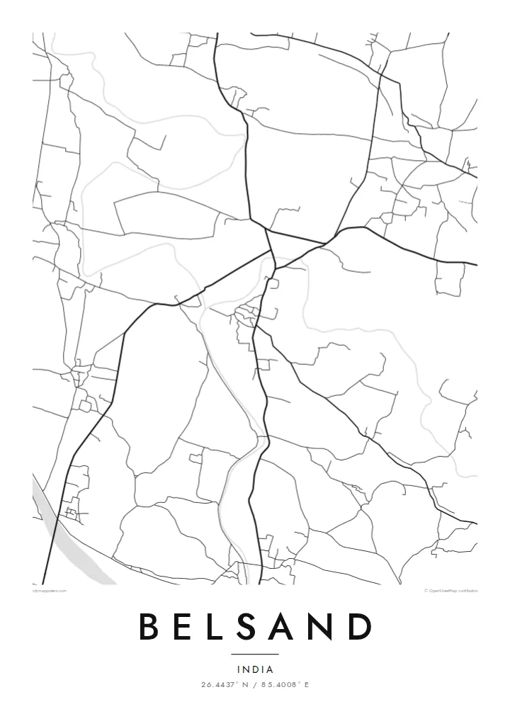
The centre of Belsand forms at a meeting of roads, with the densest streets gathered around it and lanes branching outward into nearby villages.
Minimalist map poster · India
26.4437° N / 85.4008° E
A town on the flat alluvial plain of north Bihar, where roads, fields and shifting river channels shape the land.
One city, five moods
Tap a style to see it on the wall. Every style costs the same — printed, framed or as HD files.
 Actual pixels · 24 × 36″ print file
Print-sharp
This is a 100% crop of the real print file. Every poster — printed, framed or downloaded — is rendered on our servers at 300 DPI, up to 7,200 × 10,800 pixels, so even the smallest lanes stay crisp on a 24 × 36″ print.
On the wall


The map
Belsand lies in Sitamarhi district in northern Bihar, on the broad, low plain between the Ganges and the Himalayan foothills of Nepal. The land here is built from river sediment and crossed by several rivers that descend from the north, the Bagmati among them. Their seasonal floods have long shaped farming, settlement and daily life in the district.
From above, the town forms a modest cluster of streets at a meeting of roads, with residential lanes branching off irregularly. Around it, the landscape is intensely agricultural, a fine mosaic of fields, ponds and village clusters. Old channels and embankments often appear as curving lines, marking where rivers once ran or where communities have protected themselves from high water.
A Belsand map poster brings this pattern into focus: a small town set in a flat, water-shaped country, its lines softened by nature rather than drawn by planners. It is a considered gift for families from Sitamarhi district now living in Patna, Delhi or abroad, and a clear, modest record of home.
The centre of Belsand forms at a meeting of roads, with the densest streets gathered around it and lanes branching outward into nearby villages.
Rivers of north Bihar, including the Bagmati, shape the surrounding land. Their channels and floodplains appear as broad, flowing forms on the map.
Small hamlets, ponds and fields fill the plain around town, creating a fine, scattered texture that surrounds the compact centre.
Make it yours
Add a date, a name or a line of your own, switch style, size or orientation.
The free preview is low-resolution with a watermark. Prints and HD files are rendered at 300 DPI, up to 7,200 × 10,800 px, without a watermark.
Why Belsand
Across Bihar, attachment to a home district runs deep, and many who leave for work keep strong ties with family land. A map of Belsand gives that bond a lasting place on the wall.
Add your own title, subtitle and coordinates, perhaps with a family name or a wedding date, then choose Classic black & white, Noir, Paper, Blueprint or Sand. Digital HD files cost $9 and carry no watermark.
Order the Belsand poster| Print size | Resolution | Files |
|---|---|---|
| 30 × 40 cm11.8 × 15.7″ | 3,543 × 4,724 px | PNG · PDF |
| 29.7 × 42 cm (A3)11.7 × 16.5″ | 3,508 × 4,961 px | PNG · PDF |
| 42 × 59.4 cm (A2)16.5 × 23.4″ | 4,961 × 7,016 px | PNG · PDF |
| 45.7 × 61 cm18 × 24″ | 5,400 × 7,200 px | PNG · PDF |
| 50 × 70 cm19.7 × 27.6″ | 5,906 × 8,268 px | PNG · PDF |
| 61 × 91.4 cm24 × 36″ | 7,200 × 10,800 px | PNG · PDF |
For comparison, the free preview is 900 px wide, watermarked and meant for screens. The HD files have up to 8× the resolution in each direction and print cleanly at full poster size.
Pick a style at the top of the page, then choose Printed Poster — a size and, if you like, a frame — or Digital HD Files. Checkout takes one step, and your order page updates as soon as the payment goes through.
It is printed on premium 200 gsm matte paper in one of six sizes, from 30 × 40 cm to 24 × 36″. Printed posters start at $39, shipping included.
Yes. Choose a solid wood frame in black, white, natural oak or dark wood. It comes with shatterproof glazing and is ready to hang. Framed posters start at $99, shipping included.
Shipping is free to 60+ countries. Each poster is printed by the nearest of our print partners in 30+ countries and usually arrives in 3–7 business days. You can follow the status and tracking under My Orders. A few countries take 2–5 weeks, and where we don't ship yet, the site tells you before you pay.
Send us a photo within 14 days of delivery and we will reprint it for free or refund you.
Yes. In the editor on this page, change the title, the subtitle and the coordinates line to anything you like, and pick a style and size. Printed, framed and digital orders all use exactly your design.
For $9 you get 300 DPI PNG and print-ready PDF files in all six sizes, without a watermark, to print anywhere. Not sure yet? Download a free watermarked preview first.
Nearby
