Place des Palmistes
A large open square in the old town, lined with tall palms. On the poster it appears as a clear rectangle within the fine grid of surrounding streets.
Minimalist map poster · French Guiana
4.9381° N / 52.3346° W
A small coastal grid at the tip of a former island, between a river mouth, mangroves and low Atlantic hills.

One city, five moods
Tap a style to see it on the wall. Every style costs the same — printed, framed or as HD files.
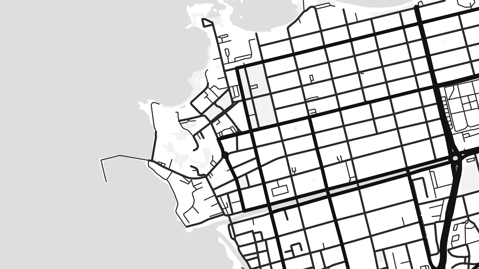 Actual pixels · 24 × 36″ print file
Print-sharp
This is a 100% crop of the real print file. Every poster — printed, framed or downloaded — is rendered on our servers at 300 DPI, up to 7,200 × 10,800 pixels, so even the smallest lanes stay crisp on a 24 × 36″ print.
On the wall


The map
Cayenne stands at the northwestern tip of the Île de Cayenne, an area of land bounded by the Cayenne River to the west, the Mahury River to the east and the Atlantic to the north. On the map the city occupies the corner where river and ocean meet. Water and mangrove-lined channels shape its edges and give the coastline a soft, irregular outline.
The old town is laid out as a tidy grid of streets running inland from the river mouth. Within it lies the Place des Palmistes, a broad open square planted with palms, and nearby the small hill of Fort Cépérou rises above the old port. Further out, suburban roads curve across low hills and between wetlands, spreading east toward Rémire-Montjoly.
Cayenne is the prefecture of French Guiana, the French overseas region on the northeast coast of South America, and the centre of its largest urban area. The Guiana Space Centre lies further west along the coast at Kourou. A Cayenne map poster shows a compact colonial grid held between river, sea and mangrove, the edge of a continent drawn in fine black lines.
A large open square in the old town, lined with tall palms. On the poster it appears as a clear rectangle within the fine grid of surrounding streets.
A small hill above the old port and the site of the colony's early fortifications. Near the river mouth, the grid breaks around its rising ground.
The Cayenne River estuary and mangrove channels soften the western and southern edges, giving the map an organic, water-bound outline instead of a hard coastline.
Make it yours
Add a date, a name or a line of your own, switch style, size or orientation.
The free preview is low-resolution with a watermark. Prints and HD files are rendered at 300 DPI, up to 7,200 × 10,800 px, without a watermark.
Why Cayenne
People connected to French Guiana through family, military service, research or the space programme often keep a quiet attachment to Cayenne. A map poster holds that attachment in a simple form that is easy to hang beside photographs or travel mementos.
You can set your own title, add a subtitle with names or a year, and edit the coordinates line. Choose among Classic black & white, Noir, Paper, Blueprint and Sand. A free watermarked preview lets you check the layout before buying.
Order the Cayenne poster| Print size | Resolution | Files |
|---|---|---|
| 30 × 40 cm11.8 × 15.7″ | 3,543 × 4,724 px | PNG · PDF |
| 29.7 × 42 cm (A3)11.7 × 16.5″ | 3,508 × 4,961 px | PNG · PDF |
| 42 × 59.4 cm (A2)16.5 × 23.4″ | 4,961 × 7,016 px | PNG · PDF |
| 45.7 × 61 cm18 × 24″ | 5,400 × 7,200 px | PNG · PDF |
| 50 × 70 cm19.7 × 27.6″ | 5,906 × 8,268 px | PNG · PDF |
| 61 × 91.4 cm24 × 36″ | 7,200 × 10,800 px | PNG · PDF |
For comparison, the free preview is 900 px wide, watermarked and meant for screens. The HD files have up to 8× the resolution in each direction and print cleanly at full poster size.
Pick a style at the top of the page, then choose Printed Poster — a size and, if you like, a frame — or Digital HD Files. Checkout takes one step, and your order page updates as soon as the payment goes through.
It is printed on premium 200 gsm matte paper in one of six sizes, from 30 × 40 cm to 24 × 36″. Printed posters start at $39, shipping included.
Yes. Choose a solid wood frame in black, white, natural oak or dark wood. It comes with shatterproof glazing and is ready to hang. Framed posters start at $99, shipping included.
Shipping is free to 60+ countries. Each poster is printed by the nearest of our print partners in 30+ countries and usually arrives in 3–7 business days. You can follow the status and tracking under My Orders. A few countries take 2–5 weeks, and where we don't ship yet, the site tells you before you pay.
Send us a photo within 14 days of delivery and we will reprint it for free or refund you.
Yes. In the editor on this page, change the title, the subtitle and the coordinates line to anything you like, and pick a style and size. Printed, framed and digital orders all use exactly your design.
For $9 you get 300 DPI PNG and print-ready PDF files in all six sizes, without a watermark, to print anywhere. Not sure yet? Download a free watermarked preview first.
Nearby
