Switchback roads
Roads leading up the mountain fold back on themselves in tight bends, creating a tangled, almost calligraphic pattern that stands out against the straighter streets below.
Minimalist map poster · Greece
40.6095° N / 23.1001° E
Villages and pine-covered slopes on a mountain above Thessaloniki, with roads climbing in tight bends toward the ridge

One city, five moods
Tap a style to see it on the wall. Every style costs the same — printed, framed or as HD files.
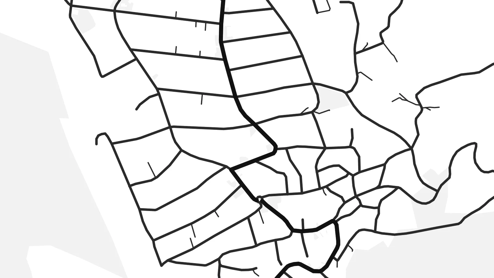 Actual pixels · 24 × 36″ print file
Print-sharp
This is a 100% crop of the real print file. Every poster — printed, framed or downloaded — is rendered on our servers at 300 DPI, up to 7,200 × 10,800 pixels, so even the smallest lanes stay crisp on a 24 × 36″ print.
On the wall


The map
Chortiátis takes its name from the mountain that rises east of Thessaloniki, and the municipal area spreads across its lower slopes. From above, the map is shaped by elevation: roads switchback up through pine woods, villages cling to shoulders of the hillside, and newer housing fills the gentler ground closer to the city. The contrast between winding mountain lanes and suburban grids is what gives the place its character on paper.
The mountain has long served Thessaloniki. In Byzantine and Ottoman times an aqueduct carried water from its springs down to the city, and stretches of that system still stand. Today the slopes are a green retreat for residents escaping the summer heat, with forest paths and viewpoints looking west over the Thermaic Gulf.
A Chortiátis map poster captures the climb from plain to ridge. Dense clusters of streets break apart into long, curving roads, then into open woodland. It is a drawing about height and distance, and it reads well as a companion to a Thessaloniki print or on its own.
Roads leading up the mountain fold back on themselves in tight bends, creating a tangled, almost calligraphic pattern that stands out against the straighter streets below.
Water from the mountain once travelled to Thessaloniki by aqueduct, and the route of that supply ties Chortiátis to the city it faces.
Pine woods cover the upper slopes, so settlements appear as islands of streets separated by broad, unmarked stretches of green and rock.
Make it yours
Add a date, a name or a line of your own, switch style, size or orientation.
The free preview is low-resolution with a watermark. Prints and HD files are rendered at 300 DPI, up to 7,200 × 10,800 px, without a watermark.
Why Chortiátis
For people from Thessaloniki, Chortiátis is the mountain on the horizon, the place for cooler evenings and weekend walks. For those who live on its slopes, it is home with a view. A map print holds both ideas in one frame.
Add your own title, a subtitle or a date, and edit the coordinates line. Pick Classic black & white, Noir, Paper, Blueprint or Sand, then download the HD files for $9 or order a printed poster with an optional wooden frame.
Order the Chortiátis poster| Print size | Resolution | Files |
|---|---|---|
| 30 × 40 cm11.8 × 15.7″ | 3,543 × 4,724 px | PNG · PDF |
| 29.7 × 42 cm (A3)11.7 × 16.5″ | 3,508 × 4,961 px | PNG · PDF |
| 42 × 59.4 cm (A2)16.5 × 23.4″ | 4,961 × 7,016 px | PNG · PDF |
| 45.7 × 61 cm18 × 24″ | 5,400 × 7,200 px | PNG · PDF |
| 50 × 70 cm19.7 × 27.6″ | 5,906 × 8,268 px | PNG · PDF |
| 61 × 91.4 cm24 × 36″ | 7,200 × 10,800 px | PNG · PDF |
For comparison, the free preview is 900 px wide, watermarked and meant for screens. The HD files have up to 8× the resolution in each direction and print cleanly at full poster size.
Pick a style at the top of the page, then choose Printed Poster — a size and, if you like, a frame — or Digital HD Files. Checkout takes one step, and your order page updates as soon as the payment goes through.
It is printed on premium 200 gsm matte paper in one of six sizes, from 30 × 40 cm to 24 × 36″. Printed posters start at $39, shipping included.
Yes. Choose a solid wood frame in black, white, natural oak or dark wood. It comes with shatterproof glazing and is ready to hang. Framed posters start at $99, shipping included.
Shipping is free to 60+ countries. Each poster is printed by the nearest of our print partners in 30+ countries and usually arrives in 3–7 business days. You can follow the status and tracking under My Orders. A few countries take 2–5 weeks, and where we don't ship yet, the site tells you before you pay.
Send us a photo within 14 days of delivery and we will reprint it for free or refund you.
Yes. In the editor on this page, change the title, the subtitle and the coordinates line to anything you like, and pick a style and size. Printed, framed and digital orders all use exactly your design.
For $9 you get 300 DPI PNG and print-ready PDF files in all six sizes, without a watermark, to print anywhere. Not sure yet? Download a free watermarked preview first.
Nearby
