Frourio hill
The low hill at the heart of Lárisa carries the ancient acropolis site and later fortifications. The streets of the centre wrap around it in a noticeably tighter pattern.
Minimalist map poster · Greece
39.6285° N / 22.4211° E
A plains city gathered around a low fortress hill, with the Pineios river curving along its northern edge.

One city, five moods
Tap a style to see it on the wall. Every style costs the same — printed, framed or as HD files.
 Actual pixels · 24 × 36″ print file
Print-sharp
This is a 100% crop of the real print file. Every poster — printed, framed or downloaded — is rendered on our servers at 300 DPI, up to 7,200 × 10,800 pixels, so even the smallest lanes stay crisp on a 24 × 36″ print.
On the wall
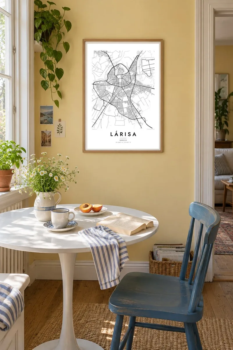


The map
Lárisa is the capital of Thessaly and the largest city on the Thessalian plain, one of the flattest and most intensively farmed landscapes in Greece. On a map the city spreads almost evenly in every direction. Its streets form a dense, slightly irregular grid that gives way to wide avenues and then to open fields. The only real relief is the low hill in the centre, where the town began.
That hill, known locally as the Frourio, holds the remains of the ancient acropolis and later fortifications. The First Ancient Theatre sits on its southern slope, uncovered in the city centre after long excavation. The Pineios river loops past to the north and west, lined with the trees of the Alcazar park, one of the largest green spaces in town and easy to spot from above.
Hippocrates, the physician of antiquity, is said to have died near Lárisa, and the city marks the connection with a memorial. A Lárisa map poster shows the compact old centre around the hill and the river bending along one side. Around them sits the ring of newer districts, reaching out toward the plain that has fed the city for millennia.
The low hill at the heart of Lárisa carries the ancient acropolis site and later fortifications. The streets of the centre wrap around it in a noticeably tighter pattern.
Thessaly's main river bends past the northern side of the city. Its looping course, with bridges and riverside greenery, gives the map a soft, organic edge.
The First Ancient Theatre is set into the hillside in the middle of the modern city. On the map it appears as a clear curve among rectilinear blocks, a reminder of how old the ground beneath the streets is.
Make it yours
Add a date, a name or a line of your own, switch style, size or orientation.
The free preview is low-resolution with a watermark. Prints and HD files are rendered at 300 DPI, up to 7,200 × 10,800 px, without a watermark.
Why Lárisa
Many Greeks pass through Lárisa at an important moment, for study, military service or family. Its map is compact and centred on a single hill, so it reads clearly on a wall. It brings back the squares, cafés and river walks without needing a caption.
You can add your own title, subtitle and coordinates line, whether that is the city's name in Greek, a graduation year or a family surname. The design comes in five styles, from Classic black & white and Noir to Paper, Blueprint and Sand.
Order the Lárisa poster| Print size | Resolution | Files |
|---|---|---|
| 30 × 40 cm11.8 × 15.7″ | 3,543 × 4,724 px | PNG · PDF |
| 29.7 × 42 cm (A3)11.7 × 16.5″ | 3,508 × 4,961 px | PNG · PDF |
| 42 × 59.4 cm (A2)16.5 × 23.4″ | 4,961 × 7,016 px | PNG · PDF |
| 45.7 × 61 cm18 × 24″ | 5,400 × 7,200 px | PNG · PDF |
| 50 × 70 cm19.7 × 27.6″ | 5,906 × 8,268 px | PNG · PDF |
| 61 × 91.4 cm24 × 36″ | 7,200 × 10,800 px | PNG · PDF |
For comparison, the free preview is 900 px wide, watermarked and meant for screens. The HD files have up to 8× the resolution in each direction and print cleanly at full poster size.
Pick a style at the top of the page, then choose Printed Poster — a size and, if you like, a frame — or Digital HD Files. Checkout takes one step, and your order page updates as soon as the payment goes through.
It is printed on premium 200 gsm matte paper in one of six sizes, from 30 × 40 cm to 24 × 36″. Printed posters start at $39, shipping included.
Yes. Choose a solid wood frame in black, white, natural oak or dark wood. It comes with shatterproof glazing and is ready to hang. Framed posters start at $99, shipping included.
Shipping is free to 60+ countries. Each poster is printed by the nearest of our print partners in 30+ countries and usually arrives in 3–7 business days. You can follow the status and tracking under My Orders. A few countries take 2–5 weeks, and where we don't ship yet, the site tells you before you pay.
Send us a photo within 14 days of delivery and we will reprint it for free or refund you.
Yes. In the editor on this page, change the title, the subtitle and the coordinates line to anything you like, and pick a style and size. Printed, framed and digital orders all use exactly your design.
For $9 you get 300 DPI PNG and print-ready PDF files in all six sizes, without a watermark, to print anywhere. Not sure yet? Download a free watermarked preview first.
Nearby
