Lower town grid
A regular pattern of streets and squares laid out after independence fills the level ground by the harbour. It is one of the clearest planned grids in Greece.
Minimalist map poster · Greece
38.2462° N / 21.7351° E
A Greek port on its own gulf, with a hilltop castle above a gridded lower town and a great bridge nearby.

One city, five moods
Tap a style to see it on the wall. Every style costs the same — printed, framed or as HD files.
 Actual pixels · 24 × 36″ print file
Print-sharp
This is a 100% crop of the real print file. Every poster — printed, framed or downloaded — is rendered on our servers at 300 DPI, up to 7,200 × 10,800 pixels, so even the smallest lanes stay crisp on a 24 × 36″ print.
On the wall


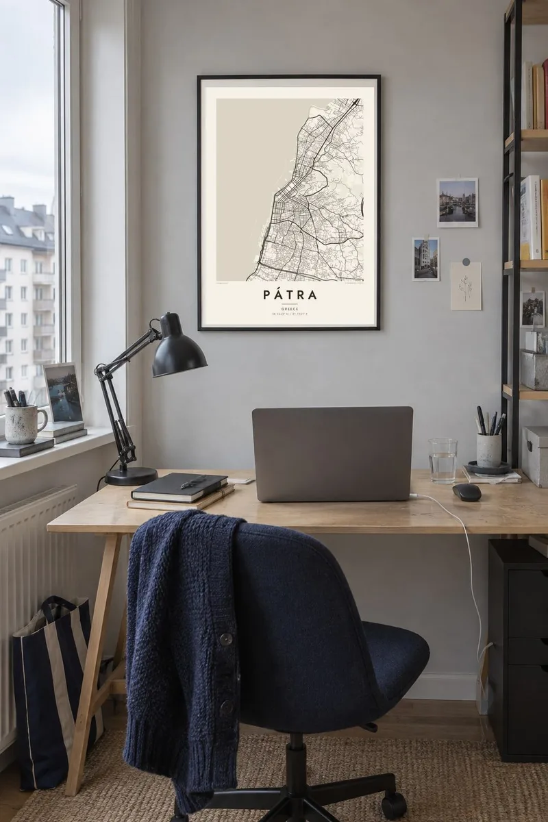
The map
Pátra, Greece's third-largest city, faces the Gulf of Patras on the northwest coast of the Peloponnese. It is built on two levels. The lower town spreads along the waterfront in a broad grid of streets and squares. The upper town climbs the slope toward the castle, connected to the lower streets by long flights of steps.
The regular plan of the lower town dates from the years after Greek independence, when the city was rebuilt on a new rectilinear layout. At its southwestern end stands the Church of Saint Andrew, one of the largest churches in Greece. It is dedicated to the city's patron saint, who according to tradition was martyred here.
To the northeast, the Rio–Antirrio Bridge spans the strait between the Gulf of Patras and the Gulf of Corinth. It is one of the longest cable-stayed bridges in the world. A Pátra map poster brings together the port, the grid, the castle hill and the sea. The city is also known across Greece for its large annual carnival.
A regular pattern of streets and squares laid out after independence fills the level ground by the harbour. It is one of the clearest planned grids in Greece.
The fortress on the hill above the city stands on the site of the old acropolis, surrounded by the irregular lanes and stairways of the upper town.
The long cable-stayed bridge crosses the narrow strait northeast of the city. It links the Peloponnese to mainland Greece and draws a straight line over open water.
Make it yours
Add a date, a name or a line of your own, switch style, size or orientation.
The free preview is low-resolution with a watermark. Prints and HD files are rendered at 300 DPI, up to 7,200 × 10,800 px, without a watermark.
Why Pátra
Pátra is a university city and a port of departure, so many people have passed through it and remember it. A map of its streets suits students, sailors and families alike. Add a name, a date or a place you lived to the title and subtitle.
Blueprint suits the harbour and bridge, Noir gives the grid a bold graphic look, and Classic, Paper and Sand are softer options. The digital HD files cost $9 for six print sizes. Matte printed posters, with an optional wooden frame, ship from partners in more than 30 countries.
Order the Pátra poster| Print size | Resolution | Files |
|---|---|---|
| 30 × 40 cm11.8 × 15.7″ | 3,543 × 4,724 px | PNG · PDF |
| 29.7 × 42 cm (A3)11.7 × 16.5″ | 3,508 × 4,961 px | PNG · PDF |
| 42 × 59.4 cm (A2)16.5 × 23.4″ | 4,961 × 7,016 px | PNG · PDF |
| 45.7 × 61 cm18 × 24″ | 5,400 × 7,200 px | PNG · PDF |
| 50 × 70 cm19.7 × 27.6″ | 5,906 × 8,268 px | PNG · PDF |
| 61 × 91.4 cm24 × 36″ | 7,200 × 10,800 px | PNG · PDF |
For comparison, the free preview is 900 px wide, watermarked and meant for screens. The HD files have up to 8× the resolution in each direction and print cleanly at full poster size.
Pick a style at the top of the page, then choose Printed Poster — a size and, if you like, a frame — or Digital HD Files. Checkout takes one step, and your order page updates as soon as the payment goes through.
It is printed on premium 200 gsm matte paper in one of six sizes, from 30 × 40 cm to 24 × 36″. Printed posters start at $39, shipping included.
Yes. Choose a solid wood frame in black, white, natural oak or dark wood. It comes with shatterproof glazing and is ready to hang. Framed posters start at $99, shipping included.
Shipping is free to 60+ countries. Each poster is printed by the nearest of our print partners in 30+ countries and usually arrives in 3–7 business days. You can follow the status and tracking under My Orders. A few countries take 2–5 weeks, and where we don't ship yet, the site tells you before you pay.
Send us a photo within 14 days of delivery and we will reprint it for free or refund you.
Yes. In the editor on this page, change the title, the subtitle and the coordinates line to anything you like, and pick a style and size. Printed, framed and digital orders all use exactly your design.
For $9 you get 300 DPI PNG and print-ready PDF files in all six sizes, without a watermark, to print anywhere. Not sure yet? Download a free watermarked preview first.
Nearby
