Euripus Strait
At Chalkida the channel between the island and the mainland narrows to a few dozen metres, and two bridges cross it. This tiny gap in the coastline defines the whole map.
Minimalist map poster · Greece
38.4943° N / 23.7109° E
A long, narrow island lying parallel to the Greek mainland, joined to it by bridges across a strait only metres wide

One city, five moods
Tap a style to see it on the wall. Every style costs the same — printed, framed or as HD files.
 Actual pixels · 24 × 36″ print file
Print-sharp
This is a 100% crop of the real print file. Every poster — printed, framed or downloaded — is rendered on our servers at 300 DPI, up to 7,200 × 10,800 pixels, so even the smallest lanes stay crisp on a 24 × 36″ print.
On the wall
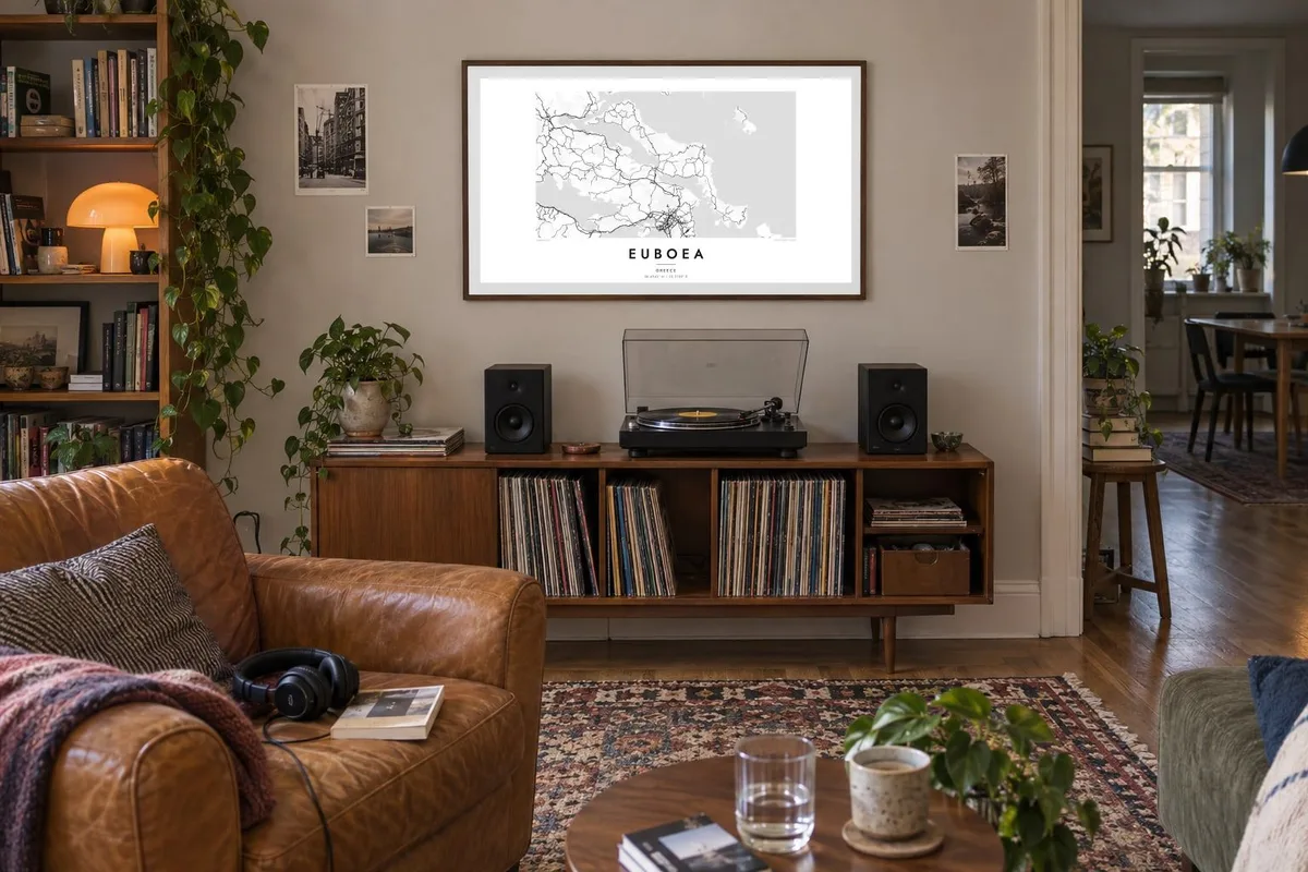


The island
Euboea is the second-largest island in Greece after Crete. It stretches for well over a hundred kilometres along the mainland coast northeast of Athens. On a map it is long, narrow and mountainous, and its axis mirrors the shape of the coast opposite. The North and South Euboean Gulfs lie between the two shores and almost close up at Chalkida, near the island's midpoint.
Chalkida, the largest town, sits at the narrowest point of the strait, the Euripus, where two bridges link the island to the mainland. The currents in the channel are well known: they change direction several times a day and have puzzled writers since ancient times. The town's streets fan out from the waterfront, and the mainland shore is only a short distance away.
The north of the island has long been known for its pine forests. The centre rises to the high peak of Dirfys, and the south narrows into a dry, rugged peninsula that ends near Karystos. Villages and small ports line both coasts, linked by roads that wind through the mountains. A Euboea map poster shows an island that feels almost part of the mainland, divided from it by a thread of sea.
At Chalkida the channel between the island and the mainland narrows to a few dozen metres, and two bridges cross it. This tiny gap in the coastline defines the whole map.
The island's highest mountain rises in central Euboea and gathers the contour lines tightly. Small roads climb to villages on its slopes and drop down to the east coast.
South of its midpoint, Euboea narrows into a long, mountainous arm that reaches toward Andros. It ends in a coast of small bays around Karystos.
Make it yours
Add a date, a name or a line of your own, switch style, size or orientation.
The free preview is low-resolution with a watermark. Prints and HD files are rendered at 300 DPI, up to 7,200 × 10,800 px, without a watermark.
Why Euboea
For many Athenians, Euboea is a place of summer homes and family villages, and it is a quieter alternative to the better-known islands. Its long profile and the fine thread of the Euripus make it a striking shape on the wall.
You can write your own title and subtitle, perhaps naming a village or a year, and adjust the coordinates line. Choose from Classic black and white, Noir, Paper, Blueprint and Sand, then order a printed poster or download the HD files for $9.
Order the Euboea poster| Print size | Resolution | Files |
|---|---|---|
| 30 × 40 cm11.8 × 15.7″ | 3,543 × 4,724 px | PNG · PDF |
| 29.7 × 42 cm (A3)11.7 × 16.5″ | 3,508 × 4,961 px | PNG · PDF |
| 42 × 59.4 cm (A2)16.5 × 23.4″ | 4,961 × 7,016 px | PNG · PDF |
| 45.7 × 61 cm18 × 24″ | 5,400 × 7,200 px | PNG · PDF |
| 50 × 70 cm19.7 × 27.6″ | 5,906 × 8,268 px | PNG · PDF |
| 61 × 91.4 cm24 × 36″ | 7,200 × 10,800 px | PNG · PDF |
For comparison, the free preview is 900 px wide, watermarked and meant for screens. The HD files have up to 8× the resolution in each direction and print cleanly at full poster size.
Pick a style at the top of the page, then choose Printed Poster — a size and, if you like, a frame — or Digital HD Files. Checkout takes one step, and your order page updates as soon as the payment goes through.
It is printed on premium 200 gsm matte paper in one of six sizes, from 30 × 40 cm to 24 × 36″. Printed posters start at $39, shipping included.
Yes. Choose a solid wood frame in black, white, natural oak or dark wood. It comes with shatterproof glazing and is ready to hang. Framed posters start at $99, shipping included.
Shipping is free to 60+ countries. Each poster is printed by the nearest of our print partners in 30+ countries and usually arrives in 3–7 business days. You can follow the status and tracking under My Orders. A few countries take 2–5 weeks, and where we don't ship yet, the site tells you before you pay.
Send us a photo within 14 days of delivery and we will reprint it for free or refund you.
Yes. In the editor on this page, change the title, the subtitle and the coordinates line to anything you like, and pick a style and size. Printed, framed and digital orders all use exactly your design.
For $9 you get 300 DPI PNG and print-ready PDF files in all six sizes, without a watermark, to print anywhere. Not sure yet? Download a free watermarked preview first.
Nearby
