Tight street mesh
Short blocks and narrow streets fill nearly the whole map. The density is typical of western Athens and gives the poster its woven texture.
Minimalist map poster · Greece
38.0154° N / 23.6919° E
A dense, fine-meshed grid of Athenian apartment blocks stretching west from the Kifissos toward the slopes of Mount Aigaleo

One city, five moods
Tap a style to see it on the wall. Every style costs the same — printed, framed or as HD files.
 Actual pixels · 24 × 36″ print file
Print-sharp
This is a 100% crop of the real print file. Every poster — printed, framed or downloaded — is rendered on our servers at 300 DPI, up to 7,200 × 10,800 pixels, so even the smallest lanes stay crisp on a 24 × 36″ print.
On the wall

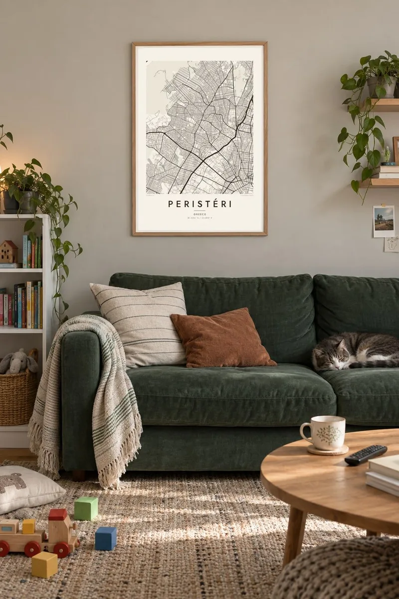

The map
Peristéri is one of the largest municipalities in Attica and part of the continuous urban area of western Athens. From above, it looks like a tightly knit mesh of short blocks and narrow streets, filled almost wall to wall with the mid-rise apartment buildings typical of the city. There are no dramatic coastlines or rivers inside its boundaries. The pattern itself is the subject.
The district grew quickly during the twentieth century, including settlement by refugees from Asia Minor after 1922, and that rapid growth shows in its compact, practical layout. The Kifissos corridor and its highway run along one side, and the rising ground toward Mount Aigaleo frames the other. Line 2 of the Athens Metro reaches Peristéri with stations running out to Anthoupoli.
A Peristéri map poster captures what makes Athenian neighbourhoods distinctive when seen in plan: extreme density, small squares opening up here and there, and main avenues cutting diagonally through the grid. Printed in black and white, the texture becomes almost like fabric, with a few open spaces and church squares standing out as pauses in the pattern.
Short blocks and narrow streets fill nearly the whole map. The density is typical of western Athens and gives the poster its woven texture.
The river channel and the major avenue beside it form a strong line along the eastern side, separating Peristéri from the neighbouring districts.
To the west the ground rises toward Mount Aigaleo. The street pattern thins and bends as it meets the slopes, which softens the grid.
Make it yours
Add a date, a name or a line of your own, switch style, size or orientation.
The free preview is low-resolution with a watermark. Prints and HD files are rendered at 300 DPI, up to 7,200 × 10,800 px, without a watermark.
Why Peristéri
Many Athenians grew up in Peristéri or have family there, and the map works as a personal marker of neighbourhood and origin. Its dense pattern also looks striking on a wall, even to people who have never been.
Personalise the title, subtitle or coordinates, perhaps with a street name or a year, and pick one of five styles. Noir makes the mesh of streets glow, while Paper gives it a softer, archival feel.
Order the Peristéri poster| Print size | Resolution | Files |
|---|---|---|
| 30 × 40 cm11.8 × 15.7″ | 3,543 × 4,724 px | PNG · PDF |
| 29.7 × 42 cm (A3)11.7 × 16.5″ | 3,508 × 4,961 px | PNG · PDF |
| 42 × 59.4 cm (A2)16.5 × 23.4″ | 4,961 × 7,016 px | PNG · PDF |
| 45.7 × 61 cm18 × 24″ | 5,400 × 7,200 px | PNG · PDF |
| 50 × 70 cm19.7 × 27.6″ | 5,906 × 8,268 px | PNG · PDF |
| 61 × 91.4 cm24 × 36″ | 7,200 × 10,800 px | PNG · PDF |
For comparison, the free preview is 900 px wide, watermarked and meant for screens. The HD files have up to 8× the resolution in each direction and print cleanly at full poster size.
Pick a style at the top of the page, then choose Printed Poster — a size and, if you like, a frame — or Digital HD Files. Checkout takes one step, and your order page updates as soon as the payment goes through.
It is printed on premium 200 gsm matte paper in one of six sizes, from 30 × 40 cm to 24 × 36″. Printed posters start at $39, shipping included.
Yes. Choose a solid wood frame in black, white, natural oak or dark wood. It comes with shatterproof glazing and is ready to hang. Framed posters start at $99, shipping included.
Shipping is free to 60+ countries. Each poster is printed by the nearest of our print partners in 30+ countries and usually arrives in 3–7 business days. You can follow the status and tracking under My Orders. A few countries take 2–5 weeks, and where we don't ship yet, the site tells you before you pay.
Send us a photo within 14 days of delivery and we will reprint it for free or refund you.
Yes. In the editor on this page, change the title, the subtitle and the coordinates line to anything you like, and pick a style and size. Printed, framed and digital orders all use exactly your design.
For $9 you get 300 DPI PNG and print-ready PDF files in all six sizes, without a watermark, to print anywhere. Not sure yet? Download a free watermarked preview first.
Nearby
