Cap de Creus
At the northern end is a knotted peninsula of bare rock, where the coastline splinters into tiny inlets around Cadaqués and Portlligat.
Minimalist map poster · Spain
41.9254° N / 3.1496° E
A rocky, indented coast of coves and headlands running north from Blanes to the French border at Portbou
One city, five moods
Tap a style to see it on the wall. Every style costs the same — printed, framed or as HD files.
 Actual pixels · 24 × 36″ print file
Print-sharp
This is a 100% crop of the real print file. Every poster — printed, framed or downloaded — is rendered on our servers at 300 DPI, up to 7,200 × 10,800 pixels, so even the smallest lanes stay crisp on a 24 × 36″ print.
On the wall


The coast
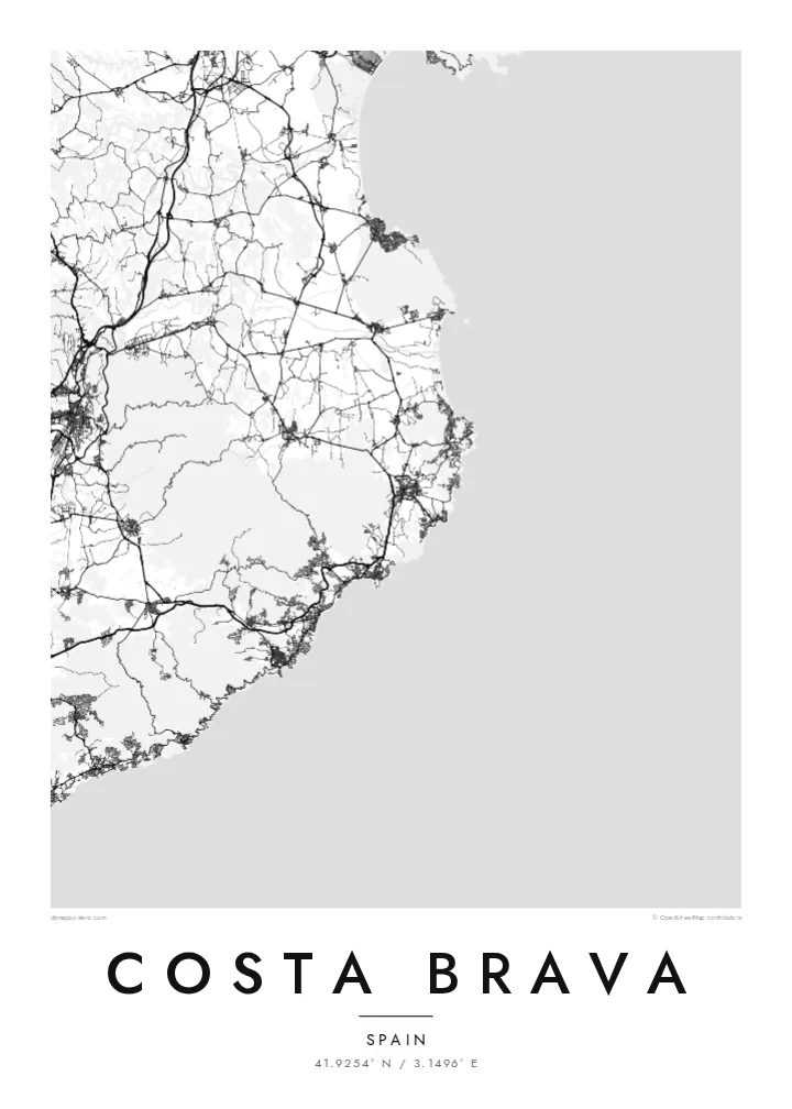
The Costa Brava is the coastline of the province of Girona in Catalonia, running from Blanes in the south to Portbou on the French border. The name means the rugged or wild coast, and it matches what the map shows: a shoreline broken into countless small coves and rocky points, with wider sandy bays, such as the Gulf of Roses, opening between the stretches of cliff.
At the northern end, the Cap de Creus peninsula is the easternmost point of the Iberian Peninsula. Salvador Dalí lived and worked in Portlligat, next to the whitewashed village of Cadaqués. Further south, Tossa de Mar keeps its medieval walled Vila Vella on a headland above the beach, one of the best-preserved fortified old towns on the Catalan coast.
A Costa Brava map poster covers the coast walked by the Camí de Ronda, an old patrol path that now links beaches and coves on foot. Between the resort towns, roads loop up and over the headlands. The wide Gulf of Roses interrupts the rocky shore with a long, gentle curve, backed by the flat wetlands of the Aiguamolls de l'Empordà.
At the northern end is a knotted peninsula of bare rock, where the coastline splinters into tiny inlets around Cadaqués and Portlligat.
A broad, smooth bay between Roses and L'Escala breaks the rocky rhythm of the coast, with the marina canals of Empuriabrava cut into the flat land behind it.
The Vila Vella sits on a small headland, and its enclosed lanes form a compact knot beside the newer, more regular streets of Tossa de Mar.
Make it yours
Add a date, a name or a line of your own, switch style, size or orientation.
The free preview is low-resolution with a watermark. Prints and HD files are rendered at 300 DPI, up to 7,200 × 10,800 px, without a watermark.
Why Costa Brava
For people who go back to the same cove every summer, or who walked the coast path from town to town, this map gives that memory a place on the wall. The title, subtitle and coordinates line can all be changed, so the poster can name a village, a house or a date.
Try Paper or Sand for a sun-warmed look, or Classic black & white, Noir and Blueprint for sharper contrast. The HD files cost $9 and include six print sizes, each as a 300 DPI PNG and a print-ready PDF without a watermark.
Order the Costa Brava poster| Print size | Resolution | Files |
|---|---|---|
| 30 × 40 cm11.8 × 15.7″ | 3,543 × 4,724 px | PNG · PDF |
| 29.7 × 42 cm (A3)11.7 × 16.5″ | 3,508 × 4,961 px | PNG · PDF |
| 42 × 59.4 cm (A2)16.5 × 23.4″ | 4,961 × 7,016 px | PNG · PDF |
| 45.7 × 61 cm18 × 24″ | 5,400 × 7,200 px | PNG · PDF |
| 50 × 70 cm19.7 × 27.6″ | 5,906 × 8,268 px | PNG · PDF |
| 61 × 91.4 cm24 × 36″ | 7,200 × 10,800 px | PNG · PDF |
For comparison, the free preview is 900 px wide, watermarked and meant for screens. The HD files have up to 8× the resolution in each direction and print cleanly at full poster size.
Pick a style at the top of the page, then choose Printed Poster — a size and, if you like, a frame — or Digital HD Files. Checkout takes one step, and your order page updates as soon as the payment goes through.
It is printed on premium 200 gsm matte paper in one of six sizes, from 30 × 40 cm to 24 × 36″. Printed posters start at $39, shipping included.
Yes. Choose a solid wood frame in black, white, natural oak or dark wood. It comes with shatterproof glazing and is ready to hang. Framed posters start at $99, shipping included.
Shipping is free to 60+ countries. Each poster is printed by the nearest of our print partners in 30+ countries and usually arrives in 3–7 business days. You can follow the status and tracking under My Orders. A few countries take 2–5 weeks, and where we don't ship yet, the site tells you before you pay.
Send us a photo within 14 days of delivery and we will reprint it for free or refund you.
Yes. In the editor on this page, change the title, the subtitle and the coordinates line to anything you like, and pick a style and size. Printed, framed and digital orders all use exactly your design.
For $9 you get 300 DPI PNG and print-ready PDF files in all six sizes, without a watermark, to print anywhere. Not sure yet? Download a free watermarked preview first.
Nearby
