Old centre
Narrow, irregular lanes make up the heart of the town, forming the densest area on the map, where streets branch and meet in a pattern shaped over generations.
Minimalist map poster · Tunisia
35.6223° N / 10.7570° E
A Tunisian Sahel town of dense streets and courtyard houses, ringed by olive groves on a gently rolling coastal plain.

One city, five moods
Tap a style to see it on the wall. Every style costs the same — printed, framed or as HD files.
 Actual pixels · 24 × 36″ print file
Print-sharp
This is a 100% crop of the real print file. Every poster — printed, framed or downloaded — is rendered on our servers at 300 DPI, up to 7,200 × 10,800 pixels, so even the smallest lanes stay crisp on a 24 × 36″ print.
On the wall
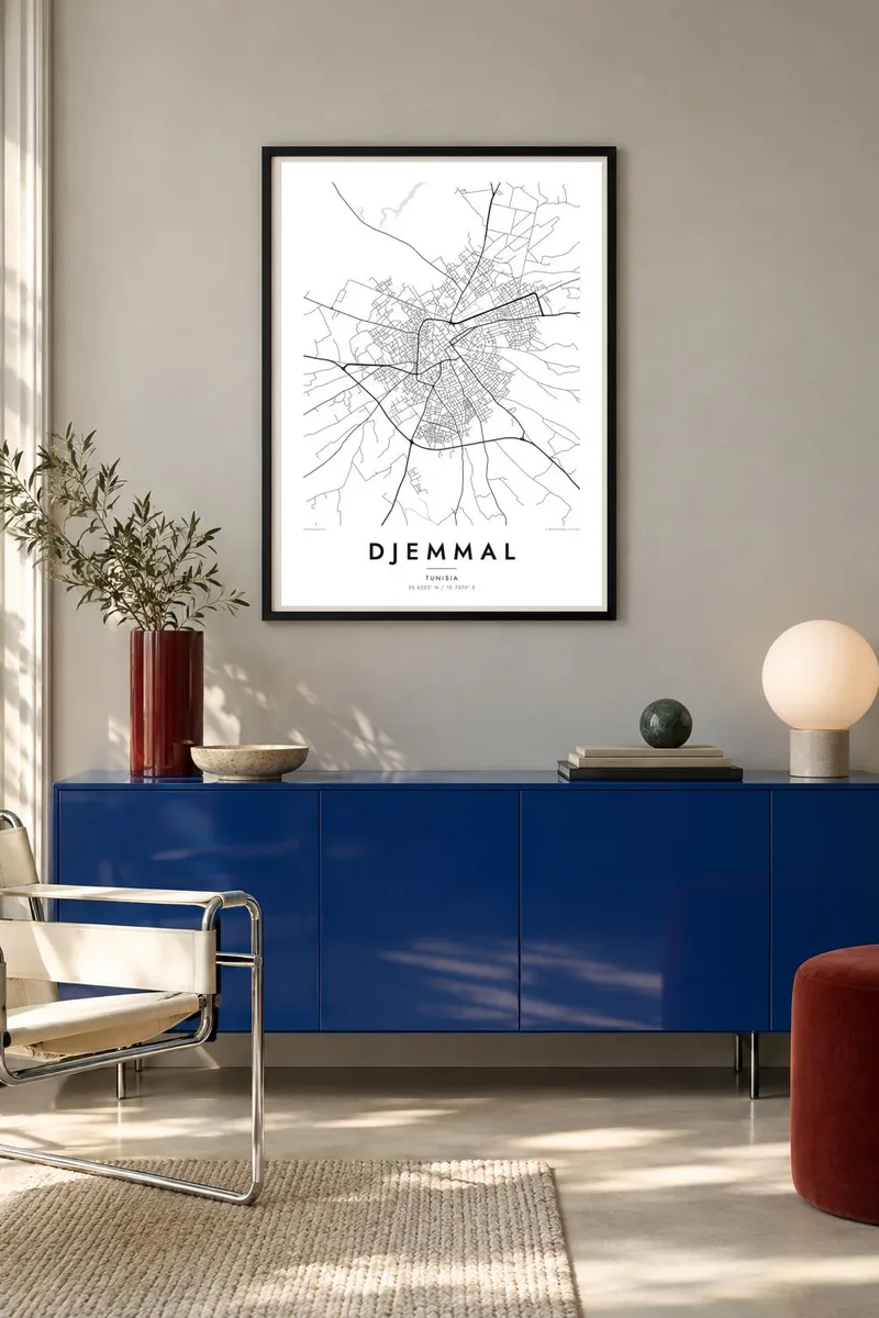


The map
Djemmal lies in the Monastir Governorate, in the heart of the Tunisian Sahel, a short drive inland from the Mediterranean coast. Its centre is a compact knot of narrow streets and closely packed houses, the traditional pattern of Sahel towns, where lanes turn often and blocks fit together without a strict plan. Newer districts extend outward along the main roads in straighter, more regular lines.
Olive groves surround the town on all sides, as they do across much of the Sahel, one of the country's oldest olive-growing regions. From above, these groves appear as fine, even textures, with orchards divided by field tracks and boundaries. Roads connect Djemmal with Monastir, Moknine and the other towns of the governorate, forming a network that ties the area together.
A Djemmal map poster sets the dense centre against the open agricultural land, a contrast that gives the composition its balance. It is a fitting piece for families from the town, wherever they now live, and it pairs well with maps of other Sahel towns or of the nearby coast between Monastir and Mahdia.
Narrow, irregular lanes make up the heart of the town, forming the densest area on the map, where streets branch and meet in a pattern shaped over generations.
Groves stretch in every direction beyond the built-up area, divided by tracks and field boundaries that add fine, repetitive detail to the edges of the poster.
Regional roads leave the town toward Monastir, Moknine and neighbouring communities, crossing the plain in long lines that frame the centre and set it in its landscape.
Make it yours
Add a date, a name or a line of your own, switch style, size or orientation.
The free preview is low-resolution with a watermark. Prints and HD files are rendered at 300 DPI, up to 7,200 × 10,800 px, without a watermark.
Why Djemmal
For people with roots in Djemmal, a map of the town is a way of keeping home near, from the family house in the old lanes to the roads out through the olive groves. It is personal without being sentimental.
Write your own title, add a subtitle with a name or date, and adjust the coordinates. Choose one of five styles, Classic black & white, Noir, Paper, Blueprint or Sand, and preview it free at 900 px before downloading or ordering a print.
Order the Djemmal poster| Print size | Resolution | Files |
|---|---|---|
| 30 × 40 cm11.8 × 15.7″ | 3,543 × 4,724 px | PNG · PDF |
| 29.7 × 42 cm (A3)11.7 × 16.5″ | 3,508 × 4,961 px | PNG · PDF |
| 42 × 59.4 cm (A2)16.5 × 23.4″ | 4,961 × 7,016 px | PNG · PDF |
| 45.7 × 61 cm18 × 24″ | 5,400 × 7,200 px | PNG · PDF |
| 50 × 70 cm19.7 × 27.6″ | 5,906 × 8,268 px | PNG · PDF |
| 61 × 91.4 cm24 × 36″ | 7,200 × 10,800 px | PNG · PDF |
For comparison, the free preview is 900 px wide, watermarked and meant for screens. The HD files have up to 8× the resolution in each direction and print cleanly at full poster size.
Pick a style at the top of the page, then choose Printed Poster — a size and, if you like, a frame — or Digital HD Files. Checkout takes one step, and your order page updates as soon as the payment goes through.
It is printed on premium 200 gsm matte paper in one of six sizes, from 30 × 40 cm to 24 × 36″. Printed posters start at $39, shipping included.
Yes. Choose a solid wood frame in black, white, natural oak or dark wood. It comes with shatterproof glazing and is ready to hang. Framed posters start at $99, shipping included.
Shipping is free to 60+ countries. Each poster is printed by the nearest of our print partners in 30+ countries and usually arrives in 3–7 business days. You can follow the status and tracking under My Orders. A few countries take 2–5 weeks, and where we don't ship yet, the site tells you before you pay.
Send us a photo within 14 days of delivery and we will reprint it for free or refund you.
Yes. In the editor on this page, change the title, the subtitle and the coordinates line to anything you like, and pick a style and size. Printed, framed and digital orders all use exactly your design.
For $9 you get 300 DPI PNG and print-ready PDF files in all six sizes, without a watermark, to print anywhere. Not sure yet? Download a free watermarked preview first.
Nearby
