El Kantara causeway
A road runs across the shallow sea from the southeast of the island to the mainland, following a route first built in antiquity. On the map it is a thin, straight line over open water.
Minimalist map poster · Tunisia
33.7736° N / 10.8942° E
A flat, compact island off southern Tunisia, tied to the mainland by an ancient causeway across shallow water

One city, five moods
Tap a style to see it on the wall. Every style costs the same — printed, framed or as HD files.
 Actual pixels · 24 × 36″ print file
Print-sharp
This is a 100% crop of the real print file. Every poster — printed, framed or downloaded — is rendered on our servers at 300 DPI, up to 7,200 × 10,800 pixels, so even the smallest lanes stay crisp on a 24 × 36″ print.
On the wall


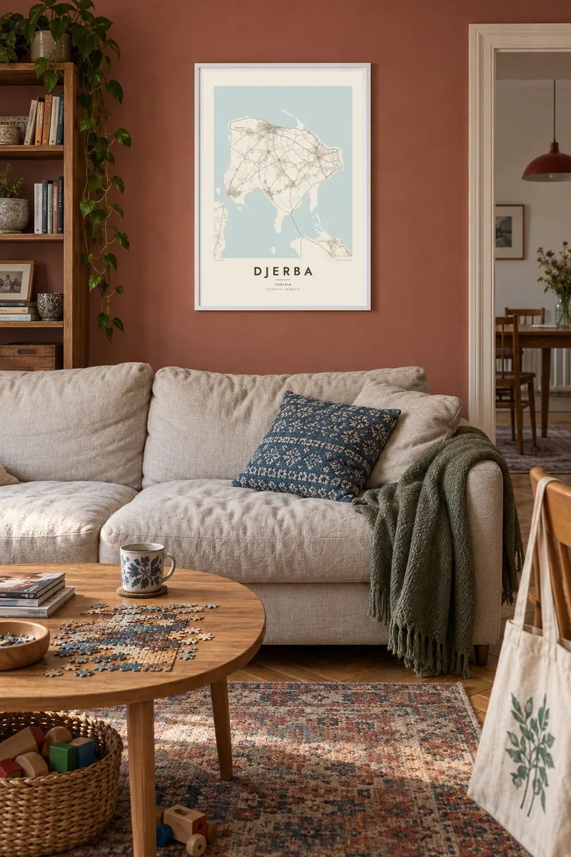
The island
Djerba lies in the Gulf of Gabès, off the southeastern coast of Tunisia, and is the largest island in North Africa. It is almost completely flat, and its outline is compact and roughly square, with sandy spits and shallow lagoons along the edges. Two links connect it to the mainland: a ferry at Ajim in the southwest, and a long causeway in the southeast that dates back to Roman times.
Djerba has no single dense town. Instead, its people are spread across the whole island. Traditional homesteads called menzels sit among olive groves and palms, linked by a web of small roads, and mosques are scattered through the countryside. UNESCO recognised this settlement pattern in 2023, when it added Djerba to the World Heritage List.
Houmt Souk, the main town, sits on the north coast with its markets and harbour. Nearby, the El Ghriba synagogue is the centre of one of the oldest Jewish communities in North Africa. Djerba is also often identified with the land of the Lotus-eaters in Homer's Odyssey. A Djerba map poster shows the island's even mesh of roads and its soft, sandy edge.
A road runs across the shallow sea from the southeast of the island to the mainland, following a route first built in antiquity. On the map it is a thin, straight line over open water.
The island's main town on the north coast, with its souks and fishing harbour. It forms the densest knot of streets in an otherwise evenly spread network.
Instead of radiating from one centre, small roads cover the island like a net, connecting villages, farms and mosques. In print, this even texture makes Djerba look unlike almost any other island.
Make it yours
Add a date, a name or a line of your own, switch style, size or orientation.
The free preview is low-resolution with a watermark. Prints and HD files are rendered at 300 DPI, up to 7,200 × 10,800 px, without a watermark.
Why Djerba
Djerba means warm winters, long beaches and a slower pace, and for some it is family history, because Djerbian families have spread across Tunisia and beyond. Its compact shape and fine road network make a poster that feels calm and full of detail at the same time.
Add your own title and subtitle in any wording you like, and set the coordinates line. Choose one of five styles. Sand and Paper suit the island's pale landscape. The HD files cost $9, and a free 900 px watermarked preview is available before you buy.
Order the Djerba poster| Print size | Resolution | Files |
|---|---|---|
| 30 × 40 cm11.8 × 15.7″ | 3,543 × 4,724 px | PNG · PDF |
| 29.7 × 42 cm (A3)11.7 × 16.5″ | 3,508 × 4,961 px | PNG · PDF |
| 42 × 59.4 cm (A2)16.5 × 23.4″ | 4,961 × 7,016 px | PNG · PDF |
| 45.7 × 61 cm18 × 24″ | 5,400 × 7,200 px | PNG · PDF |
| 50 × 70 cm19.7 × 27.6″ | 5,906 × 8,268 px | PNG · PDF |
| 61 × 91.4 cm24 × 36″ | 7,200 × 10,800 px | PNG · PDF |
For comparison, the free preview is 900 px wide, watermarked and meant for screens. The HD files have up to 8× the resolution in each direction and print cleanly at full poster size.
Pick a style at the top of the page, then choose Printed Poster — a size and, if you like, a frame — or Digital HD Files. Checkout takes one step, and your order page updates as soon as the payment goes through.
It is printed on premium 200 gsm matte paper in one of six sizes, from 30 × 40 cm to 24 × 36″. Printed posters start at $39, shipping included.
Yes. Choose a solid wood frame in black, white, natural oak or dark wood. It comes with shatterproof glazing and is ready to hang. Framed posters start at $99, shipping included.
Shipping is free to 60+ countries. Each poster is printed by the nearest of our print partners in 30+ countries and usually arrives in 3–7 business days. You can follow the status and tracking under My Orders. A few countries take 2–5 weeks, and where we don't ship yet, the site tells you before you pay.
Send us a photo within 14 days of delivery and we will reprint it for free or refund you.
Yes. In the editor on this page, change the title, the subtitle and the coordinates line to anything you like, and pick a style and size. Printed, framed and digital orders all use exactly your design.
For $9 you get 300 DPI PNG and print-ready PDF files in all six sizes, without a watermark, to print anywhere. Not sure yet? Download a free watermarked preview first.
Nearby
