Seaside oasis
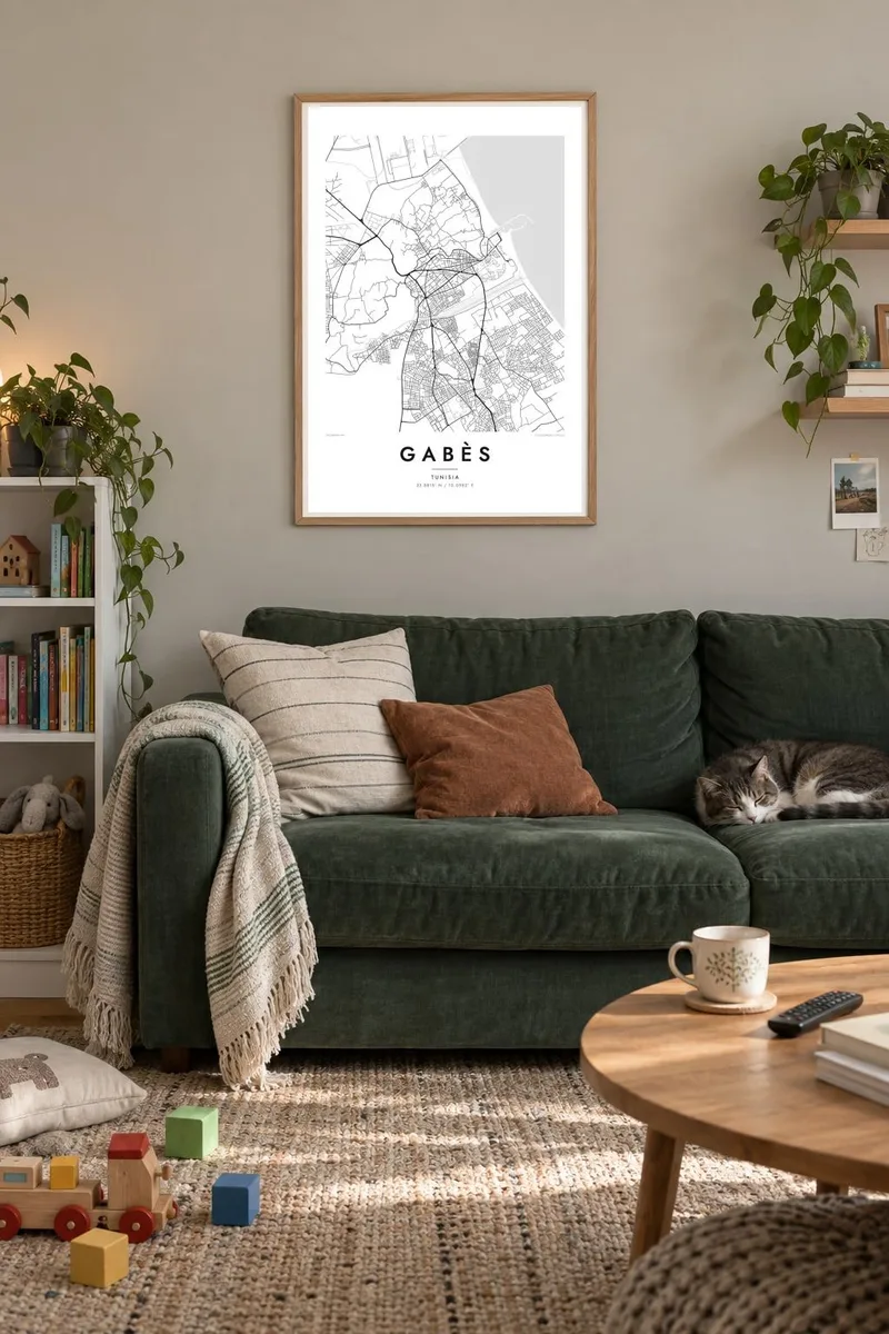
Palm groves and garden plots stretch from inland to the coast. They fill part of the poster with fine, irregular tracks, quite unlike the regular streets of the modern town.
Minimalist map poster · Tunisia
33.8815° N / 10.0982° E
A coastal oasis on the Gulf of Gabès, where palm groves run down to the sea and a wadi divides the old quarters.

One city, five moods
Tap a style to see it on the wall. Every style costs the same — printed, framed or as HD files.
 Actual pixels · 24 × 36″ print file
Print-sharp
This is a 100% crop of the real print file. Every poster — printed, framed or downloaded — is rendered on our servers at 300 DPI, up to 7,200 × 10,800 pixels, so even the smallest lanes stay crisp on a 24 × 36″ print.
On the wall


The map
Gabès sits on the southern coast of Tunisia, at the head of the gulf that shares its name. Its map is unusual for a Mediterranean city. The streets are interwoven with a large palm oasis that reaches all the way to the shoreline, so blocks of houses, irrigated plots and narrow lanes blend into an intricate pattern, bordered by the sea to the east.
The oasis is often described as one of the only seaside oases in the Mediterranean, and it has been cultivated for centuries in layered gardens of date palms, fruit trees and vegetables. The Wadi Gabès runs through the city between the traditional quarters of Jara and Menzel. A large industrial zone to the north processes phosphate.
A Gabès map poster renders that blend of city and garden in clean lines: the dense old quarters, the irregular oasis tracks, the port and the long, gently curved coast. The mountain villages of Matmata lie further inland to the south-west, beyond the frame, and many visitors pass through Gabès on their way there.
Palm groves and garden plots stretch from inland to the coast. They fill part of the poster with fine, irregular tracks, quite unlike the regular streets of the modern town.
The wadi winds through the city toward the sea, separating the old quarters of Jara and Menzel. Its curving line gives the centre its structure.
The shore of the Gulf of Gabès forms the eastern edge of the map. It is a long, gentle curve, with the port and beaches drawn against broad open water.
Make it yours
Add a date, a name or a line of your own, switch style, size or orientation.
The free preview is low-resolution with a watermark. Prints and HD files are rendered at 300 DPI, up to 7,200 × 10,800 px, without a watermark.
Why Gabès
Gabès is a city whose daily life has long been shaped by water, palms and the sea, and its map holds that balance in a single image. It makes a meaningful gift for Tunisians abroad and for travellers who passed through on their way south.
Set your own title and subtitle, in French or English if you like, add a date and the coordinates, and choose Classic black & white, Noir, Paper, Blueprint or Sand. The digital files come in six sizes, each as a 300 DPI PNG and a print-ready PDF.
Order the Gabès poster| Print size | Resolution | Files |
|---|---|---|
| 30 × 40 cm11.8 × 15.7″ | 3,543 × 4,724 px | PNG · PDF |
| 29.7 × 42 cm (A3)11.7 × 16.5″ | 3,508 × 4,961 px | PNG · PDF |
| 42 × 59.4 cm (A2)16.5 × 23.4″ | 4,961 × 7,016 px | PNG · PDF |
| 45.7 × 61 cm18 × 24″ | 5,400 × 7,200 px | PNG · PDF |
| 50 × 70 cm19.7 × 27.6″ | 5,906 × 8,268 px | PNG · PDF |
| 61 × 91.4 cm24 × 36″ | 7,200 × 10,800 px | PNG · PDF |
For comparison, the free preview is 900 px wide, watermarked and meant for screens. The HD files have up to 8× the resolution in each direction and print cleanly at full poster size.
Pick a style at the top of the page, then choose Printed Poster — a size and, if you like, a frame — or Digital HD Files. Checkout takes one step, and your order page updates as soon as the payment goes through.
It is printed on premium 200 gsm matte paper in one of six sizes, from 30 × 40 cm to 24 × 36″. Printed posters start at $39, shipping included.
Yes. Choose a solid wood frame in black, white, natural oak or dark wood. It comes with shatterproof glazing and is ready to hang. Framed posters start at $99, shipping included.
Shipping is free to 60+ countries. Each poster is printed by the nearest of our print partners in 30+ countries and usually arrives in 3–7 business days. You can follow the status and tracking under My Orders. A few countries take 2–5 weeks, and where we don't ship yet, the site tells you before you pay.
Send us a photo within 14 days of delivery and we will reprint it for free or refund you.
Yes. In the editor on this page, change the title, the subtitle and the coordinates line to anything you like, and pick a style and size. Printed, framed and digital orders all use exactly your design.
For $9 you get 300 DPI PNG and print-ready PDF files in all six sizes, without a watermark, to print anywhere. Not sure yet? Download a free watermarked preview first.
Nearby
