Hudson riverfront
The river forms the western edge of the town, with the villages' steep, dense streets pressed against the shoreline and the rail line.
Minimalist map poster · United States
41.0329° N / 73.8429° W
A Westchester town stretching from the Hudson riverfront across wooded ridges and parkways, with river villages strung along its western edge
One city, five moods
Tap a style to see it on the wall. Every style costs the same — printed, framed or as HD files.
 Actual pixels · 24 × 36″ print file
Print-sharp
This is a 100% crop of the real print file. Every poster — printed, framed or downloaded — is rendered on our servers at 300 DPI, up to 7,200 × 10,800 pixels, so even the smallest lanes stay crisp on a 24 × 36″ print.
On the wall


The map
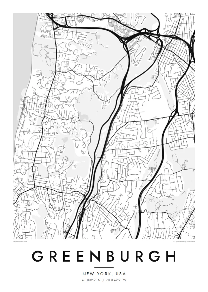
Greenburgh is a town in central Westchester County, New York, stretching from the east bank of the Hudson River inland across a series of low ridges and valleys. It contains several incorporated villages, including Tarrytown, Irvington, Dobbs Ferry, Hastings-on-Hudson, Ardsley and Elmsford, along with large unincorporated areas, so its map is really a collection of distinct communities stitched together.
The river villages cluster along the Hudson, their streets climbing steeply from the waterfront. Inland, parkways and highways follow the valleys from north to south, including the Saw Mill River Parkway, the Sprain Brook Parkway and the Bronx River Parkway. The Old Croton Aqueduct trail runs through the western villages, and the Mario M. Cuomo Bridge reaches the shore at Tarrytown.
A Greenburgh map poster shows this unusual structure well: the wide band of the Hudson on one side, the tight streets of the river villages, and the curving residential roads and wooded parkland inland. The parkways add long flowing lines through the middle, giving the composition a sense of movement from the river toward White Plains.
The river forms the western edge of the town, with the villages' steep, dense streets pressed against the shoreline and the rail line.
The Saw Mill River, Sprain Brook and Bronx River parkways run through the valleys, drawing smooth, curving lines across the wooded residential landscape.
The long Mario M. Cuomo Bridge across the Tappan Zee reaches the east bank at Tarrytown, one of the most recognisable shapes along this stretch of the river.
Make it yours
Add a date, a name or a line of your own, switch style, size or orientation.
The free preview is low-resolution with a watermark. Prints and HD files are rendered at 300 DPI, up to 7,200 × 10,800 px, without a watermark.
Why Greenburgh
People in Greenburgh often identify with a particular village or hamlet, yet the town ties them together. A map covering the riverfront and the ridges beyond makes a thoughtful gift for a new home in Hartsdale, Dobbs Ferry or Irvington, or for someone moving away.
Title the poster with your village, street or family name, add a subtitle or a date and edit the coordinates line. Choose among five styles, including the soft Sand and the dark Noir, and order a printed poster with an optional wooden frame or download HD files.
Order the Greenburgh poster| Print size | Resolution | Files |
|---|---|---|
| 30 × 40 cm11.8 × 15.7″ | 3,543 × 4,724 px | PNG · PDF |
| 29.7 × 42 cm (A3)11.7 × 16.5″ | 3,508 × 4,961 px | PNG · PDF |
| 42 × 59.4 cm (A2)16.5 × 23.4″ | 4,961 × 7,016 px | PNG · PDF |
| 45.7 × 61 cm18 × 24″ | 5,400 × 7,200 px | PNG · PDF |
| 50 × 70 cm19.7 × 27.6″ | 5,906 × 8,268 px | PNG · PDF |
| 61 × 91.4 cm24 × 36″ | 7,200 × 10,800 px | PNG · PDF |
For comparison, the free preview is 900 px wide, watermarked and meant for screens. The HD files have up to 8× the resolution in each direction and print cleanly at full poster size.
Pick a style at the top of the page, then choose Printed Poster — a size and, if you like, a frame — or Digital HD Files. Checkout takes one step, and your order page updates as soon as the payment goes through.
It is printed on premium 200 gsm matte paper in one of six sizes, from 30 × 40 cm to 24 × 36″. Printed posters start at $39, shipping included.
Yes. Choose a solid wood frame in black, white, natural oak or dark wood. It comes with shatterproof glazing and is ready to hang. Framed posters start at $99, shipping included.
Shipping is free to 60+ countries. Each poster is printed by the nearest of our print partners in 30+ countries and usually arrives in 3–7 business days. You can follow the status and tracking under My Orders. A few countries take 2–5 weeks, and where we don't ship yet, the site tells you before you pay.
Send us a photo within 14 days of delivery and we will reprint it for free or refund you.
Yes. In the editor on this page, change the title, the subtitle and the coordinates line to anything you like, and pick a style and size. Printed, framed and digital orders all use exactly your design.
For $9 you get 300 DPI PNG and print-ready PDF files in all six sizes, without a watermark, to print anywhere. Not sure yet? Download a free watermarked preview first.
Nearby
