Isthmus and bays
The city narrows between Hakodate Bay and the open strait. The shape makes the map immediately recognisable and gives it a striking symmetry.
Minimalist map poster · Japan
41.7758° N / 140.7367° E
A port city on a narrow isthmus, with Mount Hakodate at one end and a star-shaped fort inland.

One city, five moods
Tap a style to see it on the wall. Every style costs the same — printed, framed or as HD files.
 Actual pixels · 24 × 36″ print file
Print-sharp
This is a 100% crop of the real print file. Every poster — printed, framed or downloaded — is rendered on our servers at 300 DPI, up to 7,200 × 10,800 pixels, so even the smallest lanes stay crisp on a 24 × 36″ print.
On the wall


The map
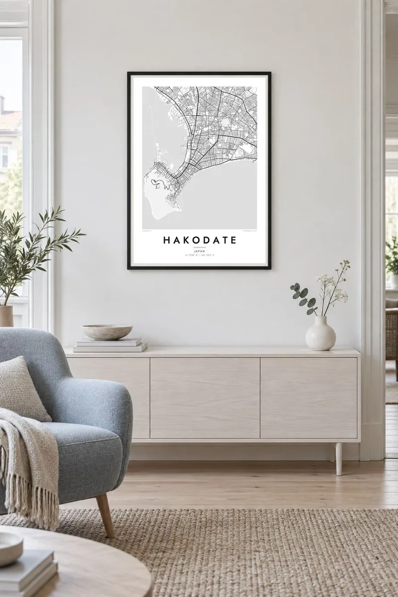
Hakodate lies at the southern tip of Hokkaido, and its shape from above is one of the most distinctive in Japan. The old city sits on a slender isthmus between two stretches of water and ends at Mount Hakodate, a wooded peak that rises steeply at the point. The famous night view from the summit shows the lit streets pinched into a narrow waist between dark water on both sides.
Hakodate was one of the first Japanese ports opened to foreign trade, in 1859. In the Motomachi district, on the lower slopes of the mountain, Western-style churches and former consulates still line the steep streets that run down to the harbour. Inland stands Goryokaku, a star-shaped fortress completed in the 1860s and the site of the final battle of the Boshin War.
A Hakodate map poster frames all of this in one memorable image: the mountain, the isthmus, the harbour and the geometric fort. Tram lines trace their way through the streets, and the coastline on both sides gives the composition a strong natural outline. Few city shapes are as graphic on a wall.
The city narrows between Hakodate Bay and the open strait. The shape makes the map immediately recognisable and gives it a striking symmetry.
The forested peak at the tip of the peninsula has almost no streets. It forms a dark, rounded mass, framed by the grid of Motomachi at its foot.
The five-pointed star fort, with its moat intact, is one of the most distinctive shapes on any Japanese map and stands out clearly among the surrounding blocks.
Make it yours
Add a date, a name or a line of your own, switch style, size or orientation.
The free preview is low-resolution with a watermark. Prints and HD files are rendered at 300 DPI, up to 7,200 × 10,800 px, without a watermark.
Why Hakodate
Hakodate's outline is striking enough to work as pure graphic design, which is why the map suits minimalist interiors so well. It appeals to travellers who remember the night view, to people from Hokkaido and to anyone who loves port cities.
Personalise the title, subtitle and coordinates line, for example with the date of a trip. Choose Classic black & white, Noir, Paper, Blueprint or Sand, then download six print sizes for $9 or order a matte printed poster.
Order the Hakodate poster| Print size | Resolution | Files |
|---|---|---|
| 30 × 40 cm11.8 × 15.7″ | 3,543 × 4,724 px | PNG · PDF |
| 29.7 × 42 cm (A3)11.7 × 16.5″ | 3,508 × 4,961 px | PNG · PDF |
| 42 × 59.4 cm (A2)16.5 × 23.4″ | 4,961 × 7,016 px | PNG · PDF |
| 45.7 × 61 cm18 × 24″ | 5,400 × 7,200 px | PNG · PDF |
| 50 × 70 cm19.7 × 27.6″ | 5,906 × 8,268 px | PNG · PDF |
| 61 × 91.4 cm24 × 36″ | 7,200 × 10,800 px | PNG · PDF |
For comparison, the free preview is 900 px wide, watermarked and meant for screens. The HD files have up to 8× the resolution in each direction and print cleanly at full poster size.
Pick a style at the top of the page, then choose Printed Poster — a size and, if you like, a frame — or Digital HD Files. Checkout takes one step, and your order page updates as soon as the payment goes through.
It is printed on premium 200 gsm matte paper in one of six sizes, from 30 × 40 cm to 24 × 36″. Printed posters start at $39, shipping included.
Yes. Choose a solid wood frame in black, white, natural oak or dark wood. It comes with shatterproof glazing and is ready to hang. Framed posters start at $99, shipping included.
Shipping is free to 60+ countries. Each poster is printed by the nearest of our print partners in 30+ countries and usually arrives in 3–7 business days. You can follow the status and tracking under My Orders. A few countries take 2–5 weeks, and where we don't ship yet, the site tells you before you pay.
Send us a photo within 14 days of delivery and we will reprint it for free or refund you.
Yes. In the editor on this page, change the title, the subtitle and the coordinates line to anything you like, and pick a style and size. Printed, framed and digital orders all use exactly your design.
For $9 you get 300 DPI PNG and print-ready PDF files in all six sizes, without a watermark, to print anywhere. Not sure yet? Download a free watermarked preview first.
Nearby
