Three-river confluence
The Jialing, Fu and Qu rivers meet near the centre and carve the district into separate banks joined by bridges. This is the defining shape of the map.
Minimalist map poster · China
29.9923° N / 106.2646° E
A river district of Chongqing where three rivers meet, with steep hills and a historic fortress above the confluence.

One city, five moods
Tap a style to see it on the wall. Every style costs the same — printed, framed or as HD files.
 Actual pixels · 24 × 36″ print file
Print-sharp
This is a 100% crop of the real print file. Every poster — printed, framed or downloaded — is rendered on our servers at 300 DPI, up to 7,200 × 10,800 pixels, so even the smallest lanes stay crisp on a 24 × 36″ print.
On the wall

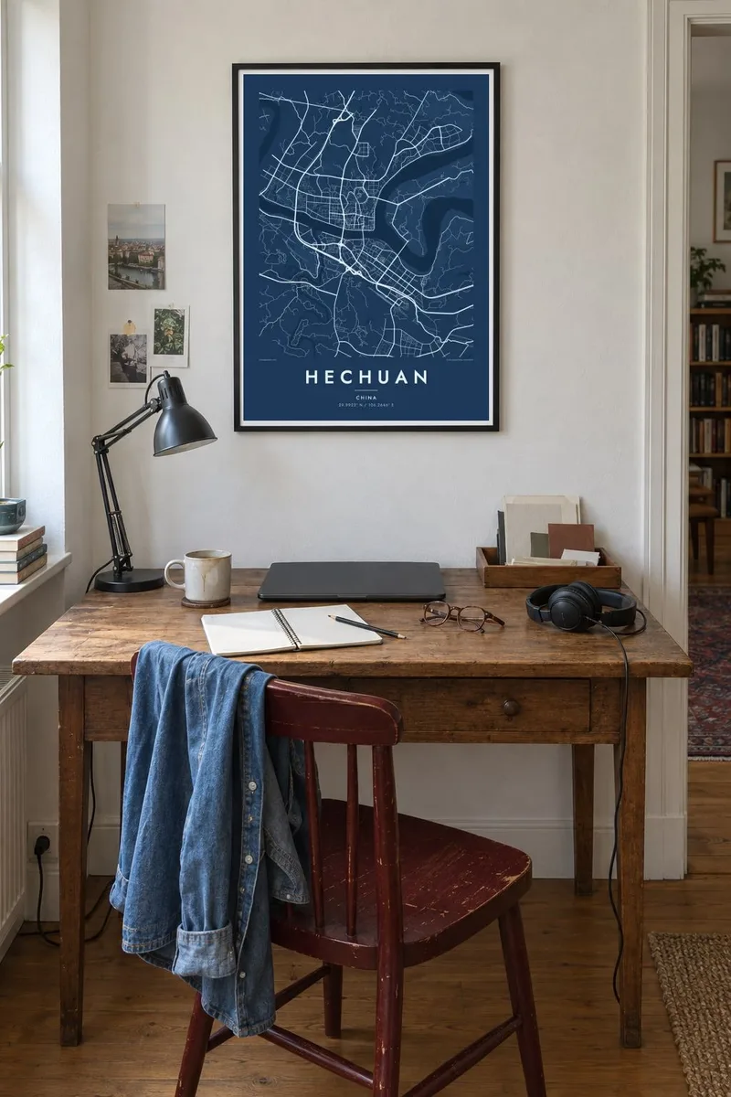
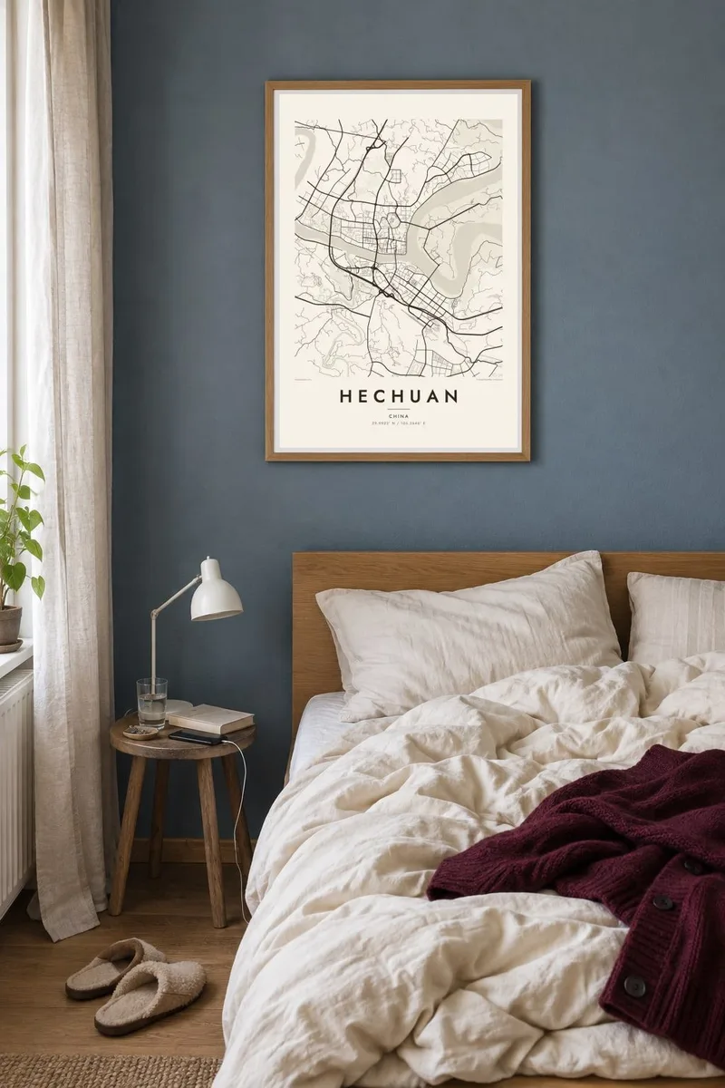
The map
Hechuan is a district of Chongqing municipality, and its name refers to rivers coming together. Here the Fu and Qu rivers join the Jialing, and on a map the urban core sits on the land between these channels. The water divides the district into distinct sections linked by bridges, so the city reads as a cluster of peninsulas rather than one solid block.
The most famous site lies on a hill east of the centre. Diaoyu Fortress held out against Mongol forces for decades in the thirteenth century, and the Mongol ruler Möngke Khan died during the siege in 1259. The fortress stands on a ridge above the Jialing, part of a landscape of steep slopes and river bends.
A Hechuan map poster shows the typical Chongqing terrain in a smaller frame. Roads bend along the contours instead of forming a grid, and newer residential districts spread onto the flatter land. The rivers draw strong white curves through the composition. The result is a map with a lot of movement, where water and slope decide the shape of every neighbourhood.
The Jialing, Fu and Qu rivers meet near the centre and carve the district into separate banks joined by bridges. This is the defining shape of the map.
A historic hilltop stronghold above the Jialing River, famous for resisting Mongol sieges. On the poster it appears as a quiet raised area among the river bends.
Instead of a grid, many roads trace the slopes and riverbanks. This gives the neighbourhoods curved, layered outlines that look striking in a single-colour print.
Make it yours
Add a date, a name or a line of your own, switch style, size or orientation.
The free preview is low-resolution with a watermark. Prints and HD files are rendered at 300 DPI, up to 7,200 × 10,800 px, without a watermark.
Why Hechuan
Hechuan's shape is unusual enough to work as a graphic piece. For people from the district it is also a record of home: which bank you lived on, which bridge you crossed. Set a custom title, a subtitle with a year, and a coordinates line that points to your street.
Pick Classic black & white, Noir, Paper, Blueprint or Sand. The digital version costs $9 and comes in six sizes, from 30×40 cm to 24×36″, as 300 DPI PNG and PDF files. Printed posters on matte paper, framed or unframed, ship from partners in more than 30 countries.
Order the Hechuan poster| Print size | Resolution | Files |
|---|---|---|
| 30 × 40 cm11.8 × 15.7″ | 3,543 × 4,724 px | PNG · PDF |
| 29.7 × 42 cm (A3)11.7 × 16.5″ | 3,508 × 4,961 px | PNG · PDF |
| 42 × 59.4 cm (A2)16.5 × 23.4″ | 4,961 × 7,016 px | PNG · PDF |
| 45.7 × 61 cm18 × 24″ | 5,400 × 7,200 px | PNG · PDF |
| 50 × 70 cm19.7 × 27.6″ | 5,906 × 8,268 px | PNG · PDF |
| 61 × 91.4 cm24 × 36″ | 7,200 × 10,800 px | PNG · PDF |
For comparison, the free preview is 900 px wide, watermarked and meant for screens. The HD files have up to 8× the resolution in each direction and print cleanly at full poster size.
Pick a style at the top of the page, then choose Printed Poster — a size and, if you like, a frame — or Digital HD Files. Checkout takes one step, and your order page updates as soon as the payment goes through.
It is printed on premium 200 gsm matte paper in one of six sizes, from 30 × 40 cm to 24 × 36″. Printed posters start at $39, shipping included.
Yes. Choose a solid wood frame in black, white, natural oak or dark wood. It comes with shatterproof glazing and is ready to hang. Framed posters start at $99, shipping included.
Shipping is free to 60+ countries. Each poster is printed by the nearest of our print partners in 30+ countries and usually arrives in 3–7 business days. You can follow the status and tracking under My Orders. A few countries take 2–5 weeks, and where we don't ship yet, the site tells you before you pay.
Send us a photo within 14 days of delivery and we will reprint it for free or refund you.
Yes. In the editor on this page, change the title, the subtitle and the coordinates line to anything you like, and pick a style and size. Printed, framed and digital orders all use exactly your design.
For $9 you get 300 DPI PNG and print-ready PDF files in all six sizes, without a watermark, to print anywhere. Not sure yet? Download a free watermarked preview first.
Nearby
