The Loop
Interstate 610 draws a rough square around the inner city, enclosing downtown, the Heights, Montrose and the Medical Center, and giving the map its central frame.
Minimalist map poster · United States
29.7633° N / 95.3633° W
A flat, sprawling city organised by concentric freeway loops and threaded by slow bayous running east toward the ship channel.

One city, five moods
Tap a style to see it on the wall. Every style costs the same — printed, framed or as HD files.
 Actual pixels · 24 × 36″ print file
Print-sharp
This is a 100% crop of the real print file. Every poster — printed, framed or downloaded — is rendered on our servers at 300 DPI, up to 7,200 × 10,800 pixels, so even the smallest lanes stay crisp on a 24 × 36″ print.
On the wall

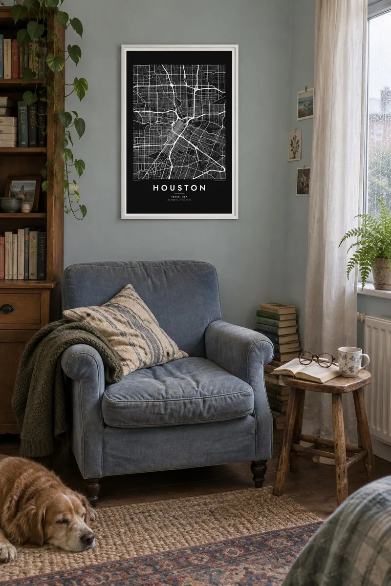

The map
Houston spreads across a nearly flat coastal plain in southeast Texas, and with no hills or major barriers to limit it, the city has grown outward in rings. The map is organised by freeways: the Interstate 610 Loop around the inner city, Beltway 8 further out, and radial highways leaving downtown like spokes. Between them lies an enormous field of suburban streets.
Water moves slowly through this landscape in bayous. Buffalo Bayou winds east from the western suburbs past downtown, where it becomes the Houston Ship Channel and continues toward Galveston Bay. Other bayous, including Brays and White Oak, trace green lines across the grid. Memorial Park and Hermann Park form large open blocks, and the Texas Medical Center is a city within the city.
Houston is the largest city in Texas and home to NASA's Johnson Space Center, which is why the first word spoken from the Moon was addressed to it. The city is also known for having no conventional zoning code. A Houston map poster reveals the logic behind its size: rings, spokes and bayous across open ground.
Interstate 610 draws a rough square around the inner city, enclosing downtown, the Heights, Montrose and the Medical Center, and giving the map its central frame.
Houston's main waterway meanders through parks west of downtown before straightening into the ship channel, home to one of the busiest ports in the United States.
A tight grid of blocks set at an angle to the surrounding streets, downtown sits where the bayou and the major freeways converge.
Make it yours
Add a date, a name or a line of your own, switch style, size or orientation.
The free preview is low-resolution with a watermark. Prints and HD files are rendered at 300 DPI, up to 7,200 × 10,800 px, without a watermark.
Why Houston
Houston is difficult to see in one piece from the ground, which is exactly why its map is so satisfying. Framed on a wall, the loops and bayous give shape to a city of long drives, for someone who moved there for work or grew up inside the Beltway.
Customise the title and subtitle, perhaps with a neighbourhood like Montrose or the Heights, and edit the coordinates line. Choose from Classic black & white, Noir, Paper, Blueprint or Sand. Digital files are $9 with no watermark, and printed versions come on matte paper with an optional frame.
Order the Houston poster| Print size | Resolution | Files |
|---|---|---|
| 30 × 40 cm11.8 × 15.7″ | 3,543 × 4,724 px | PNG · PDF |
| 29.7 × 42 cm (A3)11.7 × 16.5″ | 3,508 × 4,961 px | PNG · PDF |
| 42 × 59.4 cm (A2)16.5 × 23.4″ | 4,961 × 7,016 px | PNG · PDF |
| 45.7 × 61 cm18 × 24″ | 5,400 × 7,200 px | PNG · PDF |
| 50 × 70 cm19.7 × 27.6″ | 5,906 × 8,268 px | PNG · PDF |
| 61 × 91.4 cm24 × 36″ | 7,200 × 10,800 px | PNG · PDF |
For comparison, the free preview is 900 px wide, watermarked and meant for screens. The HD files have up to 8× the resolution in each direction and print cleanly at full poster size.
Pick a style at the top of the page, then choose Printed Poster — a size and, if you like, a frame — or Digital HD Files. Checkout takes one step, and your order page updates as soon as the payment goes through.
It is printed on premium 200 gsm matte paper in one of six sizes, from 30 × 40 cm to 24 × 36″. Printed posters start at $39, shipping included.
Yes. Choose a solid wood frame in black, white, natural oak or dark wood. It comes with shatterproof glazing and is ready to hang. Framed posters start at $99, shipping included.
Shipping is free to 60+ countries. Each poster is printed by the nearest of our print partners in 30+ countries and usually arrives in 3–7 business days. You can follow the status and tracking under My Orders. A few countries take 2–5 weeks, and where we don't ship yet, the site tells you before you pay.
Send us a photo within 14 days of delivery and we will reprint it for free or refund you.
Yes. In the editor on this page, change the title, the subtitle and the coordinates line to anything you like, and pick a style and size. Printed, framed and digital orders all use exactly your design.
For $9 you get 300 DPI PNG and print-ready PDF files in all six sizes, without a watermark, to print anywhere. Not sure yet? Download a free watermarked preview first.
Nearby
