Huai River
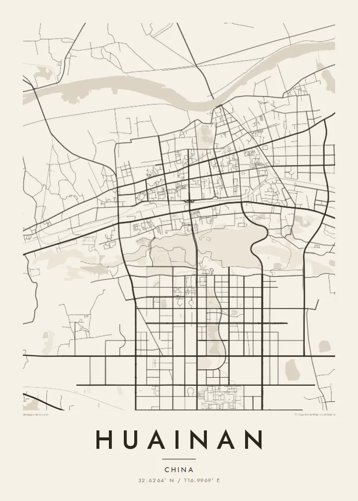
The river runs along the northern edge of the city, broad and slowly curving. Bridges and embankments mark where the urban area meets the water.
Minimalist map poster · China
A coal city stretched along the southern bank of the Huai River, its districts strung out between the water and low hills.
32.6264° N / 116.9969° E




One city, five moods
Tap a style to see it on the wall. Every style is included in the same $9 price.
 Actual pixels · 24 × 36″ HD file
Print-sharp
This is a crop of the real HD file at 100%. The paid download is rendered on our servers at 300 DPI, up to 7,200 × 10,800 pixels, so even the smallest lanes stay crisp on a 24 × 36″ print.
The map
Huainan grew in the twentieth century as a coal-mining city in central Anhui, and its map reflects that origin. It did not spread from a single old centre. Instead it developed around separate mining areas along the southern bank of the Huai River, so its districts stretch out in a long east–west line with open land and water between them.
The Huai River is the clearest line on the map, a wide, curving waterway that marks the traditional division between northern and southern China. Mining subsidence has created lakes and wetlands in several parts of the area. Some have been turned into parks, adding irregular open shapes to the street pattern.
The city's name is linked to Liu An, Prince of Huainan in the Han dynasty and compiler of the Huainanzi, and tradition credits the region with the invention of tofu. Nearby Bagong Mountain is associated with the Battle of the Fei River. A Huainan map poster shows a city defined by its river and its industry.
The river runs along the northern edge of the city, broad and slowly curving. Bridges and embankments mark where the urban area meets the water.
Separate urban districts line up from east to west, joined by long main roads. The map's elongated outline comes from mining history rather than a planned centre.
Lakes that formed over old mine workings appear as irregular open areas among the streets. Some are now landscaped, a distinctive feature of coal cities on the plain.
Make it yours
Add a date, a name or a line of your own, switch style, size or orientation.
Free preview is low-resolution with a watermark. The HD version is 7,200 × 10,800 px, 300 DPI, no watermark.
Why Huainan
Huainan is hung by people who grew up with its mines, its river and its tofu dishes. For families who have lived there for generations, the map records a place that has changed a great deal and keeps changing.
Choose a title and subtitle, and keep or edit the coordinates line. Classic black & white, Noir, Paper, Blueprint and Sand are all available. The $9 digital files come in six sizes, and a free watermarked preview lets you check the framing first.
Get the Huainan poster — $9| Print size | Resolution | Files |
|---|---|---|
| 30 × 40 cm | 3,543 × 4,724 px | PNG · PDF |
| 50 × 70 cm | 5,906 × 8,268 px | PNG · PDF |
| A3 · 29.7 × 42 cm | 3,508 × 4,961 px | PNG · PDF |
| A2 · 42 × 59.4 cm | 4,961 × 7,016 px | PNG · PDF |
| 18 × 24" | 5,400 × 7,200 px | PNG · PDF |
| 24 × 36" | 7,200 × 10,800 px | PNG · PDF |
For comparison, the free preview is 900 px wide, watermarked and meant for screens. The HD files have up to 8× the resolution in each direction and print cleanly at full poster size.
Yes. Drag and zoom the map in the editor — centre it on your neighbourhood, the old town or the whole metro area. The text updates independently.
The HD purchase includes 30×40 cm, 50×70 cm, A3, A2, 18×24″ and 24×36″, each as a 300 DPI PNG and a print-ready PDF.
You can download a free 900 px preview with a watermark. The paid HD files have no watermark and are sharp enough for large prints.
Send the PDF to any local print shop or online printing service and ask for the matching paper size. Matte paper and a thin black or oak frame suit this style best.
Nearby
