Seafront
A long promenade and coastal road trace the edge of the gulf, drawing a smooth, continuous line that anchors the whole composition.
Minimalist map poster · Turkey
36.5872° N / 36.1735° E
A port city stretched along the curve of its gulf, with the Nur Mountains rising steeply close behind it

One city, five moods
Tap a style to see it on the wall. Every style costs the same — printed, framed or as HD files.
 Actual pixels · 24 × 36″ print file
Print-sharp
This is a 100% crop of the real print file. Every poster — printed, framed or downloaded — is rendered on our servers at 300 DPI, up to 7,200 × 10,800 pixels, so even the smallest lanes stay crisp on a 24 × 36″ print.
On the wall


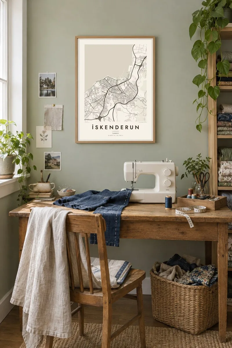
The map
İskenderun lies on the eastern shore of the Gulf of İskenderun, at the north-eastern corner of the Mediterranean. The city is squeezed between the sea and the Nur Mountains, also known as the Amanus, and on the map it forms a long, narrow band of streets following the coastline, with the steep slopes pressing in from the east.
The city carries the name of Alexander the Great: it was founded as Alexandretta after his victory at the Battle of Issus in 333 BC, fought not far to the north. Today it is a major port, with long piers and industrial zones, including a large steelworks along the coast to the north of the centre.
The seafront promenade runs for kilometres beside the water, a clean line that gives the city its character from above. The 2023 earthquakes caused serious damage here and along the coast, and rebuilding has been reshaping parts of the map. An İskenderun map poster captures the city's essential form: shoreline, grid and mountain, held in a single frame.
A long promenade and coastal road trace the edge of the gulf, drawing a smooth, continuous line that anchors the whole composition.
Harbour piers and industrial quays extend into the water, crisp geometric shapes that interrupt the gentle curve of the shoreline.
The steep slopes behind the city bring the streets to an end in irregular, climbing patterns, with roads winding up toward the Belen pass.
Make it yours
Add a date, a name or a line of your own, switch style, size or orientation.
The free preview is low-resolution with a watermark. Prints and HD files are rendered at 300 DPI, up to 7,200 × 10,800 px, without a watermark.
Why İskenderun
İskenderun means different things to different people: a seaside hometown, a port where a family worked, a city rebuilt after loss. A map of it holds the shoreline and the mountains together in a way that feels calm and lasting.
Personalise the title, subtitle and coordinates with a name, a neighbourhood or a significant date, and choose one of five styles. Blueprint suits the port, while Classic black and white keeps the coastline sharp and clear.
Order the İskenderun poster| Print size | Resolution | Files |
|---|---|---|
| 30 × 40 cm11.8 × 15.7″ | 3,543 × 4,724 px | PNG · PDF |
| 29.7 × 42 cm (A3)11.7 × 16.5″ | 3,508 × 4,961 px | PNG · PDF |
| 42 × 59.4 cm (A2)16.5 × 23.4″ | 4,961 × 7,016 px | PNG · PDF |
| 45.7 × 61 cm18 × 24″ | 5,400 × 7,200 px | PNG · PDF |
| 50 × 70 cm19.7 × 27.6″ | 5,906 × 8,268 px | PNG · PDF |
| 61 × 91.4 cm24 × 36″ | 7,200 × 10,800 px | PNG · PDF |
For comparison, the free preview is 900 px wide, watermarked and meant for screens. The HD files have up to 8× the resolution in each direction and print cleanly at full poster size.
Pick a style at the top of the page, then choose Printed Poster — a size and, if you like, a frame — or Digital HD Files. Checkout takes one step, and your order page updates as soon as the payment goes through.
It is printed on premium 200 gsm matte paper in one of six sizes, from 30 × 40 cm to 24 × 36″. Printed posters start at $39, shipping included.
Yes. Choose a solid wood frame in black, white, natural oak or dark wood. It comes with shatterproof glazing and is ready to hang. Framed posters start at $99, shipping included.
Shipping is free to 60+ countries. Each poster is printed by the nearest of our print partners in 30+ countries and usually arrives in 3–7 business days. You can follow the status and tracking under My Orders. A few countries take 2–5 weeks, and where we don't ship yet, the site tells you before you pay.
Send us a photo within 14 days of delivery and we will reprint it for free or refund you.
Yes. In the editor on this page, change the title, the subtitle and the coordinates line to anything you like, and pick a style and size. Printed, framed and digital orders all use exactly your design.
For $9 you get 300 DPI PNG and print-ready PDF files in all six sizes, without a watermark, to print anywhere. Not sure yet? Download a free watermarked preview first.
Nearby
